Chest opened
+${chestReward.xp} XP
Explorer
NOUVEAU ×${chestReward.collectible.quantity}
tapez pour fermer

See the monuments around you in AR Open chests in the app

Around Us is built for your phone — point your camera at the streets and discover the monuments and places around you in augmented reality. Around Us is built for your phone — chests unlock when you walk, explore and capture nearby places.

•

Enable Location

We need your location to show you interesting places around you

Discover nearby places

Find interesting locations and hidden gems around you

Precise directions

Get accurate directions and distances to places

Your location is never shared with other users. It's only used when you tap the location button.

Medvědín

Log in to your account

Start exploring — it's free

Trusted by 92,985 travelers worldwide

Continue with Google
Continue with Apple
or

We will send you a code to connect

By continuing, you accept our Terms and Conditions and our Privacy Policy

Check your inbox

We've sent a pincode in your inbox. Please enter the code below.

Medvědín

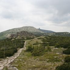
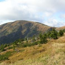
Medvědín, Mountain summit in Liberec Region, Czech Republic

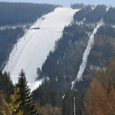
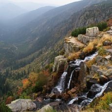
Schüsselberg (Medvědín) is a wooded summit in the Krkonoše (Giant Mountains) on the Bohemian Ridge, about 2.5 km northwest of Špindlerův Mlýn. Its north and east sides drop 400–500 m into the Elbe valley, while a shallow saddle separates it from Zlaté návrší to the west. A television transmitter stands on top, and a chairlift from Špindlerův Mlýn has reached the summit since 1979.

Uranium ore was found here by a walking gamma survey in 1952, and from 1953 two adits were driven through the massif from Horní Mísečky to the Elbe valley. Mining began on 5 April 1956; by the end of 1958, 24.5 tonnes of uranium metal had been extracted from six mineralised veins.

The German name Schüsselberg, "Bowl Mountain", refers to the hollowed summit shape above Spindlermühle. Since 1975 a chairlift from the town has carried skiers and hikers up; the summit transmitter serves radio and television to the surrounding villages.

The easiest way up is the chairlift from Špindlerův Mlýn, which ends a few dozen metres below the summit. A roughly two-kilometre branch off the Masarykova silnice from Horní Mísečky also leads up, marked red then yellow and open to cyclists. The lift has run since 1979.

Between 1952 and 1958, two adits were driven through the Medvědín massif from Horní Mísečky to the Labský důl valley, and 24.5 tonnes of uranium were extracted before the mine closed on 1 January 1959. The adit mouths were later demolished and the shaft flooded and sealed with concrete.

The community of curious travelers

AroundUs brings together thousands of curated places, local tips, and hidden gems, enriched daily by 92,985 contributors worldwide.

Start exploring
GPS coordinates
50.74158,15.58201
Latest update
October 21, 2026 19:27
Reviews
Share your experience

No review yet

Discussions
Start a discussion...

No discussion yet

« Medvědín - Mountain summit in Liberec Region, Czech Republic » is provided by Around Us (aroundus.com). Images and texts are derived from Wikimedia project under a Creative Commons license. You are allowed to copy, distribute, and modify copies of this page, under the conditions set by the license, as long as this note is clearly visible.

Discover hidden gems everywhere you go!

From secret cafés to breathtaking viewpoints, skip the crowded tourist spots and find places that match your style. Our app makes it easy with voice search, smart filtering, route optimization, and insider tips from travelers worldwide. Download now for the complete mobile experience.

Around Us App Screenshot
❝

A unique approach to discovering new places❞

— Le Figaro

❝

All the places worth exploring❞

— France Info

❝

A tailor-made excursion in just a few clicks❞

— 20 Minutes

Around Us
Travel Guide & Maps
Download

Send to your phone

QR Code
1

Open the camera app on your mobile.

2

Point at the QR code with your camera. A notification will appear.

3

Tap the notification to open the link.