Enable Location

We need your location to show you interesting places around you

Discover nearby places

Find interesting locations and hidden gems around you

Precise directions

Get accurate directions and distances to places

Your location is never shared with other users. It's only used when you tap the location button.

Pašijová draha

Log in to your account

Start exploring — it's free

Trusted by 62,329 travelers worldwide

Continue with Google
Continue with Apple
or

We will send you a code to connect

By continuing, you accept our Terms and Conditions and our Privacy Policy

Check your inbox

We've sent a pincode in your inbox. Please enter the code below.

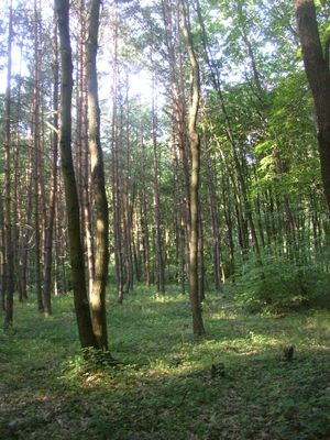
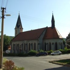
Pašijová draha, Nature reserve near Libušín, Czech Republic.

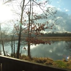
Pašijová draha is a nature reserve characterized by deep canyons carved by water erosion, exposing layers of sedimentary rock. The landscape displays travertine formations and calcareous deposits, with natural openings that reveal underground cavities beneath the surface.

The area received protected status in 1987 to safeguard its geological formations from the Cretaceous period. This designation ensured the preservation of the deep canyons and their distinctive natural features for scientific study.

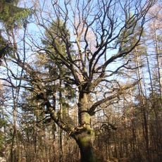
The reserve contains multiple forest ant colonies and serves as a research site for scientists studying regional biodiversity and geological formations.

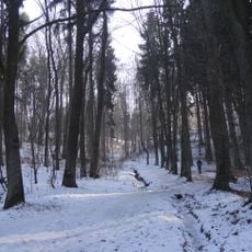
The reserve can be reached using paths that connect the surrounding villages and provide access to the protected area. Since no marked trails run through the reserve itself, visitors should use the surrounding paths and respect the boundaries of the protected zone.

The reserve contains ventaroles, natural openings that lead to underground cavities and are uncommon in this region. These geological features make the site particularly interesting for researchers studying regional biodiversity and rock formations.

The community of curious travelers

AroundUs brings together thousands of curated places, local tips, and hidden gems, enriched daily by 60,000 contributors worldwide.

Start exploring
Location
Inception
October 29, 1987
GPS coordinates
50.15470,14.04060
Latest update
December 14, 2025 14:40
Around this place
Rozdělovské věžáky
Czech Republic

Rozdělovské věžáky

3.1 km
Libušín
Czech Republic

Libušín

823 m
Hornický skanzen Mayrau
Czech Republic

Hornický skanzen Mayrau

3.2 km
Church of Saint George
Czech Republic

Church of Saint George

837 m
Důl Schöller
Czech Republic

Důl Schöller

1.2 km
Záplavy
Czech Republic

Záplavy

2.3 km
Krnčí a Voleška
Czech Republic

Krnčí a Voleška

3.2 km
Church of Saint Wenceslaus
Czech Republic

Church of Saint Wenceslaus

2.6 km
Smečenská rokle
Czech Republic

Smečenská rokle

2.7 km
Dub na Beraníku
Czech Republic

Dub na Beraníku

3.4 km
Chapel of Saint Nicholas
Czech Republic

Chapel of Saint Nicholas

2.7 km
Jasan u Turyňského rybníka
Czech Republic

Jasan u Turyňského rybníka

2.9 km
Vodní mlýn čp. 16
Czech Republic

Vodní mlýn čp. 16

3.3 km
Church of Saint Procopius
Czech Republic

Church of Saint Procopius

1.8 km
Boží muka u silnice do Kačice
Czech Republic

Boží muka u silnice do Kačice

3.1 km
Pomník T.G. Masaryka v Srbech u Tuchlovic
Czech Republic

Pomník T.G. Masaryka v Srbech u Tuchlovic

1.9 km
Rectory in Rozdělov
Czech Republic

Rectory in Rozdělov

2.6 km
Vrba převislá v Libušíně
Czech Republic

Vrba převislá v Libušíně

1.8 km
Pomník obětem 1. světové války v Srbech u Tuchlovic
Czech Republic

Pomník obětem 1. světové války v Srbech u Tuchlovic

1.9 km
Pomník obětem německého násilí v letech 1939-1945 v Srbech u Tuchlovic
Czech Republic

Pomník obětem německého násilí v letech 1939-1945 v Srbech u Tuchlovic

1.9 km
Pomník padlým ve světových válkách, Kladno-Rozdělov
Czech Republic

Pomník padlým ve světových válkách, Kladno-Rozdělov

2.6 km
Pamětní kříž L.P. 1886, Kladno-Rozdělov
Czech Republic

Pamětní kříž L.P. 1886, Kladno-Rozdělov

2.6 km
Pomník padlým ve Svinařově u Kladna
Czech Republic

Pomník padlým ve Svinařově u Kladna

3 km
Budova základní školy v Kamenných Žehrovicích
Czech Republic

Budova základní školy v Kamenných Žehrovicích

3.2 km
Bridge of former railway siding over D6 highway east of Tuchlovice
Czech Republic

Bridge of former railway siding over D6 highway east of Tuchlovice

3.2 km
World War II memorial in Kamenné Žehrovice
Czech Republic

World War II memorial in Kamenné Žehrovice

3.2 km
Hřbitov Libušín
Czech Republic

Hřbitov Libušín

815 m
Most Karlovarské třídy přes Loděnici v Kamenných Žehrovicích
Czech Republic

Most Karlovarské třídy přes Loděnici v Kamenných Žehrovicích

3.1 km
Show the full map
« Pašijová draha - Nature reserve near Libušín, Czech Republic » is provided by Around Us (aroundus.com). Images and texts are derived from Wikimedia project under a Creative Commons license. You are allowed to copy, distribute, and modify copies of this page, under the conditions set by the license, as long as this note is clearly visible.

Discover hidden gems everywhere you go!

From secret cafés to breathtaking viewpoints, skip the crowded tourist spots and find places that match your style. Our app makes it easy with voice search, smart filtering, route optimization, and insider tips from travelers worldwide. Download now for the complete mobile experience.

Around Us App Screenshot

A unique approach to discovering new places

Le Figaro

All the places worth exploring

France Info

A tailor-made excursion in just a few clicks

20 Minutes

Around Us
Travel Guide & Maps
Download

Send to your phone

QR Code
1

Open the camera app on your mobile.

2

Point at the QR code with your camera. A notification will appear.

3

Tap the notification to open the link.