Enable Location

We need your location to show you interesting places around you

Discover nearby places

Find interesting locations and hidden gems around you

Precise directions

Get accurate directions and distances to places

Your location is never shared with other users. It's only used when you tap the location button.

Súkenická

Log in to your account

Start exploring — it's free

Trusted by 62,134 travelers worldwide

Continue with Google
Continue with Apple
or

We will send you a code to connect

By continuing, you accept our Terms and Conditions and our Privacy Policy

Check your inbox

We've sent a pincode in your inbox. Please enter the code below.

Súkenická

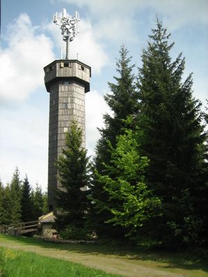
Súkenická, Observation tower on Čarták peak in Velké Karlovice, Czech Republic.

Súkenická is an observation tower atop Čarták peak standing about 952 meters above sea level. The structure has a concrete core wrapped in wooden planks, with 137 steps leading to an octagonal viewing platform positioned roughly 26 meters high.

The tower was built in 1997 originally as a base station for mobile phone networks. Public access was later arranged through discussions with the Beskydy Protected Area Administration.

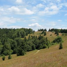
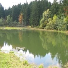
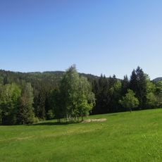
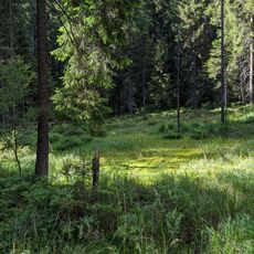
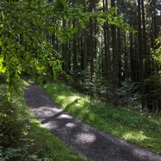
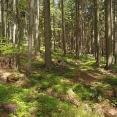
This tower marks the point where three mountain regions meet and serves as a gathering place for people from surrounding valleys. From the platform, visitors see the landscapes that both separate and connect these different areas.

Tower keys are available at Hotel Súkenická about 200 meters away. Access is typically allowed during daylight hours from June through September, so it is wise to confirm current opening times before visiting.

The tower was originally built to support mobile phone antennas, but its wooden exterior casing unexpectedly helps regulate signal coverage while preserving the landscape's natural appearance. This hidden technical purpose coexists with the public viewing function that visitors experience today.

The community of curious travelers

AroundUs brings together thousands of curated places, local tips, and hidden gems, enriched daily by 60,000 contributors worldwide.

Start exploring
Location
GPS coordinates
49.39875,18.39604
Latest update
December 14, 2025 18:01
Around this place
Monument to Maryčka Magdonova
Czech Republic

Monument to Maryčka Magdonova

8.8 km
Veľký Javorník
Slovakia

Veľký Javorník

9.1 km
Horní Bečva Reservoir
Czech Republic

Horní Bečva Reservoir

6.3 km
Church of Our Lady of the Snow in Velké Karlovice
Czech Republic

Church of Our Lady of the Snow in Velké Karlovice

9.1 km
Church of Saint Friderik of Hallum
Czech Republic

Church of Saint Friderik of Hallum

6.4 km
Zámek Bílá
Czech Republic

Zámek Bílá

5.8 km
Church of Saint Henry in Staré Hamry
Czech Republic

Church of Saint Henry in Staré Hamry

8.9 km
Maxova nádrž
Czech Republic

Maxova nádrž

3.3 km
Kudlačena
Czech Republic

Kudlačena

6.2 km
Makovský priesmyk
Slovakia

Makovský priesmyk

2.1 km
Educational trail Gruň - Bílý Kříž
Czech Republic

Educational trail Gruň - Bílý Kříž

8.9 km
V Podolánkách
Czech Republic

V Podolánkách

8.3 km
Lišková
Czech Republic

Lišková

3.8 km
Kladnatá - Grapy
Czech Republic

Kladnatá - Grapy

4.5 km
Kříž u kaple ve Velkých Karlovicích
Czech Republic

Kříž u kaple ve Velkých Karlovicích

4.2 km
Venkovský dům - Karlovské muzeum, č.p. 267
Czech Republic

Venkovský dům - Karlovské muzeum, č.p. 267

9.1 km
Chapel of the Virgin Mary of the Rosary
Czech Republic

Chapel of the Virgin Mary of the Rosary

6.2 km
Krucifix
Czech Republic

Krucifix

8.2 km
Kaple
Czech Republic

Kaple

5.9 km
Boží muka
Czech Republic

Boží muka

8.8 km
Rectory in Velké Karlovice
Czech Republic

Rectory in Velké Karlovice

9.1 km
Church of Saints John and Paul
Czech Republic

Church of Saints John and Paul

8.8 km
Kaple svatého Huberta u údolní komunikace ve Velkých Karlovicích, místní části Pluskovec
Czech Republic

Kaple svatého Huberta u údolní komunikace ve Velkých Karlovicích, místní části Pluskovec

9 km
Železniční most přes Vsetínskou Bečvu ve Velkých Karlovicích
Czech Republic

Železniční most přes Vsetínskou Bečvu ve Velkých Karlovicích

7.8 km
Zvonice u kaple svatého Huberta ve Velkých Karlovicích, místní části Pluskovec
Czech Republic

Zvonice u kaple svatého Huberta ve Velkých Karlovicích, místní části Pluskovec

9 km
Dřevěná kaple svatého Cyrila a Metoděje u silnice v osadě Hlavatá
Czech Republic

Dřevěná kaple svatého Cyrila a Metoděje u silnice v osadě Hlavatá

2.7 km
Pamětní kříž u kaple svatého Huberta ve Velkých Karlovicích, místní části Pluskovec
Czech Republic

Pamětní kříž u kaple svatého Huberta ve Velkých Karlovicích, místní části Pluskovec

9 km
Kaple svatého Floriána u hlavní komunikace ve Velkých Karlovicích, místní části Leskové
Czech Republic

Kaple svatého Floriána u hlavní komunikace ve Velkých Karlovicích, místní části Leskové

4.2 km
Show the full map
« Súkenická - Observation tower on Čarták peak in Velké Karlovice, Czech Republic » is provided by Around Us (aroundus.com). Images and texts are derived from Wikimedia project under a Creative Commons license. You are allowed to copy, distribute, and modify copies of this page, under the conditions set by the license, as long as this note is clearly visible.

Discover hidden gems everywhere you go!

From secret cafés to breathtaking viewpoints, skip the crowded tourist spots and find places that match your style. Our app makes it easy with voice search, smart filtering, route optimization, and insider tips from travelers worldwide. Download now for the complete mobile experience.

Around Us App Screenshot

A unique approach to discovering new places

Le Figaro

All the places worth exploring

France Info

A tailor-made excursion in just a few clicks

20 Minutes

Around Us
Travel Guide & Maps
Download

Send to your phone

QR Code
1

Open the camera app on your mobile.

2

Point at the QR code with your camera. A notification will appear.

3

Tap the notification to open the link.