Enable Location

We need your location to show you interesting places around you

Discover nearby places

Find interesting locations and hidden gems around you

Precise directions

Get accurate directions and distances to places

Your location is never shared with other users. It's only used when you tap the location button.

City walls of Prostějov

Log in to your account

Start exploring — it's free

Trusted by 62,387 travelers worldwide

Continue with Google
Continue with Apple
or

We will send you a code to connect

By continuing, you accept our Terms and Conditions and our Privacy Policy

Check your inbox

We've sent a pincode in your inbox. Please enter the code below.

City walls of Prostějov

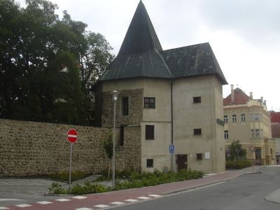
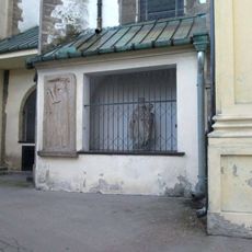
City walls of Prostějov, Medieval defensive walls in Prostějov, Czech Republic.

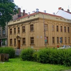
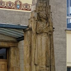
The City walls of Prostějov are stone and brick fortifications that enclose the central area and show different stages of medieval construction. They follow the outline of the historic core and remain visible from various points throughout the city.

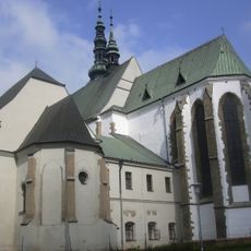
Construction began in 1495 under the Pernštejn family, during a period when defensive structures were being strengthened across the Moravian region. The integrated system was further developed with the castle built from 1522 to 1526.

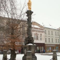
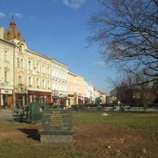
The walls form a defining part of how the city is organized, showing how medieval residents shaped their living space for protection. They stand today as a visible boundary between the historic center and newer areas.

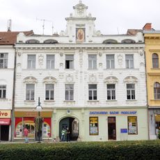
The preserved sections are accessible from several points near T.G. Masaryka Square, with informational panels at key locations. Walking the perimeter gives you a good sense of the medieval layout and the city's historical boundaries.

The fortifications incorporated Prostějov Castle, built between 1522 and 1526 as part of a unified defensive design. This arrangement allowed the trading center to be protected while serving as a visual symbol of authority.

The community of curious travelers

AroundUs brings together thousands of curated places, local tips, and hidden gems, enriched daily by 60,000 contributors worldwide.

Start exploring
Location
GPS coordinates
49.47343,17.11266
Latest update
December 14, 2025 18:47
Around this place
National House in Prostějov
Czech Republic

National House in Prostějov

144 m
Church of the Exaltation of the Holy Cross
Czech Republic

Church of the Exaltation of the Holy Cross

184 m
Old town hall in Prostějov
Czech Republic

Old town hall in Prostějov

166 m
Maria column (Prostějov)
Czech Republic

Maria column (Prostějov)

166 m
Augustiner-Chorherrenstift Proßnitz
Czech Republic

Augustiner-Chorherrenstift Proßnitz

189 m
Socha svatého Jana Nepomuckého na náměstí T. G. Masaryka v Prostějově
Czech Republic

Socha svatého Jana Nepomuckého na náměstí T. G. Masaryka v Prostějově

136 m
Statue of Karel Havlíček Borovský in Prostějov
Czech Republic

Statue of Karel Havlíček Borovský in Prostějov

151 m
Statue of Bedřich Smetana in Prostějov
Czech Republic

Statue of Bedřich Smetana in Prostějov

203 m
Memorial of Karel Vojáček and Karla Vojáčková
Czech Republic

Memorial of Karel Vojáček and Karla Vojáčková

172 m
Statue of Jiří Wolker in Prostějov
Czech Republic

Statue of Jiří Wolker in Prostějov

149 m
Socha u kostela Povýšení svatého Kříže v Prostějově
Czech Republic

Socha u kostela Povýšení svatého Kříže v Prostějově

175 m
German House
Czech Republic

German House

125 m
Dům U Měsíčka
Czech Republic

Dům U Měsíčka

212 m
Dům čp. 208
Czech Republic

Dům čp. 208

94 m
Obelisk
Czech Republic

Obelisk

71 m
Vlys vlevo od vchodu do Národního domu v Prostějově
Czech Republic

Vlys vlevo od vchodu do Národního domu v Prostějově

145 m
Bronzový Wolker na lavičce
Czech Republic

Bronzový Wolker na lavičce

209 m
Onšův dům
Czech Republic

Onšův dům

144 m
Birth house of Jiří Wolker
Czech Republic

Birth house of Jiří Wolker

166 m
Židovský dům čp. 34
Czech Republic

Židovský dům čp. 34

175 m
Kříž u kostela Povýšení svatého Kříže v Prostějově
Czech Republic

Kříž u kostela Povýšení svatého Kříže v Prostějově

177 m
Památník Spaniův - obelisk ve Smetanových sadech v Prostějově
Czech Republic

Památník Spaniův - obelisk ve Smetanových sadech v Prostějově

66 m
Kašna na Hlaváčkově náměstí v Prostějově
Czech Republic

Kašna na Hlaváčkově náměstí v Prostějově

137 m
Památník obětem okupace Varšavskou smlouvou v Prostějově
Czech Republic

Památník obětem okupace Varšavskou smlouvou v Prostějově

217 m
Fara
Czech Republic

Fara

178 m
Dům čp. 198
Czech Republic

Dům čp. 198

177 m
Kašna na náměstí T. G. Masaryka v Prostějově
Czech Republic

Kašna na náměstí T. G. Masaryka v Prostějově

196 m
Bludný kámen ve Smetanových sadech v Prostějově
Czech Republic

Bludný kámen ve Smetanových sadech v Prostějově

82 m
Show the full map
« City walls of Prostějov - Medieval defensive walls in Prostějov, Czech Republic » is provided by Around Us (aroundus.com). Images and texts are derived from Wikimedia project under a Creative Commons license. You are allowed to copy, distribute, and modify copies of this page, under the conditions set by the license, as long as this note is clearly visible.

Discover hidden gems everywhere you go!

From secret cafés to breathtaking viewpoints, skip the crowded tourist spots and find places that match your style. Our app makes it easy with voice search, smart filtering, route optimization, and insider tips from travelers worldwide. Download now for the complete mobile experience.

Around Us App Screenshot

A unique approach to discovering new places

Le Figaro

All the places worth exploring

France Info

A tailor-made excursion in just a few clicks

20 Minutes

Around Us
Travel Guide & Maps
Download

Send to your phone

QR Code
1

Open the camera app on your mobile.

2

Point at the QR code with your camera. A notification will appear.

3

Tap the notification to open the link.