Bývalá navigační věž

Log in to your account

AroundUs is a community-driven map of interesting places, built by curious explorers like you. It grows with every review, story, and photo you share.
Connect to save your favorite spots, contribute locations, and create personalized routes.
Continue with Google
Continue with Apple
Continue with X
Continue with Facebook
Continue with email
By continuing, you accept our Terms and Conditions and our Privacy Policy
Create an account

Bývalá navigační věž

Add to collection
Map
Suggest a change
Share

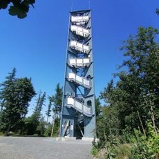
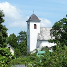
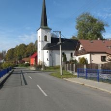
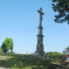
Bývalá navigační věž, Navigation tower in Budišov nad Budišovkou, Czech Republic

The navigation tower in Budišov nad Budišovkou is a structure built during the industrial era to help with orientation and guidance. It remains a recognizable landmark in the town's center and surrounding landscape.

The tower was built during the region's industrial growth period as a practical aid for transport and communication. It demonstrates how important such structures were for connecting distant areas during that time.

The tower reflects how people once relied on structures like this for daily navigation and movement. It shows the region's connection to organized transport systems that shaped community life.

The tower sits in the town center of Budišov nad Budišovkou and is easy to reach from the main streets. Parking is available nearby and the area can be explored on foot.

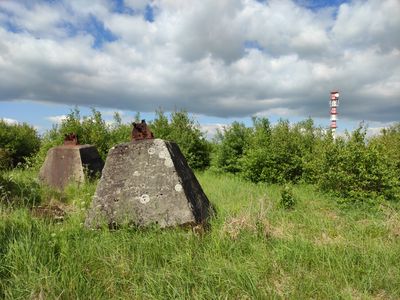
It is unusual to find such a structure far from lakes or rivers, since navigation towers typically stand along waterways. This reveals how transport networks were once organized in this inland region.

Location: Budišov nad Budišovkou

GPS coordinates: 49.77625,17.54286

Latest update: December 14, 2025 12:26

Photos
Around this place
Lávový suk Červená hora
Czech Republic

Lávový suk Červená hora

1.3 km
Church of Saint Anne and Saint James the Greater
Czech Republic

Church of Saint Anne and Saint James the Greater

4.5 km
Halaška
Czech Republic

Halaška

6.2 km
Pomník obětem bitvy u Guntramovic
Czech Republic

Pomník obětem bitvy u Guntramovic

1.5 km
Chapel of Saint John of Nepomuk
Czech Republic

Chapel of Saint John of Nepomuk

1.5 km
Červená hora
Czech Republic

Červená hora

136 m
Chapel of Saint Anne
Czech Republic

Chapel of Saint Anne

5 km
Church of Saint James the Greater
Czech Republic

Church of Saint James the Greater

3.4 km
Zlatá lípa
Czech Republic

Zlatá lípa

870 m
Cvičiště řízení bojových vozidel Libavský vrch
Czech Republic

Cvičiště řízení bojových vozidel Libavský vrch

5.6 km
Cesta Česko-německého porozumění
Czech Republic

Cesta Česko-německého porozumění

1.5 km
Smírčí kříž
Czech Republic

Smírčí kříž

3.3 km
Bývalá fara
Czech Republic

Bývalá fara

3.4 km
Statue of John of Nepomuk in Norberčany
Czech Republic

Statue of John of Nepomuk in Norberčany

3.6 km
Pomník bitvy 30. 6. 1758
Czech Republic

Pomník bitvy 30. 6. 1758

6.1 km
Church of Saint Anthony of Padua
Czech Republic

Church of Saint Anthony of Padua

3.6 km
Pomník Rudé armády
Czech Republic

Pomník Rudé armády

6.1 km
Chapel of the Nativity of the Virgin Mary
Czech Republic

Chapel of the Nativity of the Virgin Mary

3.8 km
Boží muka u severní strany kostela ve Staré Vodě
Czech Republic

Boží muka u severní strany kostela ve Staré Vodě

4.4 km
Pomník padlým v první světové válce u kostela ve Staré Vodě
Czech Republic

Pomník padlým v první světové válce u kostela ve Staré Vodě

4.4 km
Pamětní kříž u křižovatky silnic jihovýchodně od Nové Vésky
Czech Republic

Pamětní kříž u křižovatky silnic jihovýchodně od Nové Vésky

4.7 km
Boží muka u jižní strany kostela ve Staré Vodě
Czech Republic

Boží muka u jižní strany kostela ve Staré Vodě

4.5 km
Wayside cross in Podlesí
Czech Republic

Wayside cross in Podlesí

3.9 km
Boží muka na východním okraji obce při silnici na Budišov nad Budišovkou
Czech Republic

Boží muka na východním okraji obce při silnici na Budišov nad Budišovkou

4 km
Battle of Guntramovice memorial
Czech Republic

Battle of Guntramovice memorial

1.5 km
Krucifix
Czech Republic

Krucifix

6.3 km
Kaple sv. Anny se studánkou jižně od poutního místa ve Staré Vodě
Czech Republic

Kaple sv. Anny se studánkou jižně od poutního místa ve Staré Vodě

5 km
Boží muka na východním okraji obce
Czech Republic

Boží muka na východním okraji obce

4.7 km
Show the full map
Reviews

Visited this place? Tap the stars to rate it and share your experience / photos with the community! Try now! You can cancel it anytime.

« Bývalá navigační věž - Navigation tower in Budišov nad Budišovkou, Czech Republic » is provided by Around Us (aroundus.com). Images and texts are derived from Wikimedia project under a Creative Commons license. You are allowed to copy, distribute, and modify copies of this page, under the conditions set by the license, as long as this note is clearly visible.

Discover hidden gems everywhere you go!

From secret cafés to breathtaking viewpoints, skip the crowded tourist spots and find places that match your style. Our app makes it easy with voice search, smart filtering, route optimization, and insider tips from travelers worldwide. Download now for the complete mobile experience.

Around Us App Screenshot

A unique approach to discovering new places

Le Figaro

All the places worth exploring

France Info

A tailor-made excursion in just a few clicks

20 Minutes