Enable Location

We need your location to show you interesting places around you

Discover nearby places

Find interesting locations and hidden gems around you

Precise directions

Get accurate directions and distances to places

Your location is never shared with other users. It's only used when you tap the location button.

Log in to your account

Start exploring — it's free

Trusted by 62,378 travelers worldwide

Continue with Google
Continue with Apple
or

We will send you a code to connect

By continuing, you accept our Terms and Conditions and our Privacy Policy

Check your inbox

We've sent a pincode in your inbox. Please enter the code below.

Nicatous Lake

Nicatous Lake, body of water

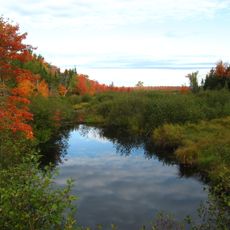
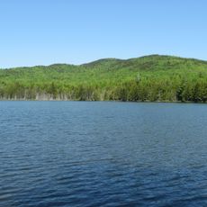
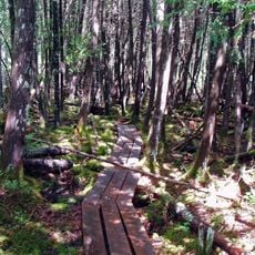
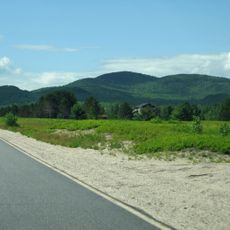
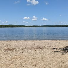
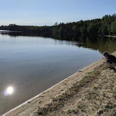
Nicatous Lake is a large reservoir in Hancock County, Maine, spanning over 5,000 acres with numerous small islands scattered throughout. The water reaches a maximum depth of about 56 feet, while the shoreline remains mostly natural and forested.

The area has been used by local communities for fishing and recreation for many years. Maine purchased about 78 islands within the lake in 1999 as part of an effort to protect nearly 9,000 acres of surrounding land.

The lake serves as a gathering place where local communities have long come together for fishing and outdoor recreation. The forested setting and remote character shape how people experience and value this natural space today.

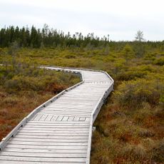
The water remains clean year-round and free from invasive plants, making it suitable for boating and fishing. Summer visitors can paddle and fish, while winter brings opportunities for ice fishing and snowmobile activities.

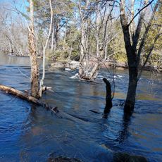
The lake supports healthy populations of landlocked salmon, brown trout, and smallmouth bass that draw anglers from the region. Its complex network of bays and inlets offers boaters surprising new routes and hidden corners to explore.

The community of curious travelers

AroundUs brings together thousands of curated places, local tips, and hidden gems, enriched daily by 60,000 contributors worldwide.

Start exploring
Location
GPS coordinates
45.08800,-68.14700
Latest update
February 9, 2026 08:21
Around this place
University of Maine
United States of America

University of Maine

46.1 km
Mount Hope Cemetery
United States of America

Mount Hope Cemetery

54.1 km
Dorothea Dix Psychiatric Center
United States of America

Dorothea Dix Psychiatric Center

55.7 km
Sunkhaze Meadows National Wildlife Refuge
United States of America

Sunkhaze Meadows National Wildlife Refuge

34.6 km
United States of America

Black Cap Mountain

49.8 km
St. Anne's Church and Mission Site
United States of America

St. Anne's Church and Mission Site

43 km
Fay Hyland Botanical Plantation
United States of America

Fay Hyland Botanical Plantation

46.7 km
Orono Bog
United States of America

Orono Bog

51.7 km
William M. Nash House
United States of America

William M. Nash House

56.9 km
Page Farm & Home Museum
United States of America

Page Farm & Home Museum

46 km
Hirundo Wildlife Refuge
United States of America

Hirundo Wildlife Refuge

51.4 km
Bear Brook Watershed in Maine
United States of America

Bear Brook Watershed in Maine

25.4 km
William Colburn House
United States of America

William Colburn House

47.4 km
Gov. Israel Washburn House
United States of America

Gov. Israel Washburn House

47.9 km
Phi Gamma Delta House
United States of America

Phi Gamma Delta House

46.8 km
Nathaniel Treat House
United States of America

Nathaniel Treat House

46.8 km
Edith Marion Patch House
United States of America

Edith Marion Patch House

46.1 km
Orono Post Office
United States of America

Orono Post Office

47.2 km
David W. Campbell House
United States of America

David W. Campbell House

57.1 km
Cherryfield Academy
United States of America

Cherryfield Academy

56.9 km
Archibald-Adams House
United States of America

Archibald-Adams House

56.4 km
Gordon Fox Ranch
United States of America

Gordon Fox Ranch

43.2 km
East Eddington Public Hall
United States of America

East Eddington Public Hall

47.7 km
District No. 2 School
United States of America

District No. 2 School

38.3 km
Johnson Brook Trail
United States of America

Johnson Brook Trail

31.5 km
Lead Mountain
United States of America

Lead Mountain

25 km
Schoodic Beach
United States of America

Schoodic Beach

56.6 km
Dawn Marie Beach
United States of America

Dawn Marie Beach

23.1 km
Show the full map
« Nicatous Lake - body of water » is provided by Around Us (aroundus.com). Images and texts are derived from Wikimedia project under a Creative Commons license. You are allowed to copy, distribute, and modify copies of this page, under the conditions set by the license, as long as this note is clearly visible.

Discover hidden gems everywhere you go!

From secret cafés to breathtaking viewpoints, skip the crowded tourist spots and find places that match your style. Our app makes it easy with voice search, smart filtering, route optimization, and insider tips from travelers worldwide. Download now for the complete mobile experience.

Around Us App Screenshot

A unique approach to discovering new places

Le Figaro

All the places worth exploring

France Info

A tailor-made excursion in just a few clicks

20 Minutes

Around Us
Travel Guide & Maps
Download

Send to your phone

QR Code
1

Open the camera app on your mobile.

2

Point at the QR code with your camera. A notification will appear.

3

Tap the notification to open the link.