Enable Location

We need your location to show you interesting places around you

Discover nearby places

Find interesting locations and hidden gems around you

Precise directions

Get accurate directions and distances to places

Your location is never shared with other users. It's only used when you tap the location button.

Chestnut Hill Historic District

Log in to your account

Start exploring — it's free

Trusted by 62,571 travelers worldwide

Continue with Google
Continue with Apple
or

We will send you a code to connect

By continuing, you accept our Terms and Conditions and our Privacy Policy

Check your inbox

We've sent a pincode in your inbox. Please enter the code below.

Chestnut Hill Historic District, US national historic district in Asheville, Buncombe County, North Carolina

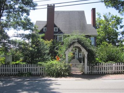
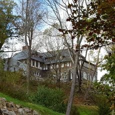
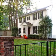
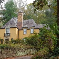
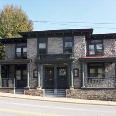
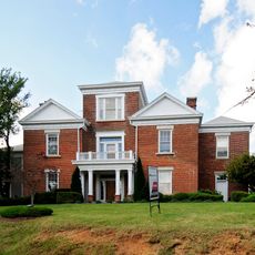
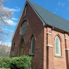
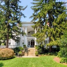
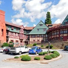
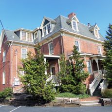
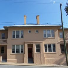
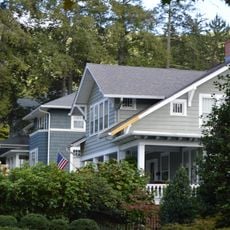
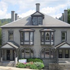
Chestnut Hill Historic District is a residential neighborhood in Asheville covering about 55 acres with approximately 238 homes built in the late 1800s and early 1900s. The architecture includes Colonial Revival, Queen Anne, and Victorian styles featuring wide porches, steep roofs, and decorative woodwork.

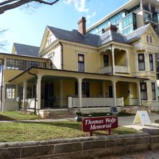
The area was farmland and woods in the late 1700s before houses began appearing around 1880 following the railroad's arrival. Major architects Richard Sharp Smith and J.A. Tennent designed homes for wealthy residents including lawyers, doctors, and business owners who helped build the neighborhood's character.

The name "Chestnut Hill" comes from the chestnut trees that once covered the area. The houses with their large front porches and the tree-lined streets reflect how residents once gathered outside and how the neighborhood served as a gathering place for the city's business owners, doctors, and professionals.

The neighborhood has wide, tree-lined streets with brick sidewalks and is easy to explore on foot at a relaxed pace. Take time to observe the house details from the street and enjoy the quiet setting of this residential area.

The neighborhood gained fame as a health refuge in the early 1900s when visitors came seeking the mild climate, particularly those with respiratory illnesses. Many homes served as guest houses and boarding houses, turning the district into a temporary home for countless health seekers staying for extended periods.

The community of curious travelers

AroundUs brings together thousands of curated places, local tips, and hidden gems, enriched daily by 60,000 contributors worldwide.

Start exploring
Location
GPS coordinates
35.60360,-82.54860
Latest update
February 9, 2026 07:43
Around this place
Thomas Wolfe House
United States of America

Thomas Wolfe House

708 m
The Orange Peel
United States of America

The Orange Peel

1.4 km
Overlook Castle
United States of America

Overlook Castle

1.5 km
Downtown Asheville Historic District
United States of America

Downtown Asheville Historic District

1 km
Jackson Building
United States of America

Jackson Building

984 m
Zealandia
United States of America

Zealandia

1.2 km
Asheville City Hall
United States of America

Asheville City Hall

895 m
S & W Cafeteria
United States of America

S & W Cafeteria

1.1 km
Asheville Art Museum
United States of America

Asheville Art Museum

1 km
Asheville Masonic Temple
United States of America

Asheville Masonic Temple

703 m
Buncombe County Courthouse
United States of America

Buncombe County Courthouse

868 m
Congregation Beth Israel
United States of America

Congregation Beth Israel

1.2 km
Young Men's Institute Building
United States of America

Young Men's Institute Building

1.1 km
William Jennings Bryan House
United States of America

William Jennings Bryan House

1 km
Grove Park Historic District
United States of America

Grove Park Historic District

819 m
Pack Memorial Library
United States of America

Pack Memorial Library

993 m
Building at 134–136½ Biltmore Avenue
United States of America

Building at 134–136½ Biltmore Avenue

1.5 km
Ravenscroft School
United States of America

Ravenscroft School

1.5 km
St. Matthias Episcopal Church
United States of America

St. Matthias Episcopal Church

1.3 km
Dr. Carl V. Reynolds House
United States of America

Dr. Carl V. Reynolds House

1.3 km
Manor and Cottages
United States of America

Manor and Cottages

745 m
George A. Mears House
United States of America

George A. Mears House

1.5 km
Claxton School
United States of America

Claxton School

651 m
Building at 140 Biltmore Avenue
United States of America

Building at 140 Biltmore Avenue

1.5 km
Proximity Park Historic District
United States of America

Proximity Park Historic District

1.3 km
Building at 130–132 Biltmore Avenue
United States of America

Building at 130–132 Biltmore Avenue

1.5 km
Moogseum
United States of America

Moogseum

772 m
Montford Area Historic District
United States of America

Montford Area Historic District

1.5 km
Show the full map
« Chestnut Hill Historic District - US national historic district in Asheville, Buncombe County, North Carolina » is provided by Around Us (aroundus.com). Images and texts are derived from Wikimedia project under a Creative Commons license. You are allowed to copy, distribute, and modify copies of this page, under the conditions set by the license, as long as this note is clearly visible.

Discover hidden gems everywhere you go!

From secret cafés to breathtaking viewpoints, skip the crowded tourist spots and find places that match your style. Our app makes it easy with voice search, smart filtering, route optimization, and insider tips from travelers worldwide. Download now for the complete mobile experience.

Around Us App Screenshot

A unique approach to discovering new places

Le Figaro

All the places worth exploring

France Info

A tailor-made excursion in just a few clicks

20 Minutes

Around Us
Travel Guide & Maps
Download

Send to your phone

QR Code
1

Open the camera app on your mobile.

2

Point at the QR code with your camera. A notification will appear.

3

Tap the notification to open the link.