Enable Location

We need your location to show you interesting places around you

Discover nearby places

Find interesting locations and hidden gems around you

Precise directions

Get accurate directions and distances to places

Your location is never shared with other users. It's only used when you tap the location button.

Log in to your account

Start exploring — it's free

Trusted by 62,481 travelers worldwide

Continue with Google
Continue with Apple
or

We will send you a code to connect

By continuing, you accept our Terms and Conditions and our Privacy Policy

Check your inbox

We've sent a pincode in your inbox. Please enter the code below.

Lexington Residential Historic District

Lexington Residential Historic District, historic district in North Carolina, United States

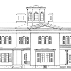
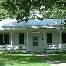
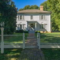
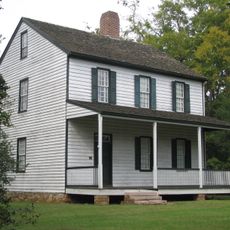
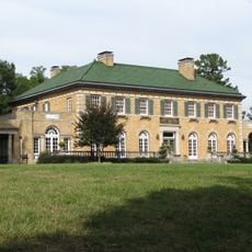
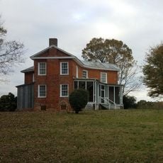
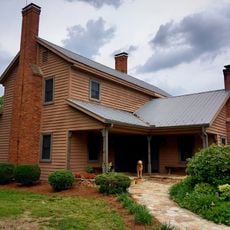
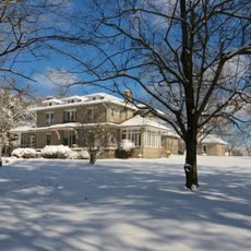
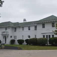
The Lexington Residential Historic District is a neighborhood in the town of Lexington containing over 800 buildings from the late 1800s and early 1900s. The houses display various styles including Queen Anne, Craftsman, and Colonial Revival, while the streets follow an irregular pattern lined with mature trees.

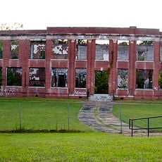
The district developed from the late 1700s when Lexington was named after the famous battle and later became the county seat. Most houses were built between 1900 and 1956 as industries like cotton mills and furniture factories drove the town's growth.

The name Lexington comes from the famous battle in Massachusetts, reflecting how early settlers named their new home. Today you can see how residents maintain their houses with care, showing they value the history of their neighborhood.

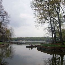
The streets are connected by sidewalks that link the neighborhood to downtown, and most houses have driveways or garages. The irregular street pattern and mature trees create a natural walking route through different neighborhoods like Park Place and Westover Heights.

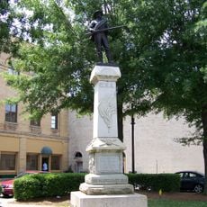
An obelisk in the cemetery honors Andrew Caldcleugh and dates to the late 1700s, well before most houses in the district were built. The graves here display various shapes and designs reflecting Victorian traditions and Christian symbols.

The community of curious travelers

AroundUs brings together thousands of curated places, local tips, and hidden gems, enriched daily by 60,000 contributors worldwide.

Start exploring
Location
GPS coordinates
35.82610,-80.25940
Latest update
February 9, 2026 07:42
Around this place
High Rock Lake
United States of America

High Rock Lake

22 km
North Carolina Transportation Museum
United States of America

North Carolina Transportation Museum

22.2 km
United States of America

Boone's Cave Park

18.8 km
Cooleemee
United States of America

Cooleemee

13.9 km
Richard Childress Racing Museum
United States of America

Richard Childress Racing Museum

9 km
The Big Chair
United States of America

The Big Chair

17.2 km
Jesse Helms Center
United States of America

Jesse Helms Center

22.9 km
Lexington Memorial Hospital
United States of America

Lexington Memorial Hospital

2.1 km
Mitchell House
United States of America

Mitchell House

16 km
Church Street School
United States of America

Church Street School

16.9 km
Thomasville Railroad Passenger Depot
United States of America

Thomasville Railroad Passenger Depot

17.7 km
Dr. William Rainey Holt House
United States of America

Dr. William Rainey Holt House

614 m
Thomasville Public Library
United States of America

Thomasville Public Library

17.2 km
Yadkin River Veterans Memorial Bridge
United States of America

Yadkin River Veterans Memorial Bridge

16.7 km
John Steele House
United States of America

John Steele House

24.7 km
Smith Clinic
United States of America

Smith Clinic

17.3 km
Grimes Brothers Mill
United States of America

Grimes Brothers Mill

433 m
Wiley and Elizabeth Forbus House
United States of America

Wiley and Elizabeth Forbus House

23.8 km
Erlanger Mill Village Historic District
United States of America

Erlanger Mill Village Historic District

1.6 km
Grimes School
United States of America

Grimes School

855 m
Walter McCanless House
United States of America

Walter McCanless House

24.7 km
Uptown Lexington Historic District
United States of America

Uptown Lexington Historic District

563 m
Philip Sowers House
United States of America

Philip Sowers House

18.6 km
Spurgeon House
United States of America

Spurgeon House

23.7 km
John Wesley Snyder House
United States of America

John Wesley Snyder House

22.2 km
T. Austin and Ernestine L. Finch House
United States of America

T. Austin and Ernestine L. Finch House

17.4 km
John Henry Welborn House
United States of America

John Henry Welborn House

777 m
Shadrach Lambeth House
United States of America

Shadrach Lambeth House

18.7 km
Show the full map
« Lexington Residential Historic District - historic district in North Carolina, United States » is provided by Around Us (aroundus.com). Images and texts are derived from Wikimedia project under a Creative Commons license. You are allowed to copy, distribute, and modify copies of this page, under the conditions set by the license, as long as this note is clearly visible.

Discover hidden gems everywhere you go!

From secret cafés to breathtaking viewpoints, skip the crowded tourist spots and find places that match your style. Our app makes it easy with voice search, smart filtering, route optimization, and insider tips from travelers worldwide. Download now for the complete mobile experience.

Around Us App Screenshot

A unique approach to discovering new places

Le Figaro

All the places worth exploring

France Info

A tailor-made excursion in just a few clicks

20 Minutes

Around Us
Travel Guide & Maps
Download

Send to your phone

QR Code
1

Open the camera app on your mobile.

2

Point at the QR code with your camera. A notification will appear.

3

Tap the notification to open the link.