Enable Location

We need your location to show you interesting places around you

Discover nearby places

Find interesting locations and hidden gems around you

Precise directions

Get accurate directions and distances to places

Your location is never shared with other users. It's only used when you tap the location button.

Frog Level Historic District

Log in to your account

Start exploring — it's free

Trusted by 61,810 travelers worldwide

Continue with Google
Continue with Apple
or

We will send you a code to connect

By continuing, you accept our Terms and Conditions and our Privacy Policy

Check your inbox

We've sent a pincode in your inbox. Please enter the code below.

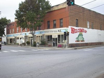
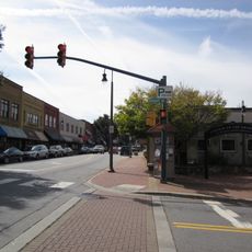
Frog Level Historic District, Historic district in Waynesville, United States.

Description

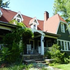
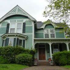
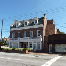
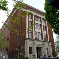
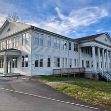
Frog Level Historic District is a commercial area with 16 preserved buildings and one structure built from brick and wood frame in the early 20th century. The structures line the streets between Commerce and Boundary and now house a mix of shops and restaurants within their restored spaces.

History

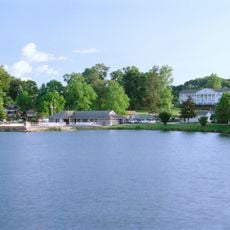
The district grew after the railway arrived in 1884, connecting Waynesville to larger transportation networks and turning it into a busy trading hub. This new connection brought merchants who built their shops and offices near Richland Creek during a period of commercial expansion.

Culture

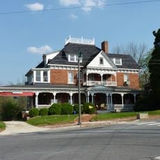
The buildings display Early Commercial and Romanesque architectural styles that shaped how merchants wanted their storefronts and offices to look. These design choices still define the character of the district today and reflect the pride people took in their commercial spaces.

Practical

The district is easy to walk through and located between two main streets, making it simple to find your way around. The well-maintained buildings and spacious sidewalks make it pleasant to explore and visit the various shops and dining spots at your own pace.

Did you know?

The name comes from frogs that once lived in the swampy areas near Richland Creek. This unusual origin is largely forgotten today since the land was drained long ago, yet the name keeps this quirky historical connection alive.

Location
GPS coordinates
35.49444,-82.99056
Latest update
December 14, 2025 15:02

AroundUs brings together thousands of curated places, local tips, and hidden gems, enriched daily by 60,000 contributors worldwide. Discover all places nearby (Waynesville).

Around this place
Ghost Town in the Sky
United States of America

Ghost Town in the Sky

10.8 km
Cold Mountain
United States of America

Cold Mountain

15.4 km
Waterrock Knob
United States of America

Waterrock Knob

13.8 km
Shining Rock Wilderness
United States of America

Shining Rock Wilderness

20.4 km
Richland Balsam
United States of America

Richland Balsam

14.2 km
Shining Rock
United States of America

Shining Rock

18.2 km
Middle Prong Wilderness
United States of America

Middle Prong Wilderness

18 km
Frank Smathers House
United States of America

Frank Smathers House

1.6 km
Boone-Withers House
United States of America

Boone-Withers House

429 m
Shook-Welch-Smathers House
United States of America

Shook-Welch-Smathers House

7.7 km
Francis Grist Mill
United States of America

Francis Grist Mill

3.7 km
Davis Family House
United States of America

Davis Family House

14.3 km
Colonial Theater
United States of America

Colonial Theater

14.3 km
Waynesville Main Street Historic District
United States of America

Waynesville Main Street Historic District

0 m
Dr. J. Howell Way House
United States of America

Dr. J. Howell Way House

753 m
United States of America

Mount Zion United Methodist Church

14.6 km
Masonic Hall
United States of America

Masonic Hall

547 m
Shackford Hall
United States of America

Shackford Hall

3.5 km
Charles and Annie Quinlan House
United States of America

Charles and Annie Quinlan House

896 m
Shelton House
United States of America

Shelton House

1.2 km
Haywood County Courthouse
United States of America

Haywood County Courthouse

373 m
Alden and Thomasene Howell House
United States of America

Alden and Thomasene Howell House

986 m
Clyde H. Ray Sr. House
United States of America

Clyde H. Ray Sr. House

311 m
Former Citizens Bank and Trust Company Building
United States of America

Former Citizens Bank and Trust Company Building

507 m
Engadine
United States of America

Engadine

21.3 km
Cataloochee Historic District
United States of America

Cataloochee Historic District

18.1 km
Richland Balsam Overlook
United States of America

Richland Balsam Overlook

14.6 km
Lake Junaluska
United States of America

Lake Junaluska

3.8 km
Show the full map
« Frog Level Historic District - Historic district in Waynesville, United States » is provided by Around Us (aroundus.com). Images and texts are derived from Wikimedia project under a Creative Commons license. You are allowed to copy, distribute, and modify copies of this page, under the conditions set by the license, as long as this note is clearly visible.

Discover hidden gems everywhere you go!

From secret cafés to breathtaking viewpoints, skip the crowded tourist spots and find places that match your style. Our app makes it easy with voice search, smart filtering, route optimization, and insider tips from travelers worldwide. Download now for the complete mobile experience.

Around Us App Screenshot

A unique approach to discovering new places

Le Figaro

All the places worth exploring

France Info

A tailor-made excursion in just a few clicks

20 Minutes

Around Us
Travel Guide & Maps
Download

Send to your phone

QR Code
1

Open the camera app on your mobile.

2

Point at the QR code with your camera. A notification will appear.

3

Tap the notification to open the link.