Enable Location

We need your location to show you interesting places around you

Discover nearby places

Find interesting locations and hidden gems around you

Precise directions

Get accurate directions and distances to places

Your location is never shared with other users. It's only used when you tap the location button.

Log in to your account

Start exploring — it's free

Trusted by 63,117 travelers worldwide

Continue with Google
Continue with Apple
or

We will send you a code to connect

By continuing, you accept our Terms and Conditions and our Privacy Policy

Check your inbox

We've sent a pincode in your inbox. Please enter the code below.

Discussion Reviews Photo
2.4k Popularity

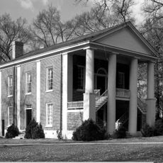
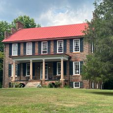
Potts Plantation, historic farm in North Carolina, United States

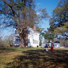
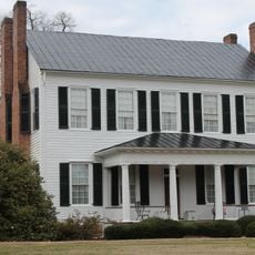
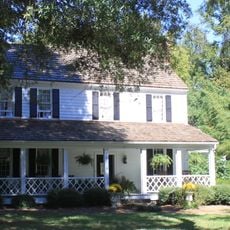
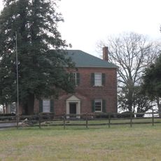
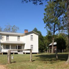
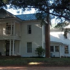
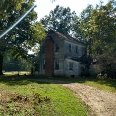
Potts Plantation is a plantation located on Smith Road about half a mile east of Cornelius in Mecklenburg County, North Carolina. The property features a main house built around 1811 from hand-hewn logs, several log outbuildings, a barn over 200 years old, and multiple tenant houses that reflect working farm life across its extensive grounds.

The land was granted to John Potts in 1753, a Scotch Irish pioneer, and has remained in the family for over two centuries. The main house was built around 1811 using traditional log construction methods that reflect early settlement and agricultural development in Mecklenburg County.

The Potts family name marks this place for over two centuries and remains deeply connected to the land and community. Family members contributed to local schools and churches, weaving their story into the broader fabric of Mecklenburg County's development.

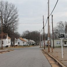
The site is accessible and located in northern Mecklenburg County, about half a mile from Cornelius, making it easy to reach by car. The property contains several historic structures spread across the grounds, so plan time to walk between the different buildings and explore the entire compound.

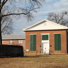
The barn contains hand-made wooden feed troughs and a large grain bin built on the farm itself, offering a rare glimpse of self-sufficiency practices. These objects reveal the practical daily methods that early farming families relied on to manage their operations.

The community of curious travelers

AroundUs brings together thousands of curated places, local tips, and hidden gems, enriched daily by 60,000 contributors worldwide.

Start exploring
Location
GPS coordinates
35.47920,-80.83690
Latest update
February 9, 2026 08:22
Around this place
Lake Norman
United States of America

Lake Norman

8.8 km
Sea Life Charlotte-Concord
United States of America

Sea Life Charlotte-Concord

15.9 km
Cowans Ford Hydroelectric Station
United States of America

Cowans Ford Hydroelectric Station

12.1 km
Richardson Stadium
United States of America

Richardson Stadium

2.3 km
Latta Plantation
United States of America

Latta Plantation

16.3 km
Ramsay Creek Park Beach
United States of America

Ramsay Creek Park Beach

6.1 km
Mount Mourne Plantation
United States of America

Mount Mourne Plantation

8.1 km
Beaver Dam Plantation House
United States of America

Beaver Dam Plantation House

1.8 km
A2 wind tunnel
United States of America

A2 wind tunnel

16.1 km
Mooresville Mill Village Historic District
United States of America

Mooresville Mill Village Historic District

11 km
Mooresville Historic District
United States of America

Mooresville Historic District

11.8 km
Johnson-Neel House
United States of America

Johnson-Neel House

13.8 km
Centre Presbyterian Church, Session House and Cemeteries
United States of America

Centre Presbyterian Church, Session House and Cemeteries

8.3 km
Eumenean Hall
United States of America

Eumenean Hall

2.5 km
Espy Watts Brawley House
United States of America

Espy Watts Brawley House

13.5 km
Philanthropic Hall, Davidson College
United States of America

Philanthropic Hall, Davidson College

2.4 km
Cedar Grove
United States of America

Cedar Grove

11 km
South Broad Street Row
United States of America

South Broad Street Row

11.4 km
United States of America

Ramah Presbyterian Church and Cemetery

5.4 km
Coddle Creek Associate Reformed Presbyterian Church, Session House and Cemetery
United States of America

Coddle Creek Associate Reformed Presbyterian Church, Session House and Cemetery

7.2 km
Croft Historic District
United States of America

Croft Historic District

14.9 km
Albert McCoy Farm
United States of America

Albert McCoy Farm

13.3 km
Hargrave House
United States of America

Hargrave House

15.2 km
Davidson Historic District
United States of America

Davidson Historic District

3.4 km
George Houston House
United States of America

George Houston House

5.2 km
Chairman Blake House
United States of America

Chairman Blake House

2.3 km
Gen. William Kerr House
United States of America

Gen. William Kerr House

12.7 km
Samuel J. McElroy House
United States of America

Samuel J. McElroy House

13.6 km
Show the full map
Reviews
Share your experience

No review yet

Discussions
Start a discussion...

No discussion yet

« Potts Plantation - historic farm in North Carolina, United States » is provided by Around Us (aroundus.com). Images and texts are derived from Wikimedia project under a Creative Commons license. You are allowed to copy, distribute, and modify copies of this page, under the conditions set by the license, as long as this note is clearly visible.

Discover hidden gems everywhere you go!

From secret cafés to breathtaking viewpoints, skip the crowded tourist spots and find places that match your style. Our app makes it easy with voice search, smart filtering, route optimization, and insider tips from travelers worldwide. Download now for the complete mobile experience.

Around Us App Screenshot

A unique approach to discovering new places

Le Figaro

All the places worth exploring

France Info

A tailor-made excursion in just a few clicks

20 Minutes

Around Us
Travel Guide & Maps
Download

Send to your phone

QR Code
1

Open the camera app on your mobile.

2

Point at the QR code with your camera. A notification will appear.

3

Tap the notification to open the link.