Enable Location

We need your location to show you interesting places around you

Discover nearby places

Find interesting locations and hidden gems around you

Precise directions

Get accurate directions and distances to places

Your location is never shared with other users. It's only used when you tap the location button.

Latta Plantation

Log in to your account

Start exploring — it's free

Trusted by 62,519 travelers worldwide

Continue with Google
Continue with Apple
or

We will send you a code to connect

By continuing, you accept our Terms and Conditions and our Privacy Policy

Check your inbox

We've sent a pincode in your inbox. Please enter the code below.

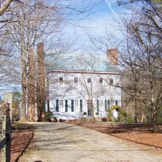
Latta Plantation, human settlement in North Carolina, United States of America

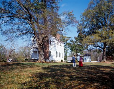
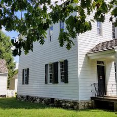
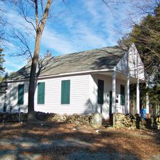
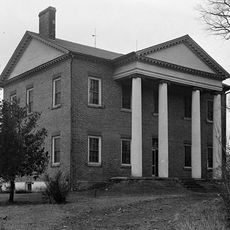
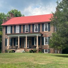
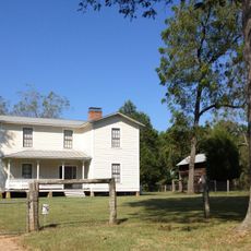
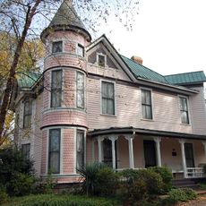
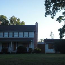
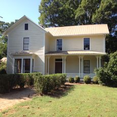
Latta Plantation is a historic site in North Carolina with buildings and grounds that reflect earlier periods of settlement and farming. The estate features wood and brick structures that show how homes and agricultural facilities were built and arranged centuries ago.

The plantation developed during the era when agriculture was the primary economic activity in the region and remains a testament to that period. Over time, the site was preserved and added to the national register of historic places to protect its significance.

The plantation served as a center of agricultural life and shows how farmers worked and lived in earlier times. Visitors can imagine daily routines as they walk through the fields and see the structures that supported farming activities.

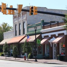
The site is easy to find in Huntersville and offers open areas to explore with both buildings and natural spaces. Visitors should plan time for walking through the grounds to see the historic structures and surrounding landscape.

The community actively participates in shaping the future of the site through meetings where members discuss preservation and visitor experiences. This involvement shows that the history remains alive and meaningful to the people who live nearby.

The community of curious travelers

AroundUs brings together thousands of curated places, local tips, and hidden gems, enriched daily by 60,000 contributors worldwide.

Start exploring
Location
GPS coordinates
35.35440,-80.93060
Latest update
February 7, 2026 11:00
Around this place
Lake Norman
United States of America

Lake Norman

14.4 km
Belmont Abbey College
United States of America

Belmont Abbey College

14.6 km
Sullenberger Aviation Museum
United States of America

Sullenberger Aviation Museum

15 km
United States of America

Mountain Island Lake

1.3 km
Charlotte Speedway
United States of America

Charlotte Speedway

13 km
Belmont Abbey
United States of America

Belmont Abbey

14.6 km
The Vue
United States of America

The Vue

15.8 km
AvidxChange Music Factory
United States of America

AvidxChange Music Factory

14.9 km
Cowans Ford Hydroelectric Station
United States of America

Cowans Ford Hydroelectric Station

9.3 km
Latta Place Historic Site
United States of America

Latta Place Historic Site

170 m
Charles R. Jonas Federal Building
United States of America

Charles R. Jonas Federal Building

15.8 km
St. Joseph's Catholic Church
United States of America

St. Joseph's Catholic Church

6.6 km
Ingleside
United States of America

Ingleside

15.9 km
Frazier Park
United States of America

Frazier Park

15.1 km
Andrew Carpenter House
United States of America

Andrew Carpenter House

11.7 km
Biddle Memorial Hall
United States of America

Biddle Memorial Hall

14 km
Sloans Ferry Bridge
United States of America

Sloans Ferry Bridge

14 km
Bryant Park
United States of America

Bryant Park

15.1 km
Downtown Mount Holly Historic District
United States of America

Downtown Mount Holly Historic District

10 km
Cedar Grove
United States of America

Cedar Grove

5.3 km
United States of America

Ramah Presbyterian Church and Cemetery

15 km
Croft Historic District
United States of America

Croft Historic District

9.7 km
Albert McCoy Farm
United States of America

Albert McCoy Farm

4.3 km
Overcarsh House
United States of America

Overcarsh House

15.8 km
Edward M. Rozzell House
United States of America

Edward M. Rozzell House

3.7 km
Belmont City Hall
United States of America

Belmont City Hall

15.7 km
Samuel J. McElroy House
United States of America

Samuel J. McElroy House

3.1 km
Union Storage and Warehouse Company Building
United States of America

Union Storage and Warehouse Company Building

15.5 km
Show the full map
« Latta Plantation - human settlement in North Carolina, United States of America » is provided by Around Us (aroundus.com). Images and texts are derived from Wikimedia project under a Creative Commons license. You are allowed to copy, distribute, and modify copies of this page, under the conditions set by the license, as long as this note is clearly visible.

Discover hidden gems everywhere you go!

From secret cafés to breathtaking viewpoints, skip the crowded tourist spots and find places that match your style. Our app makes it easy with voice search, smart filtering, route optimization, and insider tips from travelers worldwide. Download now for the complete mobile experience.

Around Us App Screenshot

A unique approach to discovering new places

Le Figaro

All the places worth exploring

France Info

A tailor-made excursion in just a few clicks

20 Minutes

Around Us
Travel Guide & Maps
Download

Send to your phone

QR Code
1

Open the camera app on your mobile.

2

Point at the QR code with your camera. A notification will appear.

3

Tap the notification to open the link.