Enable Location

We need your location to show you interesting places around you

Discover nearby places

Find interesting locations and hidden gems around you

Precise directions

Get accurate directions and distances to places

Your location is never shared with other users. It's only used when you tap the location button.

Log in to your account

Start exploring — it's free

Trusted by 63,741 travelers worldwide

Continue with Google
Continue with Apple
or

We will send you a code to connect

By continuing, you accept our Terms and Conditions and our Privacy Policy

Check your inbox

We've sent a pincode in your inbox. Please enter the code below.

Wrightsville Reservoir
Discussion Reviews Photo
1.8k Popularity

Wrightsville Reservoir, body of water

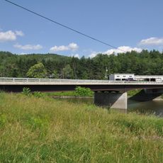
Wrightsville Reservoir is a water body in Vermont covering about 88 acres with sandy beaches, picnic areas, and playgrounds. The facility features a boat rental shop offering kayaks, paddleboards, and canoes, along with 5 miles of trails for walking, running, and biking.

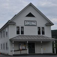
The reservoir was established in 1983 by Vermont lawmakers and is managed by four nearby towns: Middlesex, Montpelier, East Montpelier, and Worcester. This partnership allows the towns to share operational costs and maintain the park as a public recreation area.

The reservoir serves as a gathering place for the local community, drawing families and nature lovers throughout the warmer months. The mix of water activities and trail use creates a social rhythm where people return season after season to enjoy outdoor time together.

The park opens seasonally during warmer months, with a flag system indicating whether the area is accessible on any given day. Season passes provide cost-effective access to swimming, boat rentals, and activities, with discounts available for residents of the surrounding district.

The area hosts diverse bird life including ospreys and bald eagles hunting over the water, along with nesting merlins near the disc golf course that many visitors overlook. The open water and shrubby trails also provide excellent chances to spot beavers actively working along the shoreline.

The community of curious travelers

AroundUs brings together thousands of curated places, local tips, and hidden gems, enriched daily by 60,000 contributors worldwide.

Start exploring
Location
GPS coordinates
44.31667,-72.57500
Latest update
February 9, 2026 08:20
Around this place
Vermont State House
United States of America

Vermont State House

6 km
Hubbard Park
United States of America

Hubbard Park

5.4 km
Christ Episcopal Church
United States of America

Christ Episcopal Church

6.1 km
Saint Augustine Church, Montpelier
United States of America

Saint Augustine Church, Montpelier

6.5 km
Vermont Granite Museum
United States of America

Vermont Granite Museum

12.4 km
Montpelier City Hall
United States of America

Montpelier City Hall

6.4 km
Athenwood and the Thomas W. Wood Studio
United States of America

Athenwood and the Thomas W. Wood Studio

6.8 km
Montpelier Historic District
United States of America

Montpelier Historic District

6.2 km
College Hall
United States of America

College Hall

6.9 km
National Clothespin Factory
United States of America

National Clothespin Factory

7.2 km
Martin Covered Bridge
United States of America

Martin Covered Bridge

13.7 km
Green Mountain Seminary
United States of America

Green Mountain Seminary

13.2 km
Coburn Covered Bridge
United States of America

Coburn Covered Bridge

10.4 km
Colby Mansion
United States of America

Colby Mansion

13.9 km
Middlesex–Winooski River Bridge
United States of America

Middlesex–Winooski River Bridge

9.8 km
Allenwood Farm
United States of America

Allenwood Farm

12 km
Worcester Town Hall
United States of America

Worcester Town Hall

6.6 km
Kents Corner Historic District
United States of America

Kents Corner Historic District

8.8 km
East Village Meetinghouse
United States of America

East Village Meetinghouse

8.5 km
Joshua Twing Gristmill
United States of America

Joshua Twing Gristmill

13.4 km
North Calais Village Historic District
United States of America

North Calais Village Historic District

13.3 km
Theodore Wood House
United States of America

Theodore Wood House

12.9 km
Parley Davis House
United States of America

Parley Davis House

5.2 km
Chauncey B. Leonard House
United States of America

Chauncey B. Leonard House

11.8 km
Worcester Village School
United States of America

Worcester Village School

6.6 km
Gale-Bancroft House
United States of America

Gale-Bancroft House

12.9 km
Plainfield Village Historic District
United States of America

Plainfield Village Historic District

12.6 km
Capitol Theatre
United States of America

Capitol Theatre

6.2 km
Show the full map
Reviews
Share your experience

No review yet

Discussions
Start a discussion...

No discussion yet

« Wrightsville Reservoir - body of water » is provided by Around Us (aroundus.com). Images and texts are derived from Wikimedia project under a Creative Commons license. You are allowed to copy, distribute, and modify copies of this page, under the conditions set by the license, as long as this note is clearly visible.

Discover hidden gems everywhere you go!

From secret cafés to breathtaking viewpoints, skip the crowded tourist spots and find places that match your style. Our app makes it easy with voice search, smart filtering, route optimization, and insider tips from travelers worldwide. Download now for the complete mobile experience.

Around Us App Screenshot

A unique approach to discovering new places

Le Figaro

All the places worth exploring

France Info

A tailor-made excursion in just a few clicks

20 Minutes

Around Us
Travel Guide & Maps
Download

Send to your phone

QR Code
1

Open the camera app on your mobile.

2

Point at the QR code with your camera. A notification will appear.

3

Tap the notification to open the link.