Enable Location

We need your location to show you interesting places around you

Discover nearby places

Find interesting locations and hidden gems around you

Precise directions

Get accurate directions and distances to places

Your location is never shared with other users. It's only used when you tap the location button.

Log in to your account

Start exploring — it's free

Trusted by 62,473 travelers worldwide

Continue with Google
Continue with Apple
or

We will send you a code to connect

By continuing, you accept our Terms and Conditions and our Privacy Policy

Check your inbox

We've sent a pincode in your inbox. Please enter the code below.

Swartswood Lake

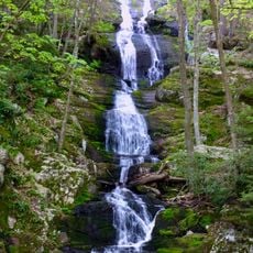
Swartswood Lake, Lake in New Jersey, USA

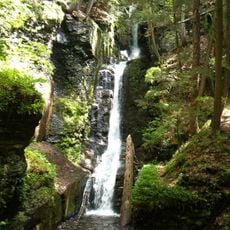
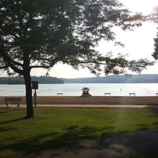
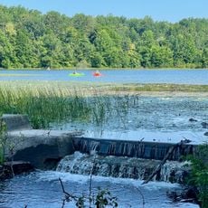
Swartswood Lake is a large reservoir in New Jersey surrounded by wooded hills and clear water. The area includes a sandy beach, grassy picnic spaces, and connected smaller lakes, with only electric boats allowed to maintain the peaceful setting.

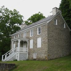
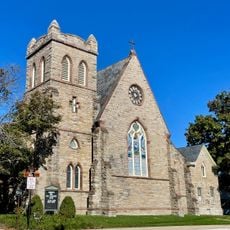
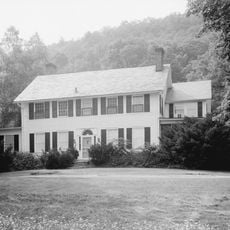
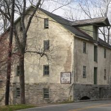
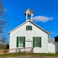
The land was acquired for public use in 1914 and has since been a place for fishing, boating, and recreation. A historic grist mill from the 1800s built with local stone stands nearby, reflecting the region's farming past.

The lake's name comes from early settlers in the area, and it has long been a gathering place for families across generations. Fishing and boating traditions remain central to how people experience and use the water today.

The lake is easily accessible by car with parking at several locations around the grounds. The park is open during daylight hours with picnic areas, restrooms, and designated boat launch spots for visitors of all levels.

The lake is home to diverse plant life including water lilies, cattails, and pickerel rush in the shallow areas, studied by botanists for their ecological value. The nearby Peters Valley School of Craft offers pottery, glassmaking, and woodworking classes in this remote artistic setting.

The community of curious travelers

AroundUs brings together thousands of curated places, local tips, and hidden gems, enriched daily by 60,000 contributors worldwide.

Start exploring
Location
GPS coordinates
41.07130,-74.83467
Latest update
February 9, 2026 08:22
Around this place
Delaware Water Gap National Recreation Area
United States of America

Delaware Water Gap National Recreation Area

11.3 km
Swartswood State Park
United States of America

Swartswood State Park

1.4 km
Kittatinny Valley State Park
United States of America

Kittatinny Valley State Park

9.8 km
United States of America

St. Paul's Abbey

7.3 km
Van Campen's Inn
United States of America

Van Campen's Inn

11.4 km
Christ Church, Newton
United States of America

Christ Church, Newton

7 km
Sussex County Courthouse
United States of America

Sussex County Courthouse

6.9 km
Henry W. Merriam House
United States of America

Henry W. Merriam House

6.9 km
Spring Valley Christian Church Site
United States of America

Spring Valley Christian Church Site

11.5 km
First Presbyterian Church
United States of America

First Presbyterian Church

6.9 km
Brodhead Farm
United States of America

Brodhead Farm

11.3 km
Harmony Hill United Methodist Church
United States of America

Harmony Hill United Methodist Church

5.1 km
Happiness is Camping
United States of America

Happiness is Camping

9.9 km
Nyce Farm
United States of America

Nyce Farm

11.1 km
Buttermilk Falls
United States of America

Buttermilk Falls

8.6 km
Old Mine Road Historic District
United States of America

Old Mine Road Historic District

10.8 km
Casper and Abraham Shafer Grist Mill Complex
United States of America

Casper and Abraham Shafer Grist Mill Complex

5.4 km
Andrew Snable House
United States of America

Andrew Snable House

11.4 km
Johnsonburg Historic District
United States of America

Johnsonburg Historic District

12.2 km
Abraham Van Campen House
United States of America

Abraham Van Campen House

10.8 km
Hill Memorial
United States of America

Hill Memorial

7 km
Walpack Methodist Church
United States of America

Walpack Methodist Church

10.3 km
Silver Spray Falls
United States of America

Silver Spray Falls

8.3 km
Wallpack Center Historic District
United States of America

Wallpack Center Historic District

10.5 km
Lafayette Village Historic District
United States of America

Lafayette Village Historic District

12.6 km
Decker Ferry House
United States of America

Decker Ferry House

12.2 km
Newton Town Plot Historic District
United States of America

Newton Town Plot Historic District

7 km
Old Mine Road
United States of America

Old Mine Road

10.8 km
Show the full map
« Swartswood Lake - Lake in New Jersey, USA » is provided by Around Us (aroundus.com). Images and texts are derived from Wikimedia project under a Creative Commons license. You are allowed to copy, distribute, and modify copies of this page, under the conditions set by the license, as long as this note is clearly visible.

Discover hidden gems everywhere you go!

From secret cafés to breathtaking viewpoints, skip the crowded tourist spots and find places that match your style. Our app makes it easy with voice search, smart filtering, route optimization, and insider tips from travelers worldwide. Download now for the complete mobile experience.

Around Us App Screenshot

A unique approach to discovering new places

Le Figaro

All the places worth exploring

France Info

A tailor-made excursion in just a few clicks

20 Minutes

Around Us
Travel Guide & Maps
Download

Send to your phone

QR Code
1

Open the camera app on your mobile.

2

Point at the QR code with your camera. A notification will appear.

3

Tap the notification to open the link.