Enable Location

We need your location to show you interesting places around you

Discover nearby places

Find interesting locations and hidden gems around you

Precise directions

Get accurate directions and distances to places

Your location is never shared with other users. It's only used when you tap the location button.

Park Farm

Log in to your account

Start exploring — it's free

Trusted by 62,441 travelers worldwide

Continue with Google
Continue with Apple
or

We will send you a code to connect

By continuing, you accept our Terms and Conditions and our Privacy Policy

Check your inbox

We've sent a pincode in your inbox. Please enter the code below.

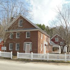
Park Farm, human settlement in Grafton, Vermont, United States of America

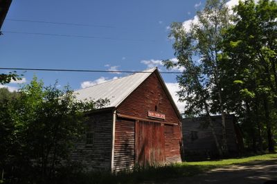
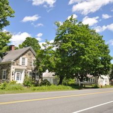
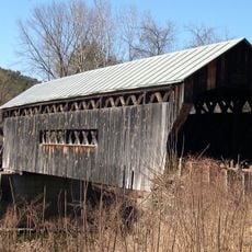
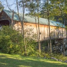
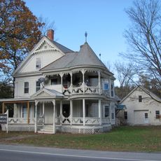
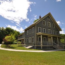
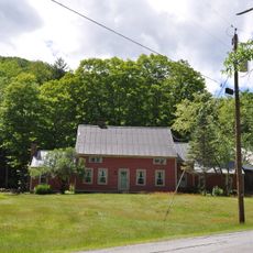
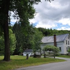
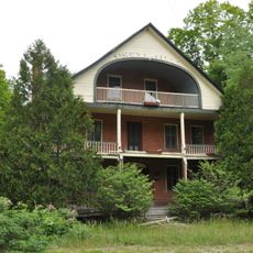
Park Farm is a historic farm property in Grafton, Vermont, with a wooden main house built around 1820 and several outbuildings including barns, sheds, and animal shelters. The property features open fields, an old orchard, and structures from the 19th century that reflect traditional farm operations.

The property was established in the early 1800s, with the main house built around 1820 and later additions to keep it functional. The Park family purchased the land in 1842 and maintained ownership for over 150 years, anchoring the farm in the region's rural heritage.

Park Farm takes its name from the family that has owned the property since 1842 and shaped its character. The traditional buildings and field layout show how farming families lived and worked across generations in this rural Vermont community.

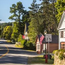
The farm is located at the corner of Woodchuck Hill Road and Middletown Road, easily accessible from main roads. Visitors should plan to walk slowly through the property to observe the buildings, fields, and quiet rural surroundings.

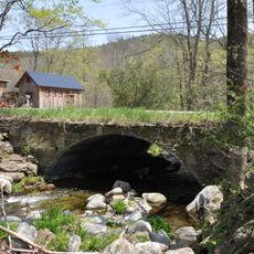
A spring-fed well from around 1790 is one of the oldest features on the property and shows how water use was managed centuries ago. This well once connected to a nearby property, revealing the deep roots of farming practices in the area.

The community of curious travelers

AroundUs brings together thousands of curated places, local tips, and hidden gems, enriched daily by 60,000 contributors worldwide.

Start exploring
Location
GPS coordinates
43.19056,-72.62528
Latest update
February 9, 2026 07:43
Around this place
Stellafane Observatory
United States of America

Stellafane Observatory

13 km
Bartonsville Covered Bridge
United States of America

Bartonsville Covered Bridge

8.1 km
Rockingham Meeting House
United States of America

Rockingham Meeting House

11.2 km
Stone Village Historic District
United States of America

Stone Village Historic District

9.6 km
Worrall Covered Bridge
United States of America

Worrall Covered Bridge

7.6 km
Hall Covered Bridge
United States of America

Hall Covered Bridge

12.7 km
Greenwood House
United States of America

Greenwood House

8.1 km
West Townshend Stone Arch Bridge
United States of America

West Townshend Stone Arch Bridge

13.7 km
Kidder Covered Bridge
United States of America

Kidder Covered Bridge

2.9 km
Jeffrey House
United States of America

Jeffrey House

10.1 km
Chester Village Historic District
United States of America

Chester Village Historic District

8.5 km
Parker Hill Rural Historic District
United States of America

Parker Hill Rural Historic District

12.4 km
Old Brick Church
United States of America

Old Brick Church

8.4 km
Windham Village Historic District
United States of America

Windham Village Historic District

8.4 km
Middletown Rural Historic District
United States of America

Middletown Rural Historic District

282 m
Grafton Public Library
United States of America

Grafton Public Library

2.4 km
Grafton Village Historic District
United States of America

Grafton Village Historic District

2.6 km
Rockingham Village Historic District
United States of America

Rockingham Village Historic District

11.1 km
Williams River Route 5 Bridge
United States of America

Williams River Route 5 Bridge

13.4 km
Simpsonville Stone Arch Bridge
United States of America

Simpsonville Stone Arch Bridge

13.6 km
Augustus and Laura Blaisdell House
United States of America

Augustus and Laura Blaisdell House

9 km
Houghtonville Historic District
United States of America

Houghtonville Historic District

2 km
Mechanicsville Historic District
United States of America

Mechanicsville Historic District

3.1 km
Grafton District Schoolhouse No. 2
United States of America

Grafton District Schoolhouse No. 2

2.4 km
Simons' Inn
United States of America

Simons' Inn

10.5 km
Milldean and Alexander-Davis House
United States of America

Milldean and Alexander-Davis House

2.5 km
South Windham Village Historic District
United States of America

South Windham Village Historic District

9.9 km
Hamilton Falls
United States of America

Hamilton Falls

12.8 km
Show the full map
« Park Farm - human settlement in Grafton, Vermont, United States of America » is provided by Around Us (aroundus.com). Images and texts are derived from Wikimedia project under a Creative Commons license. You are allowed to copy, distribute, and modify copies of this page, under the conditions set by the license, as long as this note is clearly visible.

Discover hidden gems everywhere you go!

From secret cafés to breathtaking viewpoints, skip the crowded tourist spots and find places that match your style. Our app makes it easy with voice search, smart filtering, route optimization, and insider tips from travelers worldwide. Download now for the complete mobile experience.

Around Us App Screenshot

A unique approach to discovering new places

Le Figaro

All the places worth exploring

France Info

A tailor-made excursion in just a few clicks

20 Minutes

Around Us
Travel Guide & Maps
Download

Send to your phone

QR Code
1

Open the camera app on your mobile.

2

Point at the QR code with your camera. A notification will appear.

3

Tap the notification to open the link.