Chest opened
+${chestReward.xp} XP
Explorer
NOUVEAU ×${chestReward.collectible.quantity}
tapez pour fermer
Chest locked

Open chests in the app

Around Us is built for your phone — chests unlock when you walk, explore and capture nearby places.

Enable Location

We need your location to show you interesting places around you

Discover nearby places

Find interesting locations and hidden gems around you

Precise directions

Get accurate directions and distances to places

Your location is never shared with other users. It's only used when you tap the location button.

Log in to your account

Start exploring — it's free

Trusted by 72,995 travelers worldwide

Continue with Google
Continue with Apple
or

We will send you a code to connect

By continuing, you accept our Terms and Conditions and our Privacy Policy

Check your inbox

We've sent a pincode in your inbox. Please enter the code below.

Camp Ono
Discussion Reviews Photo
1.8k Popularity

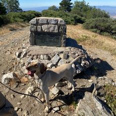
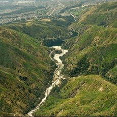
Camp Ono, Former military installation in San Bernardino, California, United States.

Camp Ono was a military installation near San Bernardino that spread across extensive grounds with housing quarters and maintenance stations. The facility supported military operations and connected to regional railroad networks.

The installation was founded in 1942 and held around 500 Italian prisoners of war during World War II while supporting military logistics. It closed in 1947 as the war ended.

Italian military units used the site during the war for vehicle and equipment maintenance work. Their labor formed part of the larger war effort coordinated across several depot companies.

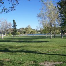
The site is not publicly accessible today and sits within a designated environmental protection area that covers the former military grounds. Visitors should check ahead about which areas may be reached and what restrictions apply.

After the war, the grounds were converted into a truck cleaning facility, abandoning its original military purpose. This reuse eventually led to soil contamination and designation as a Superfund cleanup site.

The community of curious travelers

AroundUs brings together thousands of curated places, local tips, and hidden gems, enriched daily by 60,000 contributors worldwide.

Start exploring
Location
GPS coordinates
34.20650,-117.38506
Latest update
December 14, 2025 11:21
Around this place
Glen Helen Amphitheater
United States of America

Glen Helen Amphitheater

1.6 km
Glen Helen Regional Park
United States of America

Glen Helen Regional Park

2 km
Bonita Falls
United States of America

Bonita Falls

11.3 km
Devil Canyon
United States of America

Devil Canyon

4.5 km
United States of America

Robert and Frances Fullerton Museum of Art

6 km
First Christian Church of Rialto
United States of America

First Christian Church of Rialto

11.6 km
Monument Peak
United States of America

Monument Peak

5.2 km
Santos Manuel Student Union
United States of America

Santos Manuel Student Union

6.3 km
San Bernardino Valley Water Conservation Demonstration Garden
United States of America

San Bernardino Valley Water Conservation Demonstration Garden

6.2 km
Aquatic Center
United States of America

Aquatic Center

9.5 km
San Dimas Experimental Forest
United States of America

San Dimas Experimental Forest

11.8 km
San Bernardino History and Railroad Museum
United States of America

San Bernardino History and Railroad Museum

13.3 km
Cloudland Truck Trailhead
United States of America

Cloudland Truck Trailhead

5 km
Cloudland Truck Trail Scenic View
United States of America

Cloudland Truck Trail Scenic View

6.5 km
United States of America

Art Depot Gallery

12.7 km
United States of America

The Koehler Gallery

12.9 km
United States of America

Fontana Citrus Association

13 km
United States of America

Route 66

12.1 km
United States of America

Primer Mcdonal's

11.9 km
United States of America

Work of art

6.1 km
United States of America

Work of art, statue

12.5 km
United States of America

Sherwood Lake Vista Point

11 km
United States of America

Scenic viewpoint

11.5 km
United States of America

Garces Overlook

10.1 km
United States of America

Jamajab Point

9.9 km
United States of America

Lynx Point

10.4 km
United States of America

Devils Pit

10.7 km
United States of America

Heart rock trail

11 km
Show the full map
Reviews
Share your experience

No review yet

Discussions
Start a discussion...

No discussion yet

« Camp Ono - Former military installation in San Bernardino, California, United States » is provided by Around Us (aroundus.com). Images and texts are derived from Wikimedia project under a Creative Commons license. You are allowed to copy, distribute, and modify copies of this page, under the conditions set by the license, as long as this note is clearly visible.

Discover hidden gems everywhere you go!

From secret cafés to breathtaking viewpoints, skip the crowded tourist spots and find places that match your style. Our app makes it easy with voice search, smart filtering, route optimization, and insider tips from travelers worldwide. Download now for the complete mobile experience.

Around Us App Screenshot

A unique approach to discovering new places

Le Figaro

All the places worth exploring

France Info

A tailor-made excursion in just a few clicks

20 Minutes

Around Us
Travel Guide & Maps
Download

Send to your phone

QR Code
1

Open the camera app on your mobile.

2

Point at the QR code with your camera. A notification will appear.

3

Tap the notification to open the link.