Enable Location

We need your location to show you interesting places around you

Discover nearby places

Find interesting locations and hidden gems around you

Precise directions

Get accurate directions and distances to places

Your location is never shared with other users. It's only used when you tap the location button.

Log in to your account

Start exploring — it's free

Trusted by 62,468 travelers worldwide

Continue with Google
Continue with Apple
or

We will send you a code to connect

By continuing, you accept our Terms and Conditions and our Privacy Policy

Check your inbox

We've sent a pincode in your inbox. Please enter the code below.

Wingmead, historic house in Arkansas, United States

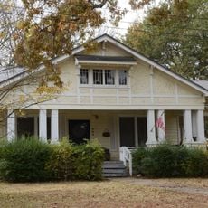
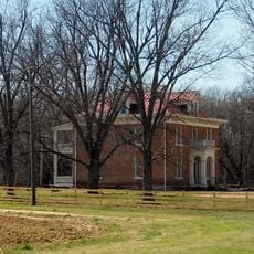
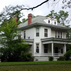
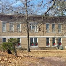
Wingmead is an estate south of DeValls Bluff in Arkansas centered on a colonial-style main house built in 1939 and spanning roughly 10,000 square feet. The property includes several man-made lakes, farm buildings, a kennel, and a retreat cabin, all set across 11,000 acres of open farmland and wooded areas.

Edgar Monsanto Queeny, president of chemical company Monsanto, purchased the land in 1937 and built the residence in 1939 to create a retreat for duck and waterfowl hunting. After his death in 1968, the estate changed hands several times and continues to operate as a farm and hunting property today.

Wingmead takes its name from Scottish roots meaning meadow of wings, reflecting the property's deep connection to waterfowl and bird life. The estate was shaped as a retreat for wealthy hunters and continues to embody the tradition of respecting wildlife while engaging with the land.

The property is accessible from DeValls Bluff via Arkansas Route 33 and sits on flat, open terrain that is straightforward to explore on foot. Plan to spend time walking through the fields and around the lakes, and dress appropriately for rural outdoor conditions.

Queeny wrote his acclaimed book Prairie Wings about wildfowl while staying here and used specialized high-speed cameras to photograph ducks in flight, with images later published in Life Magazine. His conservation work creating artificial lakes to support migratory birds became a model for wildlife protection efforts across the nation.

The community of curious travelers

AroundUs brings together thousands of curated places, local tips, and hidden gems, enriched daily by 60,000 contributors worldwide.

Start exploring
Location
GPS coordinates
34.65917,-91.45639
Latest update
February 9, 2026 08:18
Around this place
Bethel House
United States of America

Bethel House

35.4 km
De Valls Bluff Waterworks
United States of America

De Valls Bluff Waterworks

13.8 km
St. Elizabeth's Catholic Church
United States of America

St. Elizabeth's Catholic Church

13.9 km
Highway 79 Bridge
United States of America

Highway 79 Bridge

13.2 km
Standard Ice Company Building
United States of America

Standard Ice Company Building

20 km
Palmer House
United States of America

Palmer House

35.2 km
Monroe County Courthouse
United States of America

Monroe County Courthouse

13.5 km
Crocketts Bluff Hunting Lodge
United States of America

Crocketts Bluff Hunting Lodge

31.9 km
First Presbyterian Church
United States of America

First Presbyterian Church

35.6 km
Bank of Clarendon
United States of America

Bank of Clarendon

13.3 km
American Legion Hut-Des Arc
United States of America

American Legion Hut-Des Arc

35.5 km
Prairie County Courthouse
United States of America

Prairie County Courthouse

35.6 km
Cumberland Presbyterian Church
United States of America

Cumberland Presbyterian Church

13.8 km
Lo Beele House
United States of America

Lo Beele House

35 km
Abramson House
United States of America

Abramson House

24.9 km
Arkansas County Courthouse-Northern District
United States of America

Arkansas County Courthouse-Northern District

19.8 km
Bateman-Griffith House
United States of America

Bateman-Griffith House

13.6 km
Immanuel High School
United States of America

Immanuel High School

31.2 km
Moore-Jacobs House
United States of America

Moore-Jacobs House

13.8 km
Lair House
United States of America

Lair House

24.9 km
William Black Family House
United States of America

William Black Family House

34.7 km
Jefferies-Crabtree House
United States of America

Jefferies-Crabtree House

13.5 km
Marston House
United States of America

Marston House

13.8 km
Orth C. Galloway House
United States of America

Orth C. Galloway House

13.9 km
Bedford Brown Bethell House
United States of America

Bedford Brown Bethell House

35.3 km
Holly Grove Historic District
United States of America

Holly Grove Historic District

24.4 km
James A. Walls House
United States of America

James A. Walls House

25.1 km
Prairie County Courthouse
United States of America

Prairie County Courthouse

13.8 km
Show the full map
« Wingmead - historic house in Arkansas, United States » is provided by Around Us (aroundus.com). Images and texts are derived from Wikimedia project under a Creative Commons license. You are allowed to copy, distribute, and modify copies of this page, under the conditions set by the license, as long as this note is clearly visible.

Discover hidden gems everywhere you go!

From secret cafés to breathtaking viewpoints, skip the crowded tourist spots and find places that match your style. Our app makes it easy with voice search, smart filtering, route optimization, and insider tips from travelers worldwide. Download now for the complete mobile experience.

Around Us App Screenshot

A unique approach to discovering new places

Le Figaro

All the places worth exploring

France Info

A tailor-made excursion in just a few clicks

20 Minutes

Around Us
Travel Guide & Maps
Download

Send to your phone

QR Code
1

Open the camera app on your mobile.

2

Point at the QR code with your camera. A notification will appear.

3

Tap the notification to open the link.