Chest opened
+${chestReward.xp} XP
Explorer
NOUVEAU ×${chestReward.collectible.quantity}
tapez pour fermer

See the monuments around you in AR Open chests in the app

Around Us is built for your phone — point your camera at the streets and discover the monuments and places around you in augmented reality. Around Us is built for your phone — chests unlock when you walk, explore and capture nearby places.

•

Enable Location

We need your location to show you interesting places around you

Discover nearby places

Find interesting locations and hidden gems around you

Precise directions

Get accurate directions and distances to places

Your location is never shared with other users. It's only used when you tap the location button.

Twin Bridges

Log in to your account

Start exploring — it's free

Trusted by 92,727 travelers worldwide

Continue with Google
Continue with Apple
or

We will send you a code to connect

By continuing, you accept our Terms and Conditions and our Privacy Policy

Check your inbox

We've sent a pincode in your inbox. Please enter the code below.

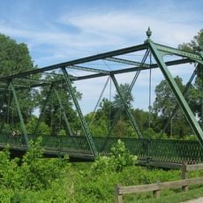
Twin Bridges, Historic wrought-iron bridge in Danville, Indiana.

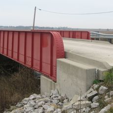
Twin Bridges are two separate bridges in Danville, Indiana, both crossing White Lick Creek. Hendricks County Bridge #178 is a 149-foot-6-inch wrought-iron Baltimore through truss built in 1887. The Big Four Railroad Bridge, built in 1906, is a three-span concrete structure that also crosses County Road 150 East. A cut stone railroad abutment from about 1870 stands nearby.

The wrought-iron Hendricks County Bridge #178, a Baltimore through truss 149 feet 6 inches long, was built in 1887 to span White Lick Creek. The Big Four Railroad added a three-span concrete bridge over the creek and County Road 150 East in 1906. A cut stone railroad abutment from about 1870 survives alongside them. The three structures were listed on the National Register of Historic Places in 2000.

The National Register of Historic Places recognizes these bridges as examples of 19th-century engineering methods and transportation development in Indiana.

You can reach these bridges from local roads running through the town. Take time to walk around them from different angles to fully appreciate their metal framework and engineering approach.

The 1870 cut stone railroad abutment associated with the bridges predates both spans by decades, a remnant of earlier rail infrastructure at the crossing. The two bridges themselves differ in material and era: a wrought-iron Baltimore through truss from 1887 and a three-span concrete railroad bridge from 1906.

The community of curious travelers

AroundUs brings together thousands of curated places, local tips, and hidden gems, enriched daily by 92,727 contributors worldwide.


Start exploring
Location
GPS coordinates
39.75417,-86.50417
Latest update
October 24, 2026 17:42
Around this place
Indianapolis Motor Speedway
United States of America

Indianapolis Motor Speedway

14.7 mi
Eagle Creek Park
United States of America

Eagle Creek Park

13 mi
Indianapolis Motor Speedway Museum
United States of America

Indianapolis Motor Speedway Museum

14.6 mi
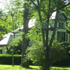
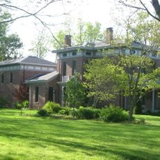
Dr. Jeremiah and Ann Jane DePew House
United States of America

Dr. Jeremiah and Ann Jane DePew House

0.9 mi
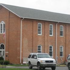
Hall School
United States of America

Hall School

14.3 mi
George Washington Tomlinson House
United States of America

George Washington Tomlinson House

13.1 mi
Lake Ditch Bridge
United States of America

Lake Ditch Bridge

12.4 mi
Hendricks County Historical Museum
United States of America

Hendricks County Historical Museum

1.1 mi
Speedway Historic District
United States of America

Speedway Historic District

14 mi
Baker's Camp Covered Bridge
United States of America

Baker's Camp Covered Bridge

14.4 mi
Jamieson-Bennett House
United States of America

Jamieson-Bennett House

12.1 mi
Plainfield Historic District
United States of America

Plainfield Historic District

6.5 mi
Hendricks County Bridge Number 316
United States of America

Hendricks County Bridge Number 316

6.7 mi
Ora Adams House
United States of America

Ora Adams House

1 mi
Danville Courthouse Square Historic District
United States of America

Danville Courthouse Square Historic District

1.1 mi
Howard School
United States of America

Howard School

13.8 mi
Leander Campbell House
United States of America

Leander Campbell House

0.7 mi
John W. McClain House
United States of America

John W. McClain House

4 mi
Mooresville Friends Academy Building
United States of America

Mooresville Friends Academy Building

11.6 mi
Danville Main Street Historic District
United States of America

Danville Main Street Historic District

1.4 mi
Wilson-Courtney House
United States of America

Wilson-Courtney House

0.9 mi
McCormack-Bowman House
United States of America

McCormack-Bowman House

8 mi
Mooresville Commercial Historic District
United States of America

Mooresville Commercial Historic District

11.9 mi
Noah and Hannah Hadley Kellum House
United States of America

Noah and Hannah Hadley Kellum House

11.2 mi
A.A. Parsons Farmstead
United States of America

A.A. Parsons Farmstead

4.7 mi
Courthouse Grounds
United States of America

Courthouse Grounds

1.2 mi
Mooresville Friends Academy Building
United States of America

Mooresville Friends Academy Building

11.6 mi
Pine Bluff Bridge
United States of America

Pine Bluff Bridge

14.6 mi
Show the full map
Reviews
Share your experience

No review yet

Discussions
Start a discussion...

No discussion yet

« Twin Bridges - Historic wrought-iron bridge in Danville, Indiana » is provided by Around Us (aroundus.com). Images and texts are derived from Wikimedia project under a Creative Commons license. You are allowed to copy, distribute, and modify copies of this page, under the conditions set by the license, as long as this note is clearly visible.

Discover hidden gems everywhere you go!

From secret cafés to breathtaking viewpoints, skip the crowded tourist spots and find places that match your style. Our app makes it easy with voice search, smart filtering, route optimization, and insider tips from travelers worldwide. Download now for the complete mobile experience.
Around Us App Screenshot
❝

A unique approach to discovering new places❞

— Le Figaro

❝

All the places worth exploring❞

— France Info

❝

A tailor-made excursion in just a few clicks❞

— 20 Minutes

Around Us
Travel Guide & Maps
Download

Send to your phone

QR Code
1

Open the camera app on your mobile.

2

Point at the QR code with your camera. A notification will appear.

3

Tap the notification to open the link.