Chest opened
+${chestReward.xp} XP
Explorer
NOUVEAU ×${chestReward.collectible.quantity}
tapez pour fermer
Chest locked

Open chests in the app

Around Us is built for your phone — chests unlock when you walk, explore and capture nearby places.

Enable Location

We need your location to show you interesting places around you

Discover nearby places

Find interesting locations and hidden gems around you

Precise directions

Get accurate directions and distances to places

Your location is never shared with other users. It's only used when you tap the location button.

Upper Beaver Meadows

Log in to your account

Start exploring — it's free

Trusted by 72,888 travelers worldwide

Continue with Google
Continue with Apple
or

We will send you a code to connect

By continuing, you accept our Terms and Conditions and our Privacy Policy

Check your inbox

We've sent a pincode in your inbox. Please enter the code below.

Upper Beaver Meadows
Discussion Reviews 1 Photos
2k Popularity

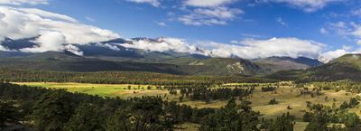
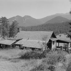
Upper Beaver Meadows, Montane meadow in Rocky Mountain National Park, Colorado

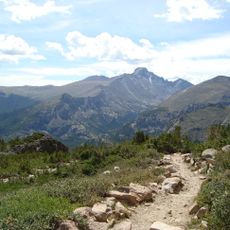
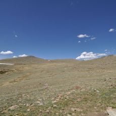
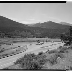
Upper Beaver Meadows is a montane grassland in Rocky Mountain National Park featuring a 5-mile loop trail through open meadows and ponderosa pine forests. The route winds between 8,440 and 9,216 feet in elevation, showcasing the natural transitions between different forest types and clearings.

The East Troublesome Fire in 2020 significantly altered the landscape, burning sections of the forest and meadow and changing the appearance of the area. Today the ecosystem shows signs of recovery, with new growth appearing in previously burned zones.

The meadow draws photographers and nature observers who come to spot mountain bluebirds, towhees, and other wildlife typical of high-altitude habitats. The open grasslands and forest edges create viewing opportunities throughout the year.

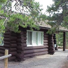
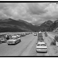
The trailhead is accessible by a short drive from the Beaver Meadows Entrance Station on a paved road. Picnic areas are available along the route, and the terrain is generally suitable for most fitness levels.

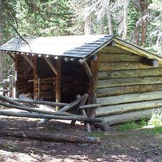
Picnic tables with fire grates are positioned throughout the route to frame views of the Continental Divide and Longs Peak. These spots allow visitors to combine meals and mountain scenery in one experience.

The community of curious travelers

AroundUs brings together thousands of curated places, local tips, and hidden gems, enriched daily by 60,000 contributors worldwide.

Start exploring
Location
GPS coordinates
40.36800,-105.63100
Latest update
December 14, 2025 09:42
Around this place
Bear Lake Trailhead
United States of America

Bear Lake Trailhead

6.4 km
Beaver Meadows Visitor Center
United States of America

Beaver Meadows Visitor Center

6 km
Tyndall Glacier
United States of America

Tyndall Glacier

8.6 km
Flattop Mountain Trail
United States of America

Flattop Mountain Trail

7.2 km
Chasm Falls
United States of America

Chasm Falls

6.5 km
Fern Lake Trail
United States of America

Fern Lake Trail

1.5 km
Mount Chiquita
United States of America

Mount Chiquita

9.8 km
Moraine Park Museum and Amphitheater
United States of America

Moraine Park Museum and Amphitheater

4.1 km
Snogo Snow Plow
United States of America

Snogo Snow Plow

6.1 km
Fern Lake Patrol Cabin
United States of America

Fern Lake Patrol Cabin

5.1 km
Park Theatre
United States of America

Park Theatre

9.2 km
William Allen White Cabins
United States of America

William Allen White Cabins

4.3 km
Glacier Basin Campground Ranger Station
United States of America

Glacier Basin Campground Ranger Station

5.2 km
Fall River Entrance Historic District
United States of America

Fall River Entrance Historic District

5.2 km
Beatrice Willard Alpine Tundra Research Plots
United States of America

Beatrice Willard Alpine Tundra Research Plots

7.4 km
Rocky Mountain National Park Utility Area Historic District
United States of America

Rocky Mountain National Park Utility Area Historic District

6 km
Moraine Park Discovery Center
United States of America

Moraine Park Discovery Center

4.2 km
Alberta Falls
United States of America

Alberta Falls

7.2 km
Fern Falls
United States of America

Fern Falls

3.9 km
Fall River Visitor Center
United States of America

Fall River Visitor Center

5.3 km
Sheep Lakes Information Station
United States of America

Sheep Lakes Information Station

4.2 km
Tundra Communities Trail
United States of America

Tundra Communities Trail

9.5 km
Glacier Basin Campground
United States of America

Glacier Basin Campground

5.4 km
Many Parks Curve
United States of America

Many Parks Curve

2.1 km
Sheep Lakes Turnout
United States of America

Sheep Lakes Turnout

4.2 km
Estes Park Aerial Tramway
United States of America

Estes Park Aerial Tramway

9.2 km
Moraine Park Amphitheater
United States of America

Moraine Park Amphitheater

4 km
Rainbow Curve
United States of America

Rainbow Curve

4.5 km
Show the full map
Reviews
Share your experience

No review yet

Discussions
Start a discussion...

No discussion yet

« Upper Beaver Meadows - Montane meadow in Rocky Mountain National Park, Colorado » is provided by Around Us (aroundus.com). Images and texts are derived from Wikimedia project under a Creative Commons license. You are allowed to copy, distribute, and modify copies of this page, under the conditions set by the license, as long as this note is clearly visible.

Discover hidden gems everywhere you go!

From secret cafés to breathtaking viewpoints, skip the crowded tourist spots and find places that match your style. Our app makes it easy with voice search, smart filtering, route optimization, and insider tips from travelers worldwide. Download now for the complete mobile experience.

Around Us App Screenshot

A unique approach to discovering new places

Le Figaro

All the places worth exploring

France Info

A tailor-made excursion in just a few clicks

20 Minutes

Around Us
Travel Guide & Maps
Download

Send to your phone

QR Code
1

Open the camera app on your mobile.

2

Point at the QR code with your camera. A notification will appear.

3

Tap the notification to open the link.