Enable Location

We need your location to show you interesting places around you

Discover nearby places

Find interesting locations and hidden gems around you

Precise directions

Get accurate directions and distances to places

Your location is never shared with other users. It's only used when you tap the location button.

Flattop Mountain Trail

Log in to your account

Start exploring — it's free

Trusted by 63,038 travelers worldwide

Continue with Google
Continue with Apple
or

We will send you a code to connect

By continuing, you accept our Terms and Conditions and our Privacy Policy

Check your inbox

We've sent a pincode in your inbox. Please enter the code below.

Discussion Reviews 1 Photos
2.4k Popularity

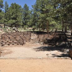
Flattop Mountain Trail, Historic hiking trail in Rocky Mountain National Park, Larimer County, United States.

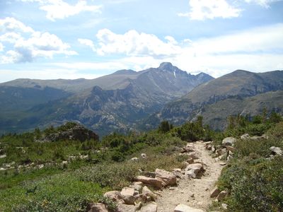
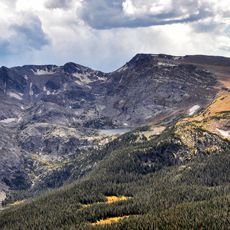
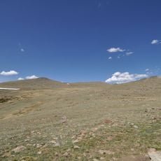
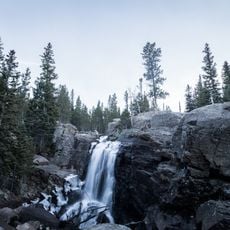
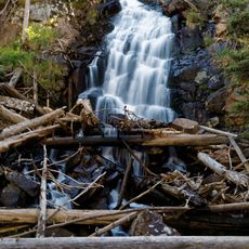
Flattop Mountain Trail is a mountain path in Rocky Mountain National Park that begins at Bear Lake Trailhead. The route climbs through forested slopes and open meadows before reaching a wide, flat summit area with views across the Continental Divide.

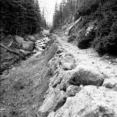
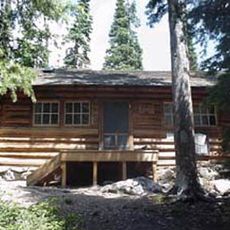
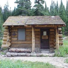
The trail was built in 1925 by the National Park Service and Civilian Conservation Corps as part of early mountain access development in American national parks. Maintenance and repairs over the decades have kept the path open for visitors.

The trail represents early twentieth-century recreational development in American national parks, demonstrating the commitment to public access in natural spaces.

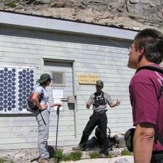
Hikers should bring plenty of water and snacks and start early to find parking at the trailhead. The elevation gain and terrain require basic mountain hiking experience and sturdy footwear.

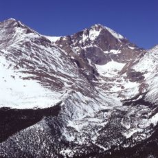
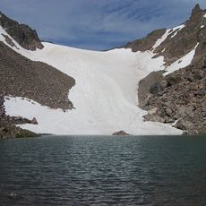
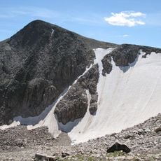
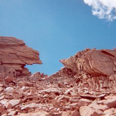
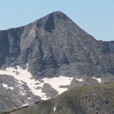
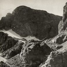
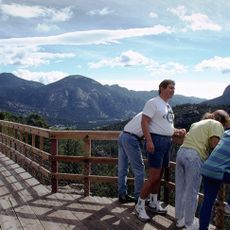
The summit's flat top offers rare views across both sides of the Continental Divide from an open plateau. From here, hikers can continue toward nearby peaks or glacier areas and explore the high-altitude landscape further.

The community of curious travelers

AroundUs brings together thousands of curated places, local tips, and hidden gems, enriched daily by 60,000 contributors worldwide.

Start exploring
Location
Architects
National Park Service, Civilian Conservation Corps
GPS coordinates
40.31387,-105.67834
Latest update
December 13, 2025 11:45
Around this place
Longs Peak
United States of America

Longs Peak

8.5 km
Mount Meeker
United States of America

Mount Meeker

9.6 km
Bear Lake Trailhead
United States of America

Bear Lake Trailhead

2.8 km
Andrews Glacier
United States of America

Andrews Glacier

3 km
Agnes Vaille Shelter
United States of America

Agnes Vaille Shelter

7.6 km
Tyndall Glacier
United States of America

Tyndall Glacier

1.4 km
Mount Ida
United States of America

Mount Ida

10.7 km
East Longs Peak Trail – Longs Peak Trail – Keyhole Route – Shelf Trail
United States of America

East Longs Peak Trail – Longs Peak Trail – Keyhole Route – Shelf Trail

8 km
Fern Lake Trail
United States of America

Fern Lake Trail

6.1 km
Mount Julian
United States of America

Mount Julian

9.3 km
Moraine Park Museum and Amphitheater
United States of America

Moraine Park Museum and Amphitheater

9.4 km
Taylor Peak
United States of America

Taylor Peak

4.4 km
United States of America

Mount Alice

8.4 km
Fern Lake Patrol Cabin
United States of America

Fern Lake Patrol Cabin

2.7 km
William Allen White Cabins
United States of America

William Allen White Cabins

9.4 km
Glacier Basin Campground Ranger Station
United States of America

Glacier Basin Campground Ranger Station

7.3 km
Beatrice Willard Alpine Tundra Research Plots
United States of America

Beatrice Willard Alpine Tundra Research Plots

9.5 km
Thunder Lake Patrol Cabin
United States of America

Thunder Lake Patrol Cabin

10.6 km
Moraine Park Discovery Center
United States of America

Moraine Park Discovery Center

9.4 km
Alberta Falls
United States of America

Alberta Falls

3.6 km
Fern Falls
United States of America

Fern Falls

3.8 km
Chasm Meadow Patrol Cabin
United States of America

Chasm Meadow Patrol Cabin

9.1 km
Sheep Lakes Information Station
United States of America

Sheep Lakes Information Station

11.3 km
Glacier Basin Campground
United States of America

Glacier Basin Campground

7.2 km
Many Parks Curve
United States of America

Many Parks Curve

9.1 km
Sheep Lakes Turnout
United States of America

Sheep Lakes Turnout

11.3 km
Moraine Park Amphitheater
United States of America

Moraine Park Amphitheater

9.4 km
Rainbow Curve
United States of America

Rainbow Curve

9.7 km
Show the full map
Reviews
Share your experience

No review yet

Discussions
Start a discussion...

No discussion yet

« Flattop Mountain Trail - Historic hiking trail in Rocky Mountain National Park, Larimer County, United States » is provided by Around Us (aroundus.com). Images and texts are derived from Wikimedia project under a Creative Commons license. You are allowed to copy, distribute, and modify copies of this page, under the conditions set by the license, as long as this note is clearly visible.

Discover hidden gems everywhere you go!

From secret cafés to breathtaking viewpoints, skip the crowded tourist spots and find places that match your style. Our app makes it easy with voice search, smart filtering, route optimization, and insider tips from travelers worldwide. Download now for the complete mobile experience.

Around Us App Screenshot

A unique approach to discovering new places

Le Figaro

All the places worth exploring

France Info

A tailor-made excursion in just a few clicks

20 Minutes

Around Us
Travel Guide & Maps
Download

Send to your phone

QR Code
1

Open the camera app on your mobile.

2

Point at the QR code with your camera. A notification will appear.

3

Tap the notification to open the link.