Enable Location

We need your location to show you interesting places around you

Discover nearby places

Find interesting locations and hidden gems around you

Precise directions

Get accurate directions and distances to places

Your location is never shared with other users. It's only used when you tap the location button.

Andrews Glacier

Log in to your account

Start exploring — it's free

Trusted by 65,649 travelers worldwide

Continue with Google
Continue with Apple
or

We will send you a code to connect

By continuing, you accept our Terms and Conditions and our Privacy Policy

Check your inbox

We've sent a pincode in your inbox. Please enter the code below.

Andrews Glacier
Discussion Reviews 1 Photos
3.6k Popularity

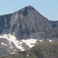
Andrews Glacier, Glacier in Rocky Mountain National Park, Colorado, US

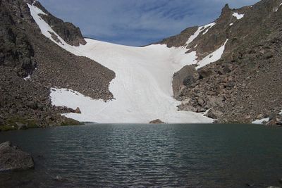
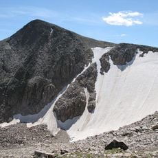
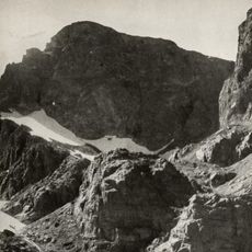
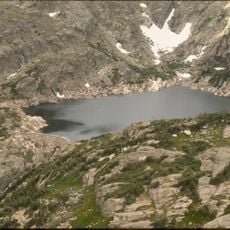
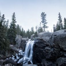
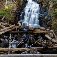
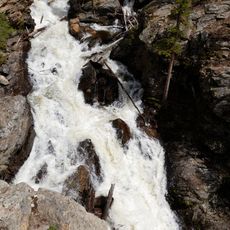
Andrews Glacier is a glacier in Rocky Mountain National Park, Colorado, sitting in a rocky cirque at around 11,200 feet (3,400 m) above sea level. Its meltwater drains directly into Andrews Tarn, a small alpine lake just below the ice.

The glacier was first mapped in 1897 by Edwin B. Andrews and Abner Sprague during an early survey of what would become Rocky Mountain National Park. Their records set the starting point for tracking how much the ice has changed in the years since.

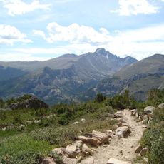
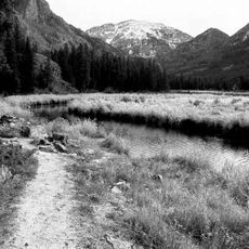
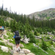
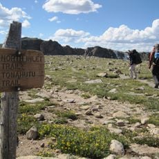
Andrews Glacier sits in a cirque that draws hikers who want to experience high alpine terrain in Rocky Mountain National Park. The small lake just below it, Andrews Tarn, is a natural resting point where people often stop to take in the open sky and rocky slopes around them.

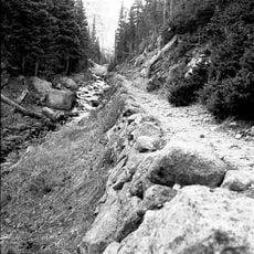
The glacier is reached by hiking from the Glacier Gorge Trailhead, following a trail that climbs through open alpine terrain for several miles. Solid footwear is important, and layers are a good idea since the weather at this elevation can change without much warning.

Andrews Glacier is one of the few remaining permanent ice patches in Colorado, yet its size is small enough that some scientists debate whether it qualifies as a true glacier or simply a perennial snowfield. The distinction matters for how its changes are tracked over time.

The community of curious travelers

AroundUs brings together thousands of curated places, local tips, and hidden gems, enriched daily by 60,000 contributors worldwide.

Start exploring
Location
GPS coordinates
40.28750,-105.68389
Latest update
March 3, 2026 14:02
Around this place
Longs Peak
United States of America

Longs Peak

6.9 km
Mount Meeker
United States of America

Mount Meeker

8 km
Bear Lake Trailhead
United States of America

Bear Lake Trailhead

4.2 km
Agnes Vaille Shelter
United States of America

Agnes Vaille Shelter

6.1 km
Tyndall Glacier
United States of America

Tyndall Glacier

2 km
Flattop Mountain Trail
United States of America

Flattop Mountain Trail

3 km
East Longs Peak Trail – Longs Peak Trail – Keyhole Route – Shelf Trail
United States of America

East Longs Peak Trail – Longs Peak Trail – Keyhole Route – Shelf Trail

7.2 km
Fern Lake Trail
United States of America

Fern Lake Trail

8.8 km
Mount Julian
United States of America

Mount Julian

11.2 km
Moraine Park Museum and Amphitheater
United States of America

Moraine Park Museum and Amphitheater

11.6 km
East Inlet Trail
United States of America

East Inlet Trail

11.2 km
Taylor Peak
United States of America

Taylor Peak

1.4 km
United States of America

Mount Alice

5.7 km
Fern Lake Patrol Cabin
United States of America

Fern Lake Patrol Cabin

5.7 km
William Allen White Cabins
United States of America

William Allen White Cabins

11.5 km
North Inlet Trail
United States of America

North Inlet Trail

11.6 km
Glacier Basin Campground Ranger Station
United States of America

Glacier Basin Campground Ranger Station

8.9 km
Tonahutu Creek Trail
United States of America

Tonahutu Creek Trail

11.8 km
Thunder Lake Patrol Cabin
United States of America

Thunder Lake Patrol Cabin

8 km
Moraine Park Discovery Center
United States of America

Moraine Park Discovery Center

11.6 km
Bluebird Lake
United States of America

Bluebird Lake

10.9 km
Alberta Falls
United States of America

Alberta Falls

4.3 km
Fern Falls
United States of America

Fern Falls

6.8 km
Adams Falls
United States of America

Adams Falls

11.1 km
Chasm Meadow Patrol Cabin
United States of America

Chasm Meadow Patrol Cabin

7.9 km
Many Parks Curve
United States of America

Many Parks Curve

12 km
Glacier Basin Campground
United States of America

Glacier Basin Campground

8.8 km
Moraine Park Amphitheater
United States of America

Moraine Park Amphitheater

11.6 km
Show the full map
Reviews
Share your experience

No review yet

Discussions
Start a discussion...

No discussion yet

« Andrews Glacier - Glacier in Rocky Mountain National Park, Colorado, US » is provided by Around Us (aroundus.com). Images and texts are derived from Wikimedia project under a Creative Commons license. You are allowed to copy, distribute, and modify copies of this page, under the conditions set by the license, as long as this note is clearly visible.

Discover hidden gems everywhere you go!

From secret cafés to breathtaking viewpoints, skip the crowded tourist spots and find places that match your style. Our app makes it easy with voice search, smart filtering, route optimization, and insider tips from travelers worldwide. Download now for the complete mobile experience.

Around Us App Screenshot

A unique approach to discovering new places

Le Figaro

All the places worth exploring

France Info

A tailor-made excursion in just a few clicks

20 Minutes

Around Us
Travel Guide & Maps
Download

Send to your phone

QR Code
1

Open the camera app on your mobile.

2

Point at the QR code with your camera. A notification will appear.

3

Tap the notification to open the link.