Mount Ida, Mountain summit in Rocky Mountain National Park, Colorado, US
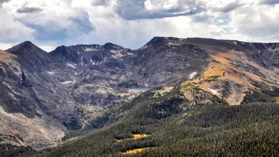
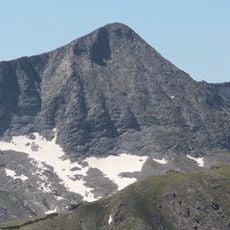
Mount Ida is a peak in Rocky Mountain National Park with exposed rocky slopes and alpine tundra above the tree line. From the summit, visitors can see across to distant ridges and understand the shape of the surrounding mountain terrain.
The peak was named by European settlers drawing from classical sources and mythological references. This naming reflects how early explorers and settlers imposed their own cultural traditions onto Colorado's geography.
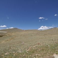
The summit area is dominated by alpine tundra vegetation with short grasses and hardy plants clinging to the rocky terrain. Visitors experience a windswept, barren landscape that reveals how life adapts to extreme elevation.
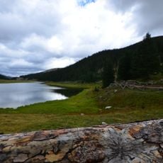
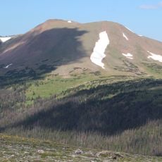
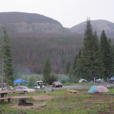
The hike begins at Milner Pass and climbs through subalpine forest before reaching open tundra. Visitors should bring protective clothing and be ready for sudden weather changes that are common at this elevation.
The peak sits directly on the Continental Divide, an invisible line that determines whether water flows east or west across the continent. Standing here gives visitors a tangible sense of being at a true geographical crossroads.
Location: Colorado
GPS coordinates: 40.37209,-105.77885
Latest update: December 12, 2025 09:03
Trail Ridge Road
6.8 km
Alpine Visitor Center
7.9 km
Milner Pass
6 km
Holzwarth Historic District
7 km
Mount Julian
1.8 km
Specimen Mountain
8.5 km
Fern Lake Patrol Cabin
9.5 km
Fall River Pump House and Catchment Basin
7.8 km
Willow Park Patrol Cabin
7.8 km
Timberline Cabin
8.3 km
Timber Creek Campground Comfort Stations
6.2 km
Fall River Pass Ranger Station
7.9 km
Beatrice Willard Alpine Tundra Research Plots
6.3 km
Willow Park Stable
7.9 km
Milner Pass Road Camp Mess Hall and House
5.8 km
Fern Falls
9.8 km
Little Buckaroo Ranch Barn
8.4 km
Fleshut Cabin
6.4 km
Timber Creek Campground Comfort Station No. 247
6.3 km
Timber Creek Campground Comfort Station No. 245
6.3 km
Timber Creek Campground Comfort Station No. 246
6.2 km
Fall River Pass Historic District
7.9 km
Alpine Ridge Trail
8.2 km
Tundra Communities Trail
6.5 km
Gore Range Overlook
6.8 km
Timber Creek Campground
6.3 km
Alpine Visitor Center Viewpoint
8 km
Rainbow Curve
10.3 kmVisited this place? Tap the stars to rate it and share your experience / photos with the community! Try now! You can cancel it anytime.
Discover hidden gems everywhere you go!
From secret cafés to breathtaking viewpoints, skip the crowded tourist spots and find places that match your style. Our app makes it easy with voice search, smart filtering, route optimization, and insider tips from travelers worldwide. Download now for the complete mobile experience.
A unique approach to discovering new places❞
— Le Figaro
All the places worth exploring❞
— France Info
A tailor-made excursion in just a few clicks❞
— 20 Minutes