Enable Location

We need your location to show you interesting places around you

Discover nearby places

Find interesting locations and hidden gems around you

Precise directions

Get accurate directions and distances to places

Your location is never shared with other users. It's only used when you tap the location button.

Mount Chiquita

Log in to your account

Start exploring — it's free

Trusted by 63,124 travelers worldwide

Continue with Google
Continue with Apple
or

We will send you a code to connect

By continuing, you accept our Terms and Conditions and our Privacy Policy

Check your inbox

We've sent a pincode in your inbox. Please enter the code below.

Mount Chiquita
Discussion Reviews 1 Photos
1.9k Popularity

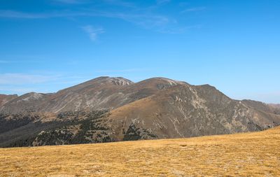
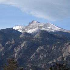
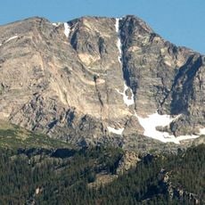
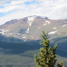
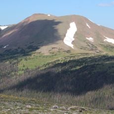
Mount Chiquita, Mountain summit in Rocky Mountain National Park, Colorado, USA.

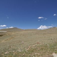
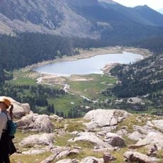
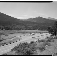
Mount Chiquita is a summit in the Mummy Range within Rocky Mountain National Park, rising to about 13,075 feet. The mountain sits among alpine meadows that fill with wildflowers during the summer season.

The mountain came under protection when Rocky Mountain National Park was established in 1915. This creation safeguarded the natural features of the area for future generations.

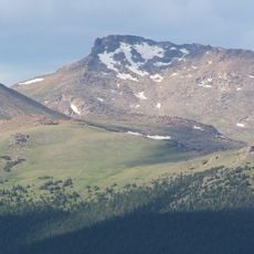
Climbers often combine this peak with two neighboring summits into a single day route that connects three mountains. This approach is popular among mountaineers seeking to complete multiple ascents in one outing.

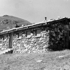
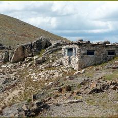
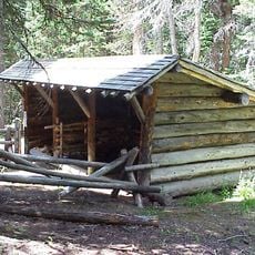
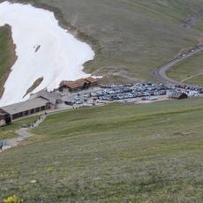
To reach this peak, drive Old Fall River Road to the Chapin Pass Trailhead, which typically opens after early July for hiking season. Plan for standard mountain hiking conditions and expect lingering snow at higher elevations early in the season.

This peak is the lowest thirteener in the park, a summit that reaches the 13,000-foot mark. This makes it a more accessible starting point for mountaineers exploring peaks at this elevation.

The community of curious travelers

AroundUs brings together thousands of curated places, local tips, and hidden gems, enriched daily by 60,000 contributors worldwide.

Start exploring
Location
GPS coordinates
40.44375,-105.68880
Latest update
December 14, 2025 11:01
Around this place
Trail Ridge Road
United States of America

Trail Ridge Road

9.2 km
Alpine Visitor Center
United States of America

Alpine Visitor Center

5.6 km
Milner Pass
United States of America

Milner Pass

10.7 km
Hagues Peak
United States of America

Hagues Peak

5.8 km
Mummy Mountain
United States of America

Mummy Mountain

6.5 km
Ypsilon Mountain
United States of America

Ypsilon Mountain

1.6 km
Chasm Falls
United States of America

Chasm Falls

3.3 km
Mount Julian
United States of America

Mount Julian

10 km
Fairchild Mountain
United States of America

Fairchild Mountain

3.4 km
Specimen Mountain
United States of America

Specimen Mountain

10.2 km
Fall River Pump House and Catchment Basin
United States of America

Fall River Pump House and Catchment Basin

5 km
Willow Park Patrol Cabin
United States of America

Willow Park Patrol Cabin

4 km
Timberline Cabin
United States of America

Timberline Cabin

4.6 km
Fall River Pass Ranger Station
United States of America

Fall River Pass Ranger Station

5.7 km
Fall River Entrance Historic District
United States of America

Fall River Entrance Historic District

9.1 km
Beatrice Willard Alpine Tundra Research Plots
United States of America

Beatrice Willard Alpine Tundra Research Plots

5.7 km
Willow Park Stable
United States of America

Willow Park Stable

3.9 km
Lawn Lake
United States of America

Lawn Lake

5.5 km
Fern Falls
United States of America

Fern Falls

10.9 km
Fall River Pass Historic District
United States of America

Fall River Pass Historic District

5.7 km
Fall River Visitor Center
United States of America

Fall River Visitor Center

9.9 km
Alpine Ridge Trail
United States of America

Alpine Ridge Trail

5.3 km
Sheep Lakes Information Station
United States of America

Sheep Lakes Information Station

7.4 km
Tundra Communities Trail
United States of America

Tundra Communities Trail

4.6 km
Many Parks Curve
United States of America

Many Parks Curve

8 km
Sheep Lakes Turnout
United States of America

Sheep Lakes Turnout

7.3 km
Gore Range Overlook
United States of America

Gore Range Overlook

6.9 km
Alpine Visitor Center Viewpoint
United States of America

Alpine Visitor Center Viewpoint

5.5 km
Show the full map
Reviews
Share your experience

No review yet

Discussions
Start a discussion...

No discussion yet

« Mount Chiquita - Mountain summit in Rocky Mountain National Park, Colorado, USA » is provided by Around Us (aroundus.com). Images and texts are derived from Wikimedia project under a Creative Commons license. You are allowed to copy, distribute, and modify copies of this page, under the conditions set by the license, as long as this note is clearly visible.

Discover hidden gems everywhere you go!

From secret cafés to breathtaking viewpoints, skip the crowded tourist spots and find places that match your style. Our app makes it easy with voice search, smart filtering, route optimization, and insider tips from travelers worldwide. Download now for the complete mobile experience.

Around Us App Screenshot

A unique approach to discovering new places

Le Figaro

All the places worth exploring

France Info

A tailor-made excursion in just a few clicks

20 Minutes

Around Us
Travel Guide & Maps
Download

Send to your phone

QR Code
1

Open the camera app on your mobile.

2

Point at the QR code with your camera. A notification will appear.

3

Tap the notification to open the link.