Enable Location

We need your location to show you interesting places around you

Discover nearby places

Find interesting locations and hidden gems around you

Precise directions

Get accurate directions and distances to places

Your location is never shared with other users. It's only used when you tap the location button.

Beebe Hill State Forest

Log in to your account

Start exploring — it's free

Trusted by 62,442 travelers worldwide

Continue with Google
Continue with Apple
or

We will send you a code to connect

By continuing, you accept our Terms and Conditions and our Privacy Policy

Check your inbox

We've sent a pincode in your inbox. Please enter the code below.

Beebe Hill State Forest

Beebe Hill State Forest, State forest in Columbia County, New York, United States.

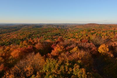
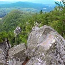
This 2,018-acre protected natural area features rolling terrain, deciduous and coniferous forests, and reaches an elevation of 460 meters with panoramic views across the surrounding landscape including distant Albany skyline.

Established in 1963, the forest contains a historic fire tower built in 1964 that served as a wildfire detection lookout until 1987, originally constructed in the Berkshires in 1928 before relocation.

The forest serves as a community gathering space where local traditions are observed and seasonal events celebrate regional flora and fauna, fostering environmental awareness and regional heritage appreciation among visitors.

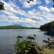
Visitors can access approximately 30 miles of marked hiking trails with blue and red blazes, parking areas near trailheads, lean-to shelters, and year-round recreational opportunities including fishing at Barrett Pond.

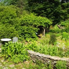
The forest contains remnants of old stone walls and outbuildings that add historic character, plus a wild blueberry patch at Harvey Mountain summit that historically contributed to local sustenance.

The community of curious travelers

AroundUs brings together thousands of curated places, local tips, and hidden gems, enriched daily by 60,000 contributors worldwide.

Start exploring
Elevation above the sea
460 m
GPS coordinates
42.33889,-73.47333
Latest update
July 24, 2025 15:31
Around this place
Tanglewood
United States of America

Tanglewood

13.5 km
Norman Rockwell Museum
United States of America

Norman Rockwell Museum

12.7 km
Naumkeag
United States of America

Naumkeag

14.1 km
Shadow Brook Farm Historic District
United States of America

Shadow Brook Farm Historic District

12.1 km
Chesterwood
United States of America

Chesterwood

11.6 km
Stockbridge Bowl
United States of America

Stockbridge Bowl

12.7 km
Steepletop
United States of America

Steepletop

3.1 km
Monument Mountain
United States of America

Monument Mountain

12.3 km
Berkshire Botanical Garden
United States of America

Berkshire Botanical Garden

12.1 km
Spencertown Academy
United States of America

Spencertown Academy

6.1 km
Goodwood
United States of America

Goodwood

11.6 km
Crandell Theatre
United States of America

Crandell Theatre

10.4 km
Housatonic Congregational Church
United States of America

Housatonic Congregational Church

12.6 km
Kenmore
United States of America

Kenmore

10.8 km
Lace House
United States of America

Lace House

5.6 km
Richmond Furnace Historical and Archeological District
United States of America

Richmond Furnace Historical and Archeological District

8.3 km
Congregational Church of West Stockbridge
United States of America

Congregational Church of West Stockbridge

8.8 km
West Stockbridge Town Hall
United States of America

West Stockbridge Town Hall

8.8 km
Ramsdell Public Library
United States of America

Ramsdell Public Library

12.6 km
Glendale Power House
United States of America

Glendale Power House

11.8 km
Citizens Hall
United States of America

Citizens Hall

12 km
West Stockbridge Grange No. 246
United States of America

West Stockbridge Grange No. 246

8.6 km
Knollcroft
United States of America

Knollcroft

7.6 km
Tracy Memorial Village Hall Complex
United States of America

Tracy Memorial Village Hall Complex

10.6 km
Turn Park Art Space
United States of America

Turn Park Art Space

8.6 km
North Hillsdale Methodist Church
United States of America

North Hillsdale Methodist Church

11.7 km
Old Curtisville Historic District
United States of America

Old Curtisville Historic District

11.9 km
Main Street Historic District
United States of America

Main Street Historic District

13.9 km
Show the full map
« Beebe Hill State Forest - State forest in Columbia County, New York, United States » is provided by Around Us (aroundus.com). Images and texts are derived from Wikimedia project under a Creative Commons license. You are allowed to copy, distribute, and modify copies of this page, under the conditions set by the license, as long as this note is clearly visible.

Discover hidden gems everywhere you go!

From secret cafés to breathtaking viewpoints, skip the crowded tourist spots and find places that match your style. Our app makes it easy with voice search, smart filtering, route optimization, and insider tips from travelers worldwide. Download now for the complete mobile experience.

Around Us App Screenshot

A unique approach to discovering new places

Le Figaro

All the places worth exploring

France Info

A tailor-made excursion in just a few clicks

20 Minutes

Around Us
Travel Guide & Maps
Download

Send to your phone

QR Code
1

Open the camera app on your mobile.

2

Point at the QR code with your camera. A notification will appear.

3

Tap the notification to open the link.