Enable Location

We need your location to show you interesting places around you

Discover nearby places

Find interesting locations and hidden gems around you

Precise directions

Get accurate directions and distances to places

Your location is never shared with other users. It's only used when you tap the location button.

Moccasin Bluff Site

Log in to your account

Start exploring — it's free

Trusted by 61,561 travelers worldwide

Continue with Google
Continue with Apple
or

We will send you a code to connect

By continuing, you accept our Terms and Conditions and our Privacy Policy

Check your inbox

We've sent a pincode in your inbox. Please enter the code below.

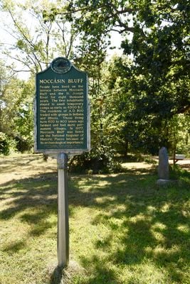
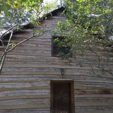
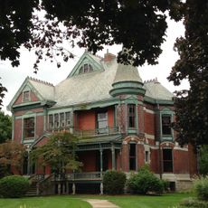
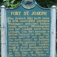
Moccasin Bluff Site, Archaeological site along St. Joseph River in Berrien County, United States

Description

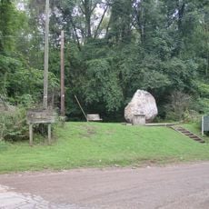
Moccasin Bluff Site is an archaeological location along the St. Joseph River in Berrien County featuring a landscape of a terrace between steep hills and two islands within the river's wide bend. Excavations revealed storage pits, fire pits, and hearths that show evidence of food preservation and early farming activities.

History

Native American groups first used this location as a seasonal camp in the 6th millennium BC, and it gradually developed into a permanent settlement with farming practices by around 1100 AD. This shift from hunting camps to farming communities shows how the way of life changed over thousands of years.

Culture

This location served as a seasonal gathering place for communities who expressed their relationship with the land through burials and food storage practices over many centuries.

Practical

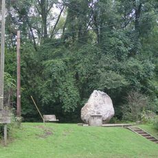
The site sits on terrain with steep hills, so visitors should expect uneven ground and possible access challenges. The best time to explore is during warmer months when the river area and landscape are easier to navigate.

Did you know?

Researchers uncovered more than 30 different animal species at this location during excavations, including substantial remains of deer and elk bones. These animal remains suggest that beyond feeding, ceremonial practices held an important place in the lives of earlier inhabitants.

Location
GPS coordinates
41.85556,-86.36667
Latest update
December 12, 2025 16:42

AroundUs brings together thousands of curated places, local tips, and hidden gems, enriched daily by 60,000 contributors worldwide. Discover all places nearby (Berrien County).

Around this place
Warren Dunes State Park
United States of America

Warren Dunes State Park

19.9 km
Main Building
United States of America

Main Building

20 km
Fort St. Joseph
United States of America

Fort St. Joseph

9.8 km
Bond Hall
United States of America

Bond Hall

20 km
Log Chapel, University of Notre Dame
United States of America

Log Chapel, University of Notre Dame

20.1 km
Clarke Memorial Fountain
United States of America

Clarke Memorial Fountain

20.2 km
Washington Hall
United States of America

Washington Hall

20.1 km
LaFortune Student Center
United States of America

LaFortune Student Center

20.2 km
Fernwood Botanical Garden and Nature Preserve
United States of America

Fernwood Botanical Garden and Nature Preserve

2 km
First Methodist Episcopal Church of Pokagon
United States of America

First Methodist Episcopal Church of Pokagon

17.2 km
Avery Road – Galien River Bridge
United States of America

Avery Road – Galien River Bridge

15.7 km
Berrien Springs Courthouse
United States of America

Berrien Springs Courthouse

10.5 km
Water Street/Darden Road Bridge
United States of America

Water Street/Darden Road Bridge

16.1 km
Old Berrien County Courthouse Complex
United States of America

Old Berrien County Courthouse Complex

10.5 km
Crystal Springs Street–Dowagiac River Bridge
United States of America

Crystal Springs Street–Dowagiac River Bridge

15.4 km
Niles Downtown Historic District
United States of America

Niles Downtown Historic District

9.6 km
Jeremiah Service House
United States of America

Jeremiah Service House

20.2 km
Thomson Road–Air Line Railroad Bridge
United States of America

Thomson Road–Air Line Railroad Bridge

14.9 km
Marquette School
United States of America

Marquette School

18.6 km
Ring Lardner House
United States of America

Ring Lardner House

10 km
Buchanan North and West Neighborhoods Historic District
United States of America

Buchanan North and West Neighborhoods Historic District

3 km
Union Block
United States of America

Union Block

3.2 km
Word of Life
United States of America

Word of Life

20.3 km
Henry A. Chapin House
United States of America

Henry A. Chapin House

9.8 km
Fort Saint Joseph Monument
United States of America

Fort Saint Joseph Monument

10 km
Fort Saint Joseph Historical Marker
United States of America

Fort Saint Joseph Historical Marker

9.9 km
Ring Lardner Historical Marker
United States of America

Ring Lardner Historical Marker

10 km
AMTK St. Joseph River Bridge
United States of America

AMTK St. Joseph River Bridge

9.2 km
Show the full map
« Moccasin Bluff Site - Archaeological site along St. Joseph River in Berrien County, United States » is provided by Around Us (aroundus.com). Images and texts are derived from Wikimedia project under a Creative Commons license. You are allowed to copy, distribute, and modify copies of this page, under the conditions set by the license, as long as this note is clearly visible.

Discover hidden gems everywhere you go!

From secret cafés to breathtaking viewpoints, skip the crowded tourist spots and find places that match your style. Our app makes it easy with voice search, smart filtering, route optimization, and insider tips from travelers worldwide. Download now for the complete mobile experience.

Around Us App Screenshot

A unique approach to discovering new places

Le Figaro

All the places worth exploring

France Info

A tailor-made excursion in just a few clicks

20 Minutes

Around Us
Travel Guide & Maps
Download

Send to your phone

QR Code
1

Open the camera app on your mobile.

2

Point at the QR code with your camera. A notification will appear.

3

Tap the notification to open the link.