Enable Location

We need your location to show you interesting places around you

Discover nearby places

Find interesting locations and hidden gems around you

Precise directions

Get accurate directions and distances to places

Your location is never shared with other users. It's only used when you tap the location button.

Berrien County

Log in to your account

Start exploring — it's free

Trusted by 62,788 travelers worldwide

Continue with Google
Continue with Apple
or

We will send you a code to connect

By continuing, you accept our Terms and Conditions and our Privacy Policy

Check your inbox

We've sent a pincode in your inbox. Please enter the code below.

Berrien County, Administrative county in Southwest Michigan, United States.

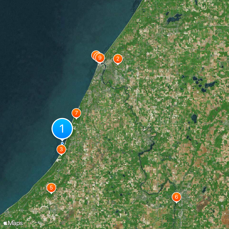
Berrien County is an administrative division in Southwest Michigan bordered by Lake Michigan to the west and Indiana to the south. The area encompasses several towns and communities scattered throughout its landscape.

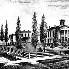
The county was established in 1829 and named after John M. Berrien, who held the position of Attorney General under President Andrew Jackson. This founding marked the early development of the region in the Midwest.

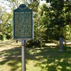
The Pokagon Band of Potawatomi maintain a reservation in the southeastern part of the county, keeping their traditions and customs alive in the community. Their presence shapes the local identity and cultural events throughout the area.

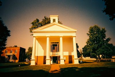
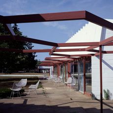
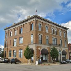
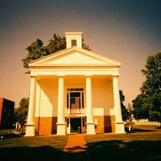
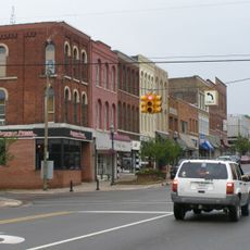
St. Joseph serves as the county's administrative center, housing the courthouse and government offices where visitors can obtain information and services. The location makes it a good starting point for exploring the area and learning about local governance.

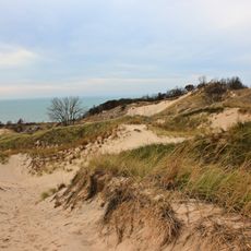
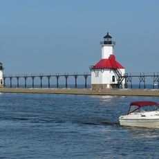
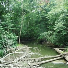
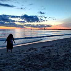
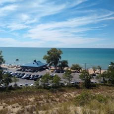
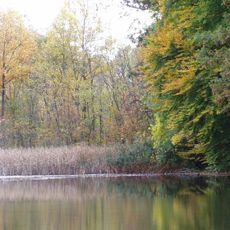
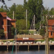
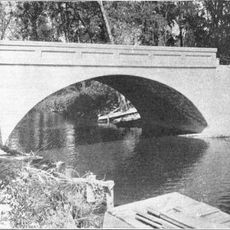
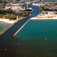
Much of the county is covered by water, making it one of Michigan's most water-rich areas. This natural feature shapes the landscape and offers distinctive opportunities for water-based activities.

The community of curious travelers

AroundUs brings together thousands of curated places, local tips, and hidden gems, enriched daily by 60,000 contributors worldwide.

Start exploring
Location
Inception
1829
Capital city
St. Joseph
Shares border with
Van Buren County, LaPorte County, Cass County, St. Joseph County, Porter County, Cook County, Lake County
GPS coordinates
41.94000,-86.59000
Latest update
December 17, 2025 10:59
Around this place
House of David
United States of America

House of David

23 km
Warren Dunes State Park
United States of America

Warren Dunes State Park

2.8 km
St. Joseph North Pier Inner and Outer Lights
United States of America

St. Joseph North Pier Inner and Outer Lights

21.2 km
Warren Woods State Park
United States of America

Warren Woods State Park

12.2 km
Fort St. Joseph
United States of America

Fort St. Joseph

30.6 km
Grand Mere State Park
United States of America

Grand Mere State Park

6.8 km
Silver Beach Amusement Park
United States of America

Silver Beach Amusement Park

21 km
Fort Miami
United States of America

Fort Miami

21 km
Moccasin Bluff Site
United States of America

Moccasin Bluff Site

20.8 km
Snow Flake Motel
United States of America

Snow Flake Motel

13.6 km
Niles Scream Park
United States of America

Niles Scream Park

25.9 km
United States of America

Corten Steel Sculpture

19.4 km
Weko Beach
United States of America

Weko Beach

589 m
Fernwood Botanical Garden and Nature Preserve
United States of America

Fernwood Botanical Garden and Nature Preserve

21.8 km
Sandburg House
United States of America

Sandburg House

7.1 km
Shiloh House
United States of America

Shiloh House

22.1 km
Blossomland Bridge
United States of America

Blossomland Bridge

21.3 km
United States of America

Southwest Michigan Underwater Preserve

23 km
Warren Featherbone Company Office Building
United States of America

Warren Featherbone Company Office Building

15.5 km
Ninth District Lighthouse Depot
United States of America

Ninth District Lighthouse Depot

21.2 km
United States of America

Legacy of Leadership

19.3 km
Avery Road – Galien River Bridge
United States of America

Avery Road – Galien River Bridge

7.9 km
Berrien Springs Courthouse
United States of America

Berrien Springs Courthouse

20.6 km
Drier's Meat Market
United States of America

Drier's Meat Market

15.6 km
St. Joseph North Pier Outer Light
United States of America

St. Joseph North Pier Outer Light

21.2 km
Old Berrien County Courthouse Complex
United States of America

Old Berrien County Courthouse Complex

20.6 km
North Watervliet Road – Paw Paw Lake Outlet Bridge
United States of America

North Watervliet Road – Paw Paw Lake Outlet Bridge

40.9 km
Niles Downtown Historic District
United States of America

Niles Downtown Historic District

30.3 km
Show the full map
Administrative divisions
« Berrien County - Administrative county in Southwest Michigan, United States » is provided by Around Us (aroundus.com). Images and texts are derived from Wikimedia project under a Creative Commons license. You are allowed to copy, distribute, and modify copies of this page, under the conditions set by the license, as long as this note is clearly visible.

Discover hidden gems everywhere you go!

From secret cafés to breathtaking viewpoints, skip the crowded tourist spots and find places that match your style. Our app makes it easy with voice search, smart filtering, route optimization, and insider tips from travelers worldwide. Download now for the complete mobile experience.

Around Us App Screenshot

A unique approach to discovering new places

Le Figaro

All the places worth exploring

France Info

A tailor-made excursion in just a few clicks

20 Minutes

Around Us
Travel Guide & Maps
Download

Send to your phone

QR Code
1

Open the camera app on your mobile.

2

Point at the QR code with your camera. A notification will appear.

3

Tap the notification to open the link.