Enable Location

We need your location to show you interesting places around you

Discover nearby places

Find interesting locations and hidden gems around you

Precise directions

Get accurate directions and distances to places

Your location is never shared with other users. It's only used when you tap the location button.

Niles

Log in to your account

Start exploring — it's free

Trusted by 62,796 travelers worldwide

Continue with Google
Continue with Apple
or

We will send you a code to connect

By continuing, you accept our Terms and Conditions and our Privacy Policy

Check your inbox

We've sent a pincode in your inbox. Please enter the code below.

Niles, Historical city in southwestern Michigan, United States.

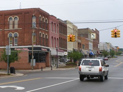
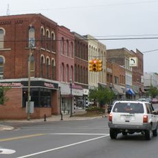
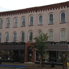
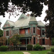
Niles is a city in southwestern Michigan near the Indiana border, situated along the St. Joseph River with rolling terrain and steep riverbanks. The downtown area sits within a region that blends rural and urban character.

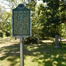
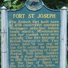
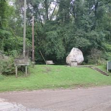
The French established Fort St. Joseph in 1697 to protect their mission, with the site later controlled by British forces. The region passed through several transitions of power before becoming part of the United States.

The Fort St. Joseph Museum displays artifacts and exhibits about the settlement of four nations: France, Britain, Spain, and the United States. Visitors can learn how different cultures shaped this region over time.

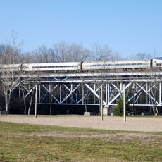
The Amtrak station connects passengers to Chicago year-round via the Blue Water and Wolverine rail services. The location also provides bus connections to larger regional cities.

From 1820 to 1865, the city served as a station on the Underground Railroad, helping people escape toward freedom in Canada. This hidden network risked the safety of those who operated it.

The community of curious travelers

AroundUs brings together thousands of curated places, local tips, and hidden gems, enriched daily by 60,000 contributors worldwide.

Start exploring
Location
Location
Inception
1827
Elevation above the sea
209 m
GPS coordinates
41.83000,-86.25333
Latest update
December 17, 2025 09:12
Around this place
Fort St. Joseph
United States of America

Fort St. Joseph

2 km
Moccasin Bluff Site
United States of America

Moccasin Bluff Site

9.8 km
Niles Scream Park
United States of America

Niles Scream Park

5.4 km
Fernwood Botanical Garden and Nature Preserve
United States of America

Fernwood Botanical Garden and Nature Preserve

8.7 km
First Methodist Episcopal Church of Pokagon
United States of America

First Methodist Episcopal Church of Pokagon

11.3 km
Crystal Springs Street–Dowagiac River Bridge
United States of America

Crystal Springs Street–Dowagiac River Bridge

11.3 km
Niles Downtown Historic District
United States of America

Niles Downtown Historic District

232 m
Thomson Road–Air Line Railroad Bridge
United States of America

Thomson Road–Air Line Railroad Bridge

8.5 km
Ring Lardner House
United States of America

Ring Lardner House

812 m
Buchanan North and West Neighborhoods Historic District
United States of America

Buchanan North and West Neighborhoods Historic District

9.3 km
Union Block
United States of America

Union Block

8.9 km
United States of America

Madeline Bertrand County Park

7.7 km
Henry A. Chapin House
United States of America

Henry A. Chapin House

93 m
Fort Saint Joseph Historical Marker
United States of America

Fort Saint Joseph Historical Marker

2 km
Fort Saint Joseph Monument
United States of America

Fort Saint Joseph Monument

2 km
Ring Lardner Historical Marker
United States of America

Ring Lardner Historical Marker

846 m
United States of America

Topinabee Lake Preserve

5.1 km
AMTK St. Joseph River Bridge
United States of America

AMTK St. Joseph River Bridge

792 m
South Berrien Center Union Church and Cemetery
United States of America

South Berrien Center Union Church and Cemetery

11.2 km
United States of America

Orchard Hill Country Club

6.3 km
United States of America

Plym Park Golf Course

1.5 km
United States of America

Brookwood Golf Course

7.2 km
United States of America

Signal Point Country Club

2.8 km
Zinc Collar Pad Company Building
United States of America

Zinc Collar Pad Company Building

9 km
United States of America

Niles Riverfront Amphitheater

556 m
United States of America

The Tin Shop

8.9 km
United States of America

SL Consignment Gallery

8.8 km
United States of America

Statue, Work of art

8.8 km
Show the full map
« Niles - Historical city in southwestern Michigan, United States » is provided by Around Us (aroundus.com). Images and texts are derived from Wikimedia project under a Creative Commons license. You are allowed to copy, distribute, and modify copies of this page, under the conditions set by the license, as long as this note is clearly visible.

Discover hidden gems everywhere you go!

From secret cafés to breathtaking viewpoints, skip the crowded tourist spots and find places that match your style. Our app makes it easy with voice search, smart filtering, route optimization, and insider tips from travelers worldwide. Download now for the complete mobile experience.

Around Us App Screenshot

A unique approach to discovering new places

Le Figaro

All the places worth exploring

France Info

A tailor-made excursion in just a few clicks

20 Minutes

Around Us
Travel Guide & Maps
Download

Send to your phone

QR Code
1

Open the camera app on your mobile.

2

Point at the QR code with your camera. A notification will appear.

3

Tap the notification to open the link.