Enable Location

We need your location to show you interesting places around you

Discover nearby places

Find interesting locations and hidden gems around you

Precise directions

Get accurate directions and distances to places

Your location is never shared with other users. It's only used when you tap the location button.

Log in to your account

Start exploring — it's free

Trusted by 62,474 travelers worldwide

Continue with Google
Continue with Apple
or

We will send you a code to connect

By continuing, you accept our Terms and Conditions and our Privacy Policy

Check your inbox

We've sent a pincode in your inbox. Please enter the code below.

Salmon River Reservoir

Salmon River Reservoir, body of water

Salmon River Reservoir, also known as Redfield Reservoir, is a large body of water in Oswego County that stretches for nearly seven miles and covers over two thousand acres. The water is typically around twenty feet (6 meters) deep on average, with a maximum depth of about fifty-seven feet (17 meters), and is fed by multiple streams flowing from the nearby Tug Hill Plateau.

The reservoir was constructed to store water in the region and developed over time as a fishing destination. State stocking programs, particularly between 2003 and 2008, introduced walleye to the water, and while initial surveys showed limited success, later studies revealed natural reproduction of this species.

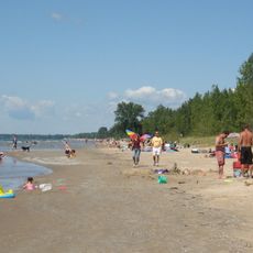
The reservoir serves as a gathering place for local anglers who practice a quiet fishing tradition throughout the year. Visitors experience a sense of community here, where experienced fishers and beginners alike share tips and enjoy the outdoor lifestyle that centers on this water.

Multiple boat launch sites with parking and sturdy ramps are located at CCC Road, Jackson Road, and County Route 17, providing easy access for boats and gear. The Redfield Island Day Use Area features a wheelchair-accessible platform for fishing or viewing, allowing all visitors to enjoy the water regardless of physical ability.

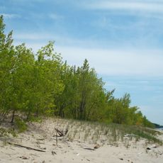
This is the best fishing spot entirely within Oswego County borders and hosts both naturally reproducing walleye and trout from stocking programs alongside bass and crappie. The surrounding terrain consists of shale rock with minimal vegetation, keeping the area remote and maintaining its natural character despite heavy use by anglers.

The community of curious travelers

AroundUs brings together thousands of curated places, local tips, and hidden gems, enriched daily by 60,000 contributors worldwide.

Start exploring
Location
GPS coordinates
43.54417,-75.91944
Latest update
February 9, 2026 08:21
Around this place
Southwick Beach State Park
United States of America

Southwick Beach State Park

33.9 km
Salmon River Falls
United States of America

Salmon River Falls

1.8 km
Whetstone Gulf State Park
United States of America

Whetstone Gulf State Park

40 km
Sandy Pond Beach Unique Area
United States of America

Sandy Pond Beach Unique Area

25.8 km
Selkirk Light
United States of America

Selkirk Light

23 km
Southwick Beach
United States of America

Southwick Beach

34.1 km
Pulaski Village Historic District
United States of America

Pulaski Village Historic District

17.1 km
Orson Ames House
United States of America

Orson Ames House

27.2 km
Cyrus Bates House
United States of America

Cyrus Bates House

38.6 km
Carley's Mills Schoolhouse
United States of America

Carley's Mills Schoolhouse

24.8 km
Trinity Church
United States of America

Trinity Church

33.8 km
Fred Smart House
United States of America

Fred Smart House

16.3 km
Stillwater Bridge
United States of America

Stillwater Bridge

233 m
Smith-Ripley House
United States of America

Smith-Ripley House

30.8 km
Osceola Town Hall
United States of America

Osceola Town Hall

16.5 km
Constableville Village Historic District
United States of America

Constableville Village Historic District

39.5 km
Peter Chandler House
United States of America

Peter Chandler House

26.7 km
Ava Town Hall
United States of America

Ava Town Hall

38.2 km
Phineas Davis Farmstead
United States of America

Phineas Davis Farmstead

26.3 km
First National Bank of Lacona
United States of America

First National Bank of Lacona

16.4 km
Adams Commercial Historic District
United States of America

Adams Commercial Historic District

30.7 km
Fowler-Loomis House
United States of America

Fowler-Loomis House

26.1 km
Timothy Skinner House
United States of America

Timothy Skinner House

26.9 km
Thayer Farmstead
United States of America

Thayer Farmstead

26.8 km
Mexico High School
United States of America

Mexico High School

27.1 km
Lacona Clock Tower
United States of America

Lacona Clock Tower

16.4 km
Leonard Ames Farmhouse
United States of America

Leonard Ames Farmhouse

27.6 km
Southwich Beach
United States of America

Southwich Beach

34.2 km
Show the full map
« Salmon River Reservoir - body of water » is provided by Around Us (aroundus.com). Images and texts are derived from Wikimedia project under a Creative Commons license. You are allowed to copy, distribute, and modify copies of this page, under the conditions set by the license, as long as this note is clearly visible.

Discover hidden gems everywhere you go!

From secret cafés to breathtaking viewpoints, skip the crowded tourist spots and find places that match your style. Our app makes it easy with voice search, smart filtering, route optimization, and insider tips from travelers worldwide. Download now for the complete mobile experience.

Around Us App Screenshot

A unique approach to discovering new places

Le Figaro

All the places worth exploring

France Info

A tailor-made excursion in just a few clicks

20 Minutes

Around Us
Travel Guide & Maps
Download

Send to your phone

QR Code
1

Open the camera app on your mobile.

2

Point at the QR code with your camera. A notification will appear.

3

Tap the notification to open the link.