Kankossa Department, department in Mauritania
Location: Assaba Region
Elevation above the sea: 151 m
GPS coordinates: 15.93584,-11.51935
Latest update: April 2, 2025 11:56

Niokolo-Koba National Park
365.2 km
Aoukar Depression
314.7 km
Boucle du Baoulé National Park
350.5 km
River Gambia National Park
449.9 km
MacCarthy Island
440.1 km
Gouina Falls
218.5 km
Bassari Country
398.6 km
Badiar National Park
417.3 km
Dindefelo Falls
406.9 km
Félou Falls
176.8 km
Lake Manantali
334.1 km
Talari Gorges
246.9 km
Cercles de pierres de Wassu
438.1 km
Deer Island (Gambia)
453 km
Isla Sepu
447.6 km
Tata of Koniakary
164.9 km
Isla Brikama
454 km
Bird Island
442.4 km
Eisenbahnbrücke von Kidira
180.1 km
Cercles de pierres de Kerbatch
455.7 km
Sankulay Kunda Bridge
440.6 km
Straßenbrücke von Kidira
180.5 km
Isla Pangon
440.2 km
Isla Pasari
371.2 km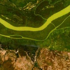
Isla Ba Faraba
468.5 km
Mimang Island
450.7 km
Simbalo
356.8 km
Fort de Médine
174.3 kmVisited this place? Tap the stars to rate it and share your experience / photos with the community! Try now! You can cancel it anytime.

Discover hidden gems everywhere you go!
From secret cafés to breathtaking viewpoints, skip the crowded tourist spots and find places that match your style. Our app makes it easy with voice search, smart filtering, route optimization, and insider tips from travelers worldwide. Download now for the complete mobile experience.

A unique approach to discovering new places❞
— Le Figaro
All the places worth exploring❞
— France Info
A tailor-made excursion in just a few clicks❞
— 20 Minutes