Coffre ${chestReward.rarityLabel}
+${chestReward.xp} XP
Explorer
NOUVEAU ×${chestReward.collectible.quantity}
tapez pour fermer
Chest locked

Open chests in the app

Around Us is built for your phone — chests unlock when you walk, explore and capture nearby places.

Enable Location

We need your location to show you interesting places around you

Discover nearby places

Find interesting locations and hidden gems around you

Precise directions

Get accurate directions and distances to places

Your location is never shared with other users. It's only used when you tap the location button.

Hindu Kush

Log in to your account

Start exploring — it's free

Trusted by 72,285 travelers worldwide

Continue with Google
Continue with Apple
or

We will send you a code to connect

By continuing, you accept our Terms and Conditions and our Privacy Policy

Check your inbox

We've sent a pincode in your inbox. Please enter the code below.

Hindu Kush
Discussion Reviews 4 Photos
449k Popularity

Hindu Kush, Mountain range between Afghanistan and Pakistan

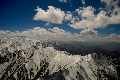
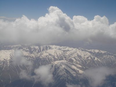
The range stretches 800 kilometers through Central and South Asia, with peaks rising to 7,708 meters at Tirich Mir. Its ridges and valleys form a natural barrier between Pakistan and Afghanistan, crossed by narrow passes and glacier-fed rivers.

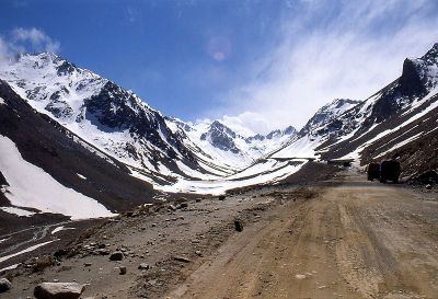
The mountain passes served for centuries as routes for armies, including those of Alexander the Great and Genghis Khan during their campaigns into India. These routes shaped the course of trade lines and political boundaries throughout the region.

Shepherds today still move large herds through the valleys, often following old routes passed down through generations. In the surrounding villages, travelers encounter small mosques and communal areas where local life gathers for markets and celebrations.

The region experiences around four major earthquakes each year, caused by the collision of two tectonic plates. Travelers should prepare for rough weather conditions, as the climate at high elevations shifts quickly and passes often become inaccessible.

The mountain system creates distinct climate zones that influence valley agriculture, requiring extensive irrigation for crops at high elevations. Each valley has developed its own planting methods, often adapted to sun exposure and water availability along the slopes.

The community of curious travelers

AroundUs brings together thousands of curated places, local tips, and hidden gems, enriched daily by 60,000 contributors worldwide.

Start exploring
Location
تحصیل چترال
Elevation above the sea
7,708 m
Part of
Alpide belt
GPS coordinates
36.27000,71.78000
Latest update
December 18, 2025 07:45
Reviews
Share your experience

No review yet

Discussions
Start a discussion...

No discussion yet

« Hindu Kush - Mountain range between Afghanistan and Pakistan » is provided by Around Us (aroundus.com). Images and texts are derived from Wikimedia project under a Creative Commons license. You are allowed to copy, distribute, and modify copies of this page, under the conditions set by the license, as long as this note is clearly visible.

Discover hidden gems everywhere you go!

From secret cafés to breathtaking viewpoints, skip the crowded tourist spots and find places that match your style. Our app makes it easy with voice search, smart filtering, route optimization, and insider tips from travelers worldwide. Download now for the complete mobile experience.

Around Us App Screenshot

A unique approach to discovering new places

Le Figaro

All the places worth exploring

France Info

A tailor-made excursion in just a few clicks

20 Minutes

Around Us
Travel Guide & Maps
Download

Send to your phone

QR Code
1

Open the camera app on your mobile.

2

Point at the QR code with your camera. A notification will appear.

3

Tap the notification to open the link.