Enable Location

We need your location to show you interesting places around you

Discover nearby places

Find interesting locations and hidden gems around you

Precise directions

Get accurate directions and distances to places

Your location is never shared with other users. It's only used when you tap the location button.

Terich Mir

Log in to your account

Start exploring — it's free

Trusted by 61,562 travelers worldwide

Continue with Google
Continue with Apple
or

We will send you a code to connect

By continuing, you accept our Terms and Conditions and our Privacy Policy

Check your inbox

We've sent a pincode in your inbox. Please enter the code below.

Terich Mir

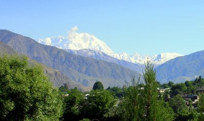
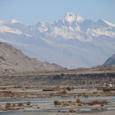
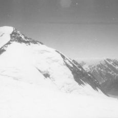
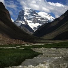
Terich Mir, Mountain peak in Chitral District, Pakistan.

Description

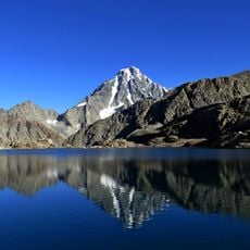
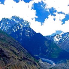
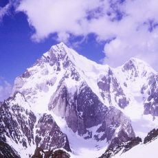
Terich Mir is the highest peak in the Hindu Kush range at 7,708 meters, standing as one of the world's most prominent mountains in this region. The massif rises steeply above the Chitral Valley, displaying snow-covered slopes year-round at higher elevations.

History

The peak was first successfully summited in 1950 by Norwegian mountaineers led by Arne Næss, marking a major milestone in Hindu Kush exploration. This early expedition opened the summit to further mountaineering activity and gained international recognition in climbing circles.

Culture

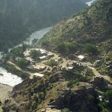
The mountain holds spiritual significance for local Kalash communities and Chitrali residents, who view it through stories of protective spirits dwelling in its heights. These beliefs shape how people relate to and honor the landscape today.

Practical

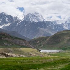
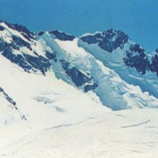
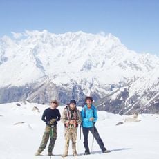
The mountain demands careful preparation and mountaineering equipment, as the altitude and snow-covered slopes present significant physical challenges. Summer offers the most favorable window for climbing attempts, when weather conditions are more stable and access routes are less obstructed.

Did you know?

The name comes from the Wakhi language, where 'trich' means shadow or darkness and 'mir' means king—a poetic reference reflecting its commanding presence above the valley. This naming reveals how mountaineers and local communities perceive the power and majesty of the peak.

Elevation above the sea
7,708 m
GPS coordinates
36.25786,71.85045
Latest update
December 14, 2025 18:51

AroundUs brings together thousands of curated places, local tips, and hidden gems, enriched daily by 60,000 contributors worldwide. Discover all places nearby (Khyber Pakhtunkhwa).

« Terich Mir - Mountain peak in Chitral District, Pakistan » is provided by Around Us (aroundus.com). Images and texts are derived from Wikimedia project under a Creative Commons license. You are allowed to copy, distribute, and modify copies of this page, under the conditions set by the license, as long as this note is clearly visible.

Discover hidden gems everywhere you go!

From secret cafés to breathtaking viewpoints, skip the crowded tourist spots and find places that match your style. Our app makes it easy with voice search, smart filtering, route optimization, and insider tips from travelers worldwide. Download now for the complete mobile experience.

Around Us App Screenshot

A unique approach to discovering new places

Le Figaro

All the places worth exploring

France Info

A tailor-made excursion in just a few clicks

20 Minutes

Around Us
Travel Guide & Maps
Download

Send to your phone

QR Code
1

Open the camera app on your mobile.

2

Point at the QR code with your camera. A notification will appear.

3

Tap the notification to open the link.