Chitral Fort, Military fort in Chitral, Pakistan
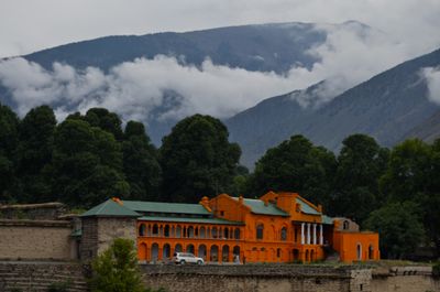
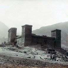
Chitral Fort is a fortification on the banks of Chitral River with 7.5 meter high walls and barriers about 2.4 meters thick made from mud brick, stone, and wood. The structure contains multiple rooms and a former Darbar Hall that was restored after the 2015 earthquake to preserve the original character of the building.
The fort was built as the seat of the traditional rulers, the Mehtar, and served the region for centuries as an important administrative and defensive post. In 1895 it played a critical role in resisting a major siege, marking a significant moment in the region's history.
The fort displays traditional building methods from northern Pakistan, using stone, wood, and mud brick suited to local needs and the harsh mountain climate. Visitors can observe how rooms and walls were constructed using techniques that generations of craftspeople refined over time.
Visitors should wear sturdy shoes since stairs and pathways inside the fort are uneven and steep. It is best to arrive in the morning when temperatures are comfortable and the site is less crowded.
The fort remains the property of the Mehtar family, Chitral's last ruling dynasty, and is not managed as a typical museum. This gives the site a personal character that sets it apart from standard historical sites.
The community of curious travelers
AroundUs brings together thousands of curated places, local tips, and hidden gems, enriched daily by 60,000 contributors worldwide.