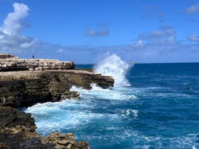
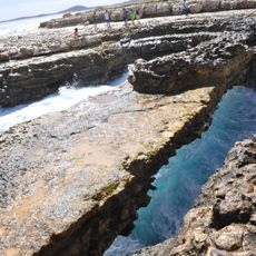
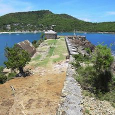
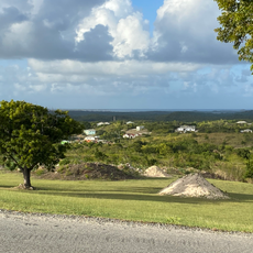
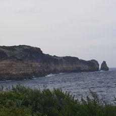
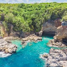
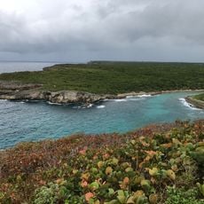
Devils Bridge, Natural limestone arch in Willikies, Antigua.
Devils Bridge is a natural limestone arch formation that rises above the Atlantic Ocean in Willikies. The structure displays the power of waves that crash through blowholes carved by continuous water erosion over many centuries.
The site was where enslaved Africans made desperate attempts to escape, hoping ocean currents would carry them to freedom. This tragic past remains an essential part of the location's history.
The site carries local stories about supernatural forces tied to the dangerous waters surrounding it. People in the area have passed down these tales through generations as part of their connection to this wild ocean landscape.
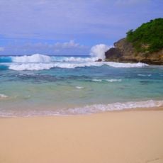
The surfaces around the formation can be slippery, and waves become especially powerful during high tide or rough weather. Wear sturdy shoes and stay alert when moving near the outer rocks to avoid accidents.
An Easter celebration brings traditional kite flying to the area, with local craftspeople displaying their flying techniques above the coastal landscape. This colorful annual event has become deeply rooted in the community's seasonal calendar.
Location: Willikies
Elevation above the sea: 1 m
Address: 482C+6J4, Willikies, Antigua and Barbuda
GPS coordinates: 17.10000,-61.68333
Latest update: December 14, 2025 18:20
Parliament of Antigua and Barbuda
16.1 km
Boggy Peak
19.9 km
St. John's Cathedral
17.1 km
Chances Peak
67.9 km
Fort Barrington
21.8 km
Devil's Bridge
528 m
Fort James
19.5 km
Fort Berkeley
13.6 km
Government House, Montserrat
69.1 km
Museum of Antigua and Barbuda
17.3 km
Antigua Naval Dockyard and Related Archaeological Sites
13.4 km
Dockyard Museum
13.5 km
Newfield, Antigua and Barbuda
5.1 km
Le Piton
71.4 km
Iglesia de San Bernabé
13.2 km
National Museum of Montserrat
64.5 km
Monument aux morts d'Anse-Bertrand
72.3 km
Pointe De La Petite Vigie
71.2 km
Station balnéaire d'Anse Bertrand
72.3 km
Grotte de l'anse Castalia
70.9 km
Two Foot Bay
63.7 km
St Johns
17.8 km
Trou à Man Lwi
71.2 km
Clarence House
13.1 km
Soufriere Hills Volcano
68.2 km
Trou Madame Coco
72.6 km
Dry Ghaut
68 km
Anse Laborde Beach
71.3 kmVisited this place? Tap the stars to rate it and share your experience / photos with the community! Try now! You can cancel it anytime.
Discover hidden gems everywhere you go!
From secret cafés to breathtaking viewpoints, skip the crowded tourist spots and find places that match your style. Our app makes it easy with voice search, smart filtering, route optimization, and insider tips from travelers worldwide. Download now for the complete mobile experience.
A unique approach to discovering new places❞
— Le Figaro
All the places worth exploring❞
— France Info
A tailor-made excursion in just a few clicks❞
— 20 Minutes