Chest opened
+${chestReward.xp} XP
Explorer
NOUVEAU ×${chestReward.collectible.quantity}
tapez pour fermer
Chest locked

Open chests in the app

Around Us is built for your phone — chests unlock when you walk, explore and capture nearby places.

Enable Location

We need your location to show you interesting places around you

Discover nearby places

Find interesting locations and hidden gems around you

Precise directions

Get accurate directions and distances to places

Your location is never shared with other users. It's only used when you tap the location button.

Log in to your account

Start exploring — it's free

Trusted by 72,881 travelers worldwide

Continue with Google
Continue with Apple
or

We will send you a code to connect

By continuing, you accept our Terms and Conditions and our Privacy Policy

Check your inbox

We've sent a pincode in your inbox. Please enter the code below.

Mont Tatiri
Discussion Reviews Photo
30+ Popularity

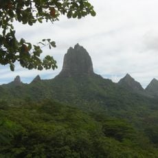
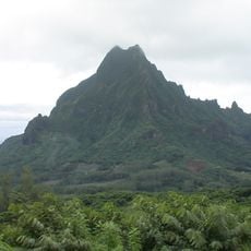
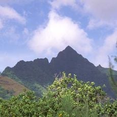
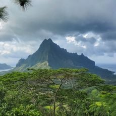
Mont Tatiri, Mountain summit in Tahiti, French Polynesia.

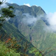
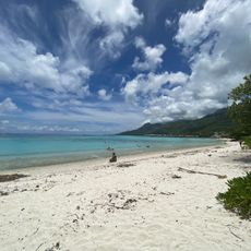
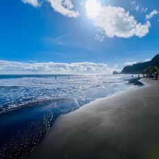
Mont Tatiri is a summit on Tahiti that rises 316 meters above sea level, covered with natural tropical vegetation and diverse plant species. The mountain's slopes display the lush plant life typical of the island's higher elevations.

This peak formed through volcanic activity that shaped Tahiti and the broader geological history of French Polynesia. The mountain's creation is tied to the ancient volcanic processes that built the islands of the South Pacific.

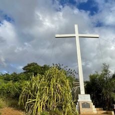
This summit holds meaning for local communities who have lived on these islands for centuries and view the mountain as part of their ancestral lands. The surrounding slopes and valleys shaped how people organized their settlements and daily routines across Tahiti.

Wear sturdy shoes and prepare for wet, sometimes slippery conditions because of the tropical vegetation on the slopes. Starting early in the day gives you better light and enough time to complete the climb before darkness falls.

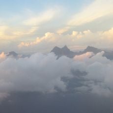
On clear days, you can see multiple nearby peaks from this summit, including Mont Orohena, which is the highest mountain in the region. This view reveals how the different mountains connect across the islands and shape the broader landscape.

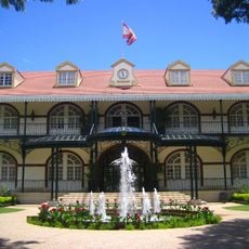
The community of curious travelers

AroundUs brings together thousands of curated places, local tips, and hidden gems, enriched daily by 60,000 contributors worldwide.

Start exploring
Location
Elevation above the sea
316 m
GPS coordinates
-17.51667,-149.88333
Latest update
December 15, 2025 13:24
Reviews
Share your experience

No review yet

Discussions
Start a discussion...

No discussion yet

« Mont Tatiri - Mountain summit in Tahiti, French Polynesia » is provided by Around Us (aroundus.com). Images and texts are derived from Wikimedia project under a Creative Commons license. You are allowed to copy, distribute, and modify copies of this page, under the conditions set by the license, as long as this note is clearly visible.

Discover hidden gems everywhere you go!

From secret cafés to breathtaking viewpoints, skip the crowded tourist spots and find places that match your style. Our app makes it easy with voice search, smart filtering, route optimization, and insider tips from travelers worldwide. Download now for the complete mobile experience.

Around Us App Screenshot

A unique approach to discovering new places

Le Figaro

All the places worth exploring

France Info

A tailor-made excursion in just a few clicks

20 Minutes

Around Us
Travel Guide & Maps
Download

Send to your phone

QR Code
1

Open the camera app on your mobile.

2

Point at the QR code with your camera. A notification will appear.

3

Tap the notification to open the link.