Enable Location

We need your location to show you interesting places around you

Discover nearby places

Find interesting locations and hidden gems around you

Precise directions

Get accurate directions and distances to places

Your location is never shared with other users. It's only used when you tap the location button.

Mont Orohena

Log in to your account

Start exploring — it's free

Trusted by 62,060 travelers worldwide

Continue with Google
Continue with Apple
or

We will send you a code to connect

By continuing, you accept our Terms and Conditions and our Privacy Policy

Check your inbox

We've sent a pincode in your inbox. Please enter the code below.

Mont Orohena

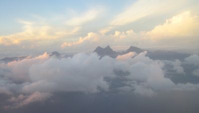
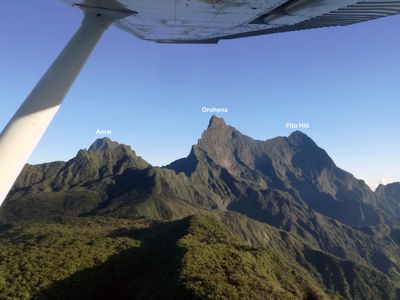
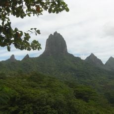
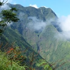
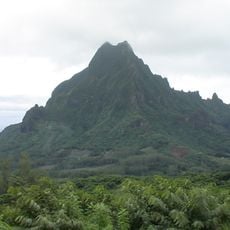
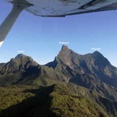
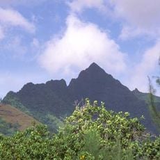
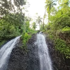
Mont Orohena, Mountain summit in Tahiti, French Polynesia

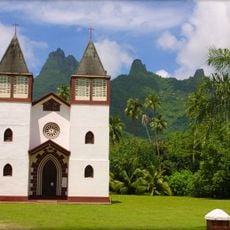
Mont Orohena is the highest peak in French Polynesia, rising to 2,241 meters above sea level from the center of Tahiti. The mountain is an extinct volcano with two distinctive summits visible from various points across the island.

The mountain formed through volcanic activity that shaped the South Pacific island system millions of years ago. Its central location on Tahiti reflects how the entire island emerged from the same geological processes.

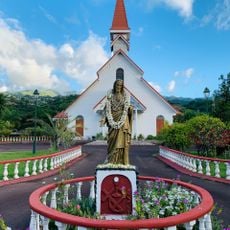
The mountain shapes how locals and visitors perceive Tahiti's landscape, with its twin peaks forming a recognizable landmark visible from many parts of the island. People often point it out as a natural reference point when describing their surroundings.

Visitors should plan their ascent during the dry season and bring appropriate climbing equipment, as the route presents technical challenges. The terrain requires mountaineering experience and solid physical preparation.

The mountain stands apart for its extreme topographic isolation, placing it among only a few peaks worldwide with this geographical characteristic. This separation from other highland areas makes it geologically notable.

The community of curious travelers

AroundUs brings together thousands of curated places, local tips, and hidden gems, enriched daily by 60,000 contributors worldwide.

Start exploring
Location
Elevation above the sea
2,241 m
GPS coordinates
-17.61921,-149.47771
Latest update
December 7, 2025 19:24
« Mont Orohena - Mountain summit in Tahiti, French Polynesia » is provided by Around Us (aroundus.com). Images and texts are derived from Wikimedia project under a Creative Commons license. You are allowed to copy, distribute, and modify copies of this page, under the conditions set by the license, as long as this note is clearly visible.

Discover hidden gems everywhere you go!

From secret cafés to breathtaking viewpoints, skip the crowded tourist spots and find places that match your style. Our app makes it easy with voice search, smart filtering, route optimization, and insider tips from travelers worldwide. Download now for the complete mobile experience.

Around Us App Screenshot

A unique approach to discovering new places

Le Figaro

All the places worth exploring

France Info

A tailor-made excursion in just a few clicks

20 Minutes

Around Us
Travel Guide & Maps
Download

Send to your phone

QR Code
1

Open the camera app on your mobile.

2

Point at the QR code with your camera. A notification will appear.

3

Tap the notification to open the link.