Mount Tohivea, Volcanic summit in Moorea, French Polynesia
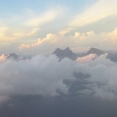
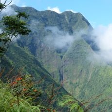
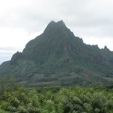
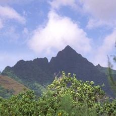
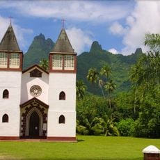
Mount Tohivea is the highest point on Moorea, a dark grey volcanic rock summit reaching 1,207 metres. Its sheer faces rise from a forested ridge, with lower jagged peaks of the same ridge flanking it on both sides. Green vegetation covers the lower slopes, and the summit is visible from the west coast of Tahiti, about 24 kilometres away.
The mountain formed during a volcanic building phase roughly 1.5 to 2 million years ago. This volcanic process gradually shaped the central landscape of Moorea over a long period of time.
Mount Tohivea stands at the centre of Moorea, and its 1,207-metre summit is the island's highest point. From the west coast of Tahiti, about 24 kilometres away, the mountain is visible across the sea, so it serves as a landmark for people on both islands.
The best time to hike is in the early morning hours when visibility is better and weather remains more stable. Good footwear and plenty of water are essential since the climb is steep and the terrain is often wet.
Mount Tohivea is the eroded rim of an extinct shield volcano, and together with the neighbouring peaks of Mouaroa and Mouaputa it marks what remains of the crater edge. The volcano that built Moorea was active between 1.9 and 1.5 million years ago, fed by the Society Hotspot. From the summit trails, hikers look north over Cook's and Opunohu bays and east towards Tahiti, about 24 kilometres away.
The community of curious travelers
AroundUs brings together thousands of curated places, local tips, and hidden gems, enriched daily by 92,779 contributors worldwide.