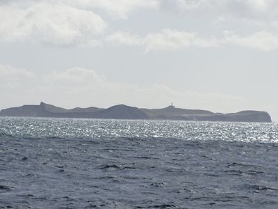
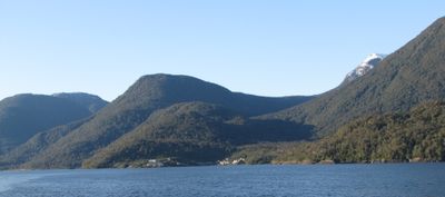
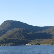
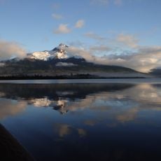
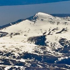
Magdalena Island, Island in Aysén Region, Chile.
Magdalena Island covers around 951 square miles (2,462 square kilometers) and features rugged terrain, deep ravines, and coastal coves that support diverse marine and terrestrial species.
The island was designated as a forest reserve in the 1960s and officially became a protected park on July 11, 1983, with further conservation expansions occurring in 2018.
Local fishing communities, including Puerto Gaviota, have historically relied on the codfish industry and continue to maintain maritime traditions closely tied to Patagonian life and heritage.
Access to Magdalena Island is primarily by boat from Puerto Cisnes or Puerto Puyuhuapi, and visitors should prepare for remote conditions with limited facilities and variable weather patterns.
The island hosts the endangered southern river otter, known locally as huillin, making it a critical site for conservation efforts focused on protecting this rare aquatic mammal species.
Location: Aysén Region
GPS coordinates: -44.59556,-73.19028
Latest update: December 2, 2025 09:25
Chile stretches over 2,670 miles (4,300 kilometers) from north to south, crossing some of South America's most varied landscapes. The north features the Atacama Desert with its salt flats, geysers at El Tatio, and astronomical observatories such as Paranal. The coastal city of Valparaíso displays colonial architecture on steep hillsides, while the abandoned nitrate mining towns of Humberstone and Sewell recall the country's industrial past. The Andean region includes active volcanoes like Villarrica and Osorno, and Lauca National Park with Lake Chungará at over 14,760 feet (4,500 meters) elevation. The Lake District and Patagonia offer extensive forests, glaciers, and fjords. Torres del Paine National Park attracts hikers with its granite peaks and Grey Glacier. Lake General Carrera on the Argentine border shows turquoise waters, while Queulat and Bernardo O'Higgins national parks preserve remote wilderness. Chiloé Island is known for its wooden churches and traditional architecture. Further south, Puerto Williams on Navarino Island marks one of the world's southernmost settlements. Easter Island sits 2,300 miles (3,700 kilometers) west of the coast in the Pacific, displaying over 900 moai statues from its Polynesian past. The Juan Fernández Archipelago, also in the Pacific, offers endemic flora and fauna. In central Chile, ski resorts like Valle Nevado provide winter sports in the Andes, while the Elqui Valley is recognized for pisco production and clear night skies. Santiago, the capital, sits in an Andean valley and serves as a starting point for trips to surrounding national parks such as La Campana.
Isla Magdalena National Park
16.6 km
Cay
54.2 km
Mentolat
14.4 km
Roca Chacabuco
39.6 km
Playa Nuevo Reino
43 km
Roca de Afuera
32.1 km
Roca Blanca
17.7 km
Río Ventisquero Queulat
52.1 km
Mirador
53.6 km
Playa Puerto Cisnes
43 km
Playa Bonita
37.5 km
Playa Allanao
39.3 km
Scenic viewpoint
53.6 km
Scenic viewpoint
53.4 km
Paseo en bote zodiac y guiados en Kayak Experiencia Austral
53.7 km
Mirador Virgen de las Rosas
42.6 km
Mirador Panorámico
53.3 km
Muelle Laguna Témpanos
53.7 km
Dolphin Spotting
50 km
Mirador Río Cisnes
50.6 km
Scenic viewpoint
53.5 km
Mirador
50.3 km
Mirador
51.6 km
Scenic viewpoint
42.9 km
Mirador Dos Lagunas
44.8 km
Waterfall
53.6 km
La cascada y pozón
42.8 km
Los canelos
47.7 kmVisited this place? Tap the stars to rate it and share your experience / photos with the community! Try now! You can cancel it anytime.
Discover hidden gems everywhere you go!
From secret cafés to breathtaking viewpoints, skip the crowded tourist spots and find places that match your style. Our app makes it easy with voice search, smart filtering, route optimization, and insider tips from travelers worldwide. Download now for the complete mobile experience.
A unique approach to discovering new places❞
— Le Figaro
All the places worth exploring❞
— France Info
A tailor-made excursion in just a few clicks❞
— 20 Minutes