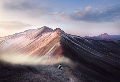
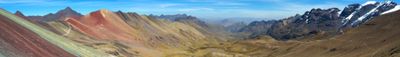
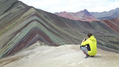
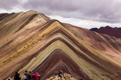
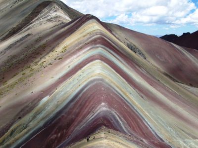
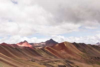
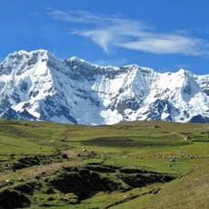
Vinicunca, Mountain ridge in Cusco region, Peru
Mineral layers in shades of red, yellow, purple, and green stretch across the slopes of this Andean peak at 17,100 ft (5,200 m) elevation, forming parallel bands. The geological formations appear most clearly on the eroded flanks, where different sedimentary strata have been exposed through natural processes and create a distinctive striped pattern.
The rock layers formed approximately 24 million years ago during prolonged geological processes that deposited different minerals in succession. Ice sheets covered the area during glacial periods, preserving the sedimentary formations that were exposed only in recent times through glacier retreat and erosion. The site gained international attention after 2015.
Andean communities from the Pitumarca region maintain centuries-old connections to this mountain, which holds spiritual significance as a sacred place. Local residents now organize guided treks and provide accommodations, drawing on their traditional knowledge of the high-altitude environment while benefiting from the growing tourism sector that has developed around the site.
Access requires a several-hour drive from Cusco followed by a hike at elevations exceeding 16,400 ft (5,000 m), making proper acclimatization necessary. Most visitors depart before dawn and need warm clothing plus sun protection. Conditions between May and September offer drier weather with clearer visibility. Entrance tickets are sold at the trailhead, where basic food stands operate.
The color palette results from specific mineral compositions: iron oxides produce red and yellow tones, copper sulfates create green hues, while magnesium carbonates form whitish bands. Sulfur compounds contribute to yellowish areas. Color intensity varies with moisture and light conditions, with early morning sunlight enhancing contrasts most dramatically.
The community of curious travelers
AroundUs brings together thousands of curated places, local tips, and hidden gems, enriched daily by 60,000 contributors worldwide.