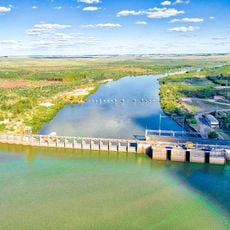
Palmar Dam, Hydroelectric power station at Rio Negro, Uruguay
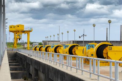
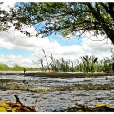
Palmar Dam stretches across 2080 meters of the Rio Negro and produces electrical power through its turbine system. The structure serves as a passage connecting different regions on both sides of the river.
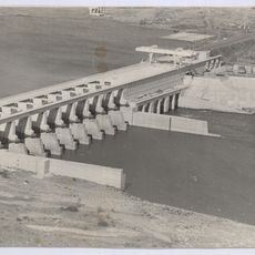
Construction began in the 1970s with Brazilian financing and was completed in 1982. This project played an important role in strengthening the nation's energy infrastructure.
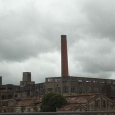
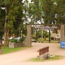
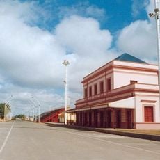
The town of Palmar grew as a community around this project, originally established to house workers during construction. You can still see how daily life there developed in connection with this facility.
The facility can be reached by road that runs across the structure, connecting vehicles between both banks. You can explore the surrounding area and find viewing spots along the dam itself.
The dam performs a dual role by generating power while also serving as a roadway between two regions. This combination of energy production and transportation infrastructure is an example of practical engineering.
Inception: 1977
Length: 2,080 m
GPS coordinates: -33.05558,-57.45069
Latest update: December 8, 2025 19:51
Frigorífico Anglo del Uruguay
79.7 km
Rincón del Caqute
99.4 km
Termas del Gualeguaychú
96.2 km
Represa de Baygorria
63.6 km
Colegio del Uruguay
97 km
Palace Cave
38.4 km
Reserva de flora y fauna Dr. Rodolfo Tálice
69.4 km
Parque Nacional de los Esteros de Farrapos e Islas del Río Uruguay
71.7 km
Faro de Rincón del Bonete
99 km
Localidad Rupestre de Chamangá
98.8 km
St. Joseph's Cathedral, Gualeguaychú
99.2 km
Reserva forestal Chaviyú
67.8 km
National Technological University – Concepción del Uruguay Regional Faculty
95.9 km
Museo Luis Alberto Solari
80.8 km
Monument to Christopher Columbus
93.7 km
Gualeguaychú train station
99.8 km
Stella Maris Lighthouse
96.2 km
Santa Isabel, Paso de los Toros
92.1 km
Casa de Rivera, Durazno
93.6 km
San Isidro Golf & Yacht Club
56 km
Centro de detención del Batallón de Infantería No. 9
80.7 km
Biblioteca Popular El porvenir
96.9 km
Catedral de Trinidad, Flores
72.7 km
Centro de detención del Grupo de Artillería No 3
92.3 km
Centro de detención del Batallón de Ingenieros No. 3
92.5 km
Casa que habito el Gral. Benjamín Victorica
97.1 km
Edificio de la Aduana Vieja
95.9 km
Casa del Gral. Justo José de Urquiza
97 kmVisited this place? Tap the stars to rate it and share your experience / photos with the community! Try now! You can cancel it anytime.
Discover hidden gems everywhere you go!
From secret cafés to breathtaking viewpoints, skip the crowded tourist spots and find places that match your style. Our app makes it easy with voice search, smart filtering, route optimization, and insider tips from travelers worldwide. Download now for the complete mobile experience.
A unique approach to discovering new places❞
— Le Figaro
All the places worth exploring❞
— France Info
A tailor-made excursion in just a few clicks❞
— 20 Minutes