Frigorífico Anglo del Uruguay

Log in to your account

AroundUs is a community-driven map of interesting places, built by curious explorers like you. It grows with every review, story, and photo you share.
Connect to save your favorite spots, contribute locations, and create personalized routes.
Continue with Google
Continue with Apple
Continue with X
Continue with Facebook
Continue with email
By continuing, you accept our Terms and Conditions and our Privacy Policy
Create an account

Frigorífico Anglo del Uruguay

Add to collection
Map
Suggest a change
Share

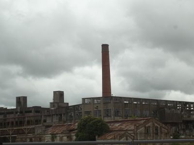
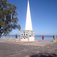
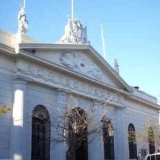
Frigorífico Anglo del Uruguay, Meat processing factory in Fray Bentos, Uruguay.

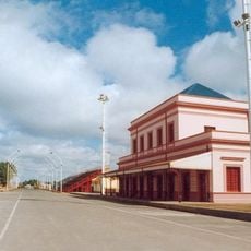
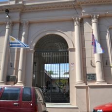
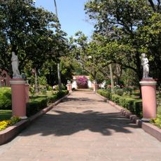
Frigorífico Anglo del Uruguay is an industrial complex built along the Uruguay River with brick structures designed for processing and preserving meat. The site contains multiple buildings and original machinery that display the scale and methods of this once-massive operation.

The facility opened in the late 1800s and produced meat under the Fray Bentos brand for markets across Europe. After more than a century of operation, the plant closed in 1979 and was preserved as a window into industrial heritage.

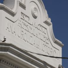
The factory drew workers from around the world who built a complete community on-site with shops, schools, and gathering spaces. These neighborhoods reflected the multicultural character of those who labored here and shaped daily life far beyond just work hours.

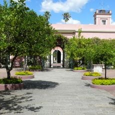
The site now operates as a museum with guided tours through preserved machinery and work areas that demonstrate how production once happened here. Wear comfortable shoes, as the grounds are extensive and require substantial walking to explore.

Products made here fed Allied forces during both World Wars, serving as a crucial supply line for preserved meat across the conflict. Few visitors realize how this remote factory became an essential part of global military food supply during those years.

Location: Río Negro Department

Location: Fray Bentos

Industry: meat industry, food industry

Part of: Fray Bentos Industrial Landscape

GPS coordinates: -33.13333,-58.30000

Latest update: December 7, 2025 19:28

Photos
Around this place
San José palace
Argentina

San José palace

81.3 km
Termas del Gualeguaychú
Argentina

Termas del Gualeguaychú

21.2 km
Palmar Dam
Uruguay

Palmar Dam

79.7 km
Colegio del Uruguay
Argentina

Colegio del Uruguay

72.5 km
Agraciada Beach
Uruguay

Agraciada Beach

76.1 km
Parque Nacional de los Esteros de Farrapos e Islas del Río Uruguay
Uruguay

Parque Nacional de los Esteros de Farrapos e Islas del Río Uruguay

47.4 km
Autódromo de Concepción del Uruguay
Argentina

Autódromo de Concepción del Uruguay

75.5 km
Gualeguaychú Sambadrome
Argentina

Gualeguaychú Sambadrome

24.2 km
Monumento a Perpetuidad, Paysandú
Uruguay

Monumento a Perpetuidad, Paysandú

92.3 km
St. Joseph's Cathedral, Gualeguaychú
Argentina

St. Joseph's Cathedral, Gualeguaychú

24.2 km
Reserva forestal Chaviyú
Argentina

Reserva forestal Chaviyú

74.1 km
National Technological University – Concepción del Uruguay Regional Faculty
Argentina

National Technological University – Concepción del Uruguay Regional Faculty

71.3 km
Museo Luis Alberto Solari
Uruguay

Museo Luis Alberto Solari

2.3 km
Gualeguaychú train station
Argentina

Gualeguaychú train station

24.2 km
Stella Maris Lighthouse
Argentina

Stella Maris Lighthouse

73.9 km
Centro de Documentación e Investigación Daniel Vidart
Uruguay

Centro de Documentación e Investigación Daniel Vidart

92.9 km
Castells Bridge
Uruguay

Castells Bridge

90.7 km
Parque Acuático Concepción
Argentina

Parque Acuático Concepción

75.8 km
San Isidro Golf & Yacht Club
Uruguay

San Isidro Golf & Yacht Club

29.7 km
Centro de detención del Batallón de Infantería No. 9
Uruguay

Centro de detención del Batallón de Infantería No. 9

2.1 km
Biblioteca Popular El porvenir
Argentina

Biblioteca Popular El porvenir

72.4 km
Monumento al Himno Nacional
Uruguay

Monumento al Himno Nacional

92.5 km
Casa que habito el Gral. Benjamín Victorica
Argentina

Casa que habito el Gral. Benjamín Victorica

72.7 km
Edificio del antiguo Hospital y Asilo Pinillas. Primer hospital de caridad de las Hermanas del Huerto construido en 1883 - Actual Sede de la Casa del Espíritu de Paysandú.
Uruguay

Edificio del antiguo Hospital y Asilo Pinillas. Primer hospital de caridad de las Hermanas del Huerto construido en 1883 - Actual Sede de la Casa del Espíritu de Paysandú.

93 km
Plaza Ramírez
Argentina

Plaza Ramírez

81.4 km
Jefatura de policía de Paysandu
Uruguay

Jefatura de policía de Paysandu

93 km
Edificio de la Aduana Vieja
Argentina

Edificio de la Aduana Vieja

71.3 km
Casa del Gral. Justo José de Urquiza
Argentina

Casa del Gral. Justo José de Urquiza

72.6 km
Show the full map
Reviews

Visited this place? Tap the stars to rate it and share your experience / photos with the community! Try now! You can cancel it anytime.

« Frigorífico Anglo del Uruguay - Meat processing factory in Fray Bentos, Uruguay » is provided by Around Us (aroundus.com). Images and texts are derived from Wikimedia project under a Creative Commons license. You are allowed to copy, distribute, and modify copies of this page, under the conditions set by the license, as long as this note is clearly visible.

Discover hidden gems everywhere you go!

From secret cafés to breathtaking viewpoints, skip the crowded tourist spots and find places that match your style. Our app makes it easy with voice search, smart filtering, route optimization, and insider tips from travelers worldwide. Download now for the complete mobile experience.

Around Us App Screenshot

A unique approach to discovering new places

Le Figaro

All the places worth exploring

France Info

A tailor-made excursion in just a few clicks

20 Minutes