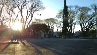
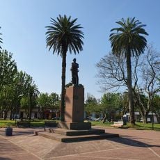
Treinta y Tres Department, Administrative department in eastern Uruguay
Treinta y Tres Department occupies eastern Uruguay with flat grounds transitioning to rolling hills in its western areas. These geological formations called cuchillas shape the landscape throughout the territory.
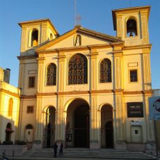
The department was established in 1884 through administrative divisions created by national legislation. This reorganization separated territory from neighboring districts to form a new administrative unit.
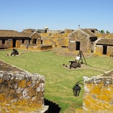
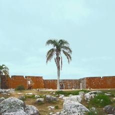
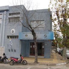
The region preserves ancient Indigenous settlement sites that reveal long human presence in this area. These places remain part of local identity and connect people to the territory's earliest inhabitants.
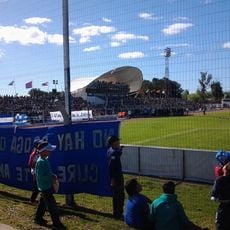
Visitors can access public sports facilities with modern synthetic grass fields, tennis courts, and hockey grounds throughout the area. These installations are open to everyone and provide diverse recreational options.
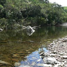
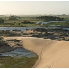
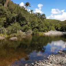
Quebrada de los Cuervos, a ravine near this department, was Uruguay's first state-protected natural area. This ecologically significant site offers visitors a chance to explore unspoiled landscapes.
Inception: 1884
Capital city: Treinta y Tres
Elevation above the sea: 163 m
Part of: South America Midwest Integrated Zone
Shares border with: Cerro Largo Department, Lavalleja Department, Rocha Department, Florida Department, Durazno Department, Rio Grande do Sul
Website: http://33.gub.uy
GPS coordinates: -33.23083,-54.38222
Latest update: December 7, 2025 10:04
Cerro Catedral
131.1 km
Fortaleza de Santa Teresa
113.1 km
Quebrada de los Cuervos
34.5 km
Santa Teresa National Park
115.3 km
Lascano
51.8 km
Parque nacional Cabo Polonio
139.1 km
Fuerte San Miguel
93.5 km
Estadio Arquitecto Antonio Eleuterio Ubilla
99 km
Bañados del Este Biosphere Reserve
46.5 km
Faro de Cabo Polonio
142.2 km
Posta del Chuy
100 km
Chuí Lighthouse
109.6 km
San Miguel national park
92.5 km
Capilla Farruco
112.6 km
Santa Teresa
115.7 km
Quebrada de los cuervos
35.6 km
Faro Punta Palmar
120.8 km
Museo Histórico General Aparicio Saravia
82.7 km
Cathedral of Melo
97.4 km
Regional History Museum of Melo
97.5 km
Estación Treinta y Tres
52.8 km
Antiga Enfermaria Militar
119.3 km
Widow's Beach
120.2 km
Arroyo Piedras Blancas
132.9 km
Museo Criollo e Indígena (San Miguel)
93.5 km
Museo Fortaleza de Santa Teresa
113.1 km
Museo Fortín de San Miguel
93.5 kmVisited this place? Tap the stars to rate it and share your experience / photos with the community! Try now! You can cancel it anytime.
Discover hidden gems everywhere you go!
From secret cafés to breathtaking viewpoints, skip the crowded tourist spots and find places that match your style. Our app makes it easy with voice search, smart filtering, route optimization, and insider tips from travelers worldwide. Download now for the complete mobile experience.
A unique approach to discovering new places❞
— Le Figaro
All the places worth exploring❞
— France Info
A tailor-made excursion in just a few clicks❞
— 20 Minutes