Oruro, Colonial mining city in western Altiplano, Bolivia
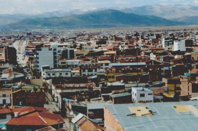
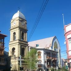
This place is a city in western Bolivia, sitting at 3,700 meters (12,139 feet) above sea level on the Altiplano, surrounded by mountains where tin and silver have been mined for centuries. The streets downtown run in a grid around Plaza 10 de Febrero, lined with colonial churches and two-story buildings with wrought-iron balconies.
The settlement was founded in 1606 as Real Villa de San Felipe de Austria and grew into an economic powerhouse through silver mining. The decline of silver in the 19th century led to the discovery of large tin deposits, which brought renewed wealth during the 20th century.
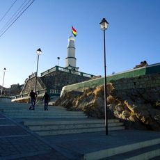
Carnival transforms the streets into a vast stage each February, with thousands of dancers wearing velvet and sequined costumes that weigh up to 20 kilograms. The Santuario del Socavón church draws pilgrims who pray to the Virgin of the Mineshaft, while market women sell fresh quinoa and potatoes grown in the surrounding valleys.
The altitude can cause shortness of breath and fatigue in visitors, so walking slowly and drinking plenty of water helps. The place serves as a transport hub with bus connections to La Paz about three hours away and to Uyuni for trips to the salt flats.
The San José mine in the nearby hills can be visited, where workers still extract tin using the same tools and methods employed for generations. The Museo Antropológico Eduardo López Rivas displays skulls with deliberate deformations, a practice common among pre-Columbian societies in the region.
Location: Oruro Department
Inception: November 1, 1606
Elevation above the sea: 3,710 m
Website: http://oruroweb.com
GPS coordinates: -17.96984,-67.11483
Latest update: December 12, 2025 17:30
This collection includes towns established above 3,000 meters altitude, mainly located in the Andes and on Asian highlands. These urban centers house several million inhabitants who live daily under conditions where oxygen is scarce. La Rinconada in Peru reaches 5,300 meters, making it the highest...
Cochabamba
120.1 km
Tunari National Park
115.7 km
Virgen del Socavón
812 m
Estadio Jesús Bermúdez
2.7 km
Metropolitan Cathedral of Saint Sebastian
120.1 km
Tunari
107.9 km
Iglesia y Convento de Santa Teresa, Cochabamba
120.3 km
Conchupata Lighthouse
534 m
Estación Cochabamba
119.8 km
Templo de Santo Domingo, Cochabamba
119.9 km
Templo de La Merced
119.2 km
Jesuit Church
120.1 km
Machacamarca Railway museum
24.9 km
Templo de Sica Sica
97 km
Isla de Panza
84 km
Wila Ch'ankha
51.6 km
MARTadero
118.5 km
Wila Sirka
119.8 km
Represa Tacagua
103.6 km
Cathedral of Our Lady of the Assumption
145 m
Church of San Ildefonso, Quillacollo
108.9 km
Banco Mercantil
120 km
Escuela de comando y Estado Mayor, Cochabamba
119.6 km
Antiguo Edificio Obispado
120.1 km
Casa Familia Cornejo
120.2 km
Iglesia de San Juan de Dios
120.1 km
Fountain of the Three Graces
120.1 km
Casa Familia Blanco
120 kmVisited this place? Tap the stars to rate it and share your experience / photos with the community! Try now! You can cancel it anytime.
Discover hidden gems everywhere you go!
From secret cafés to breathtaking viewpoints, skip the crowded tourist spots and find places that match your style. Our app makes it easy with voice search, smart filtering, route optimization, and insider tips from travelers worldwide. Download now for the complete mobile experience.
A unique approach to discovering new places❞
— Le Figaro
All the places worth exploring❞
— France Info
A tailor-made excursion in just a few clicks❞
— 20 Minutes