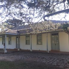
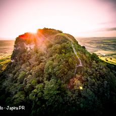
Pico Agudo, Mountain peak in Sapopema, Brazil.
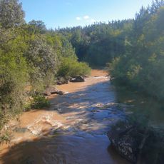
Pico Agudo is a mountain peak that rises 1,200 meters above sea level, overlooking the Tibagi River valley with distinctive steep slopes and rocky outcrops. The terrain features natural hiking paths that traverse the mountainside.
Geologist Reinhard Maack conducted extensive surveys of the peak and surrounding Tibagi River valley during the 1920s and 1930s. These early explorations contributed to understanding the geological features of the area.
The peak serves as a natural landmark that residents and visitors use for outdoor recreation and to orient themselves in the region. People are drawn to this location for hiking and to experience the mountain landscape.
The peak is accessible via several established hiking trails that lead directly to the summit at varying difficulty levels. Visitors should prepare for uneven terrain and variable weather conditions, as conditions can change rapidly in the mountains.
The peak sits roughly 20 kilometers north of the Mauá Hydroelectric Plant, making it a distinct geographical marker in the landscape. This proximity to a major infrastructure project makes the location easy to identify in the region.
The community of curious travelers
AroundUs brings together thousands of curated places, local tips, and hidden gems, enriched daily by 60,000 contributors worldwide.