Camanducaia, Administrative division in Minas Gerais, Brazil.
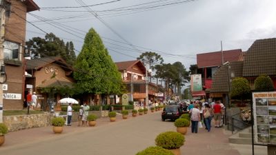
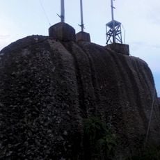
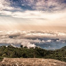
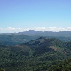
Camanducaia is a municipality in Minas Gerais characterized by mountainous terrain and natural reserves situated at an elevated altitude. The landscape is shaped by hills and forests that create a setting of rolling geography throughout the area.
The municipality was founded in the mid-1800s during a period when coffee cultivation drove economic growth across the region. This era shaped its early development and made it a center of agricultural production.
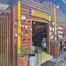
Local life revolves around agricultural traditions, especially during harvest celebrations when the community gathers to honor customs rooted in colonial times. You can see this in traditional events and the way people come together to mark the significance of regional crops.
The area is well-connected by major roads and offers a range of accommodations for different budgets. Its higher elevation means visitors should expect cooler temperatures, especially in the evenings.
The territory is part of a large environmental protection zone that spans hundreds of square kilometers and preserves varied ecosystems. This protected status makes the region a place where conservation and settlement coexist.
Location: Minas Gerais
Inception: 1868
Elevation above the sea: 1,015 m
Shares border with: Cambuí, Itapeva, Extrema, Sapucaí-Mirim, Gonçalves, Córrego do Bom Jesus, Paraisópolis, Joanópolis, São José dos Campos
GPS coordinates: -22.75500,-46.14500
Latest update: December 19, 2025 23:40
Pedra de São Domingos
20.2 km
Pico do Selado
18.4 kmChapéu do Bispo
18.8 km
Fernão Dias Environmental Protection Area
12.3 km
Parada da Fonte
8.6 kmSão Francisco Xavier Environmental Protection Area
26.2 kmSão Domingos
12.6 kmMirandouro
19.3 kmScenic viewpoint
18.5 kmPrainha do Salto
8.9 kmEscola de Falcoaria de Monte Verde
14 kmPinheiro Velho
16.1 kmPedra Sao Domingos
20.3 kmMirandouro
18.8 kmCachoeira do Adão
15.4 kmMirandouro
19.4 kmPlatô
18.8 kmMirante
18.5 kmCascatinha da Pedreira
17.1 kmScenic viewpoint
18.4 kmScenic viewpoint
19.9 kmSubida dos Ciprestes
19.8 kmScenic viewpoint
14.7 kmScenic viewpoint
10.6 kmScenic viewpoint
10.9 kmAlto da Boa Vista
11.3 kmScenic viewpoint
23.1 kmScenic viewpoint
3.8 kmVisited this place? Tap the stars to rate it and share your experience / photos with the community! Try now! You can cancel it anytime.
Discover hidden gems everywhere you go!
From secret cafés to breathtaking viewpoints, skip the crowded tourist spots and find places that match your style. Our app makes it easy with voice search, smart filtering, route optimization, and insider tips from travelers worldwide. Download now for the complete mobile experience.
A unique approach to discovering new places❞
— Le Figaro
All the places worth exploring❞
— France Info
A tailor-made excursion in just a few clicks❞
— 20 Minutes