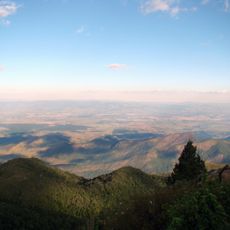
Pedra de São Domingos, Mountain summit in Mantiqueira range, Minas Gerais, Brazil.
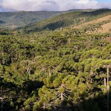
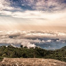
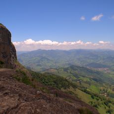
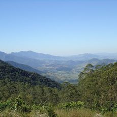
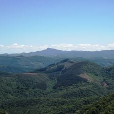
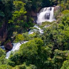
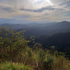
Pedra de São Domingos is a mountain summit in the Mantiqueira range rising to about 2,050 meters, with views extending in all directions toward surrounding municipalities and mountain ranges. The peak offers a complete panorama across the landscape, encompassing several municipalities and other highland areas.
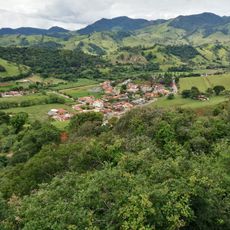
The mountain served for centuries as a natural boundary marker between the municipalities of Paraisópolis, Córrego do Bom Jesus, and Gonçalves. This geographic role shaped the region's administrative divisions when they were established.
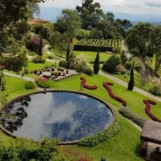
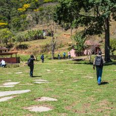
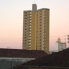
The communities at the mountain's base maintain rural farming traditions that shape daily life in the surrounding valley.
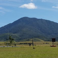
The route starts from Córrego do Bom Jesus with a drive followed by a steep final ascent that can be done on foot or by four-wheel vehicle. The terrain demands appropriate gear and physical preparation for the climb.
On clear nights, the summit reveals city lights twinkling in the distance from multiple locations in the lowlands below. This rare long-distance view is part of what draws people to make the climb.
GPS coordinates: -22.69148,-45.96029
Latest update: December 12, 2025 17:46
Amantikir
38.4 km
Pico do Itapeva
45 km
Boa Vista Palace
36.1 km
Pico Agudo
37.1 km
Pico dos Dias Observatory
42.6 km
Campos do Jordão State Park
44.5 km
Pico do Selado
24.7 km
Basilica of the Good Lord Jesus, Tremembé
51.6 km
Q! Emporium
49.2 km
Mananciais de Campos do Jordão State Park
41.6 km
Casa da Xilogravura
38.7 km
Museu da Imigração Italiana de Quiririm "José Indiani"
49.9 km
O Verdadeiro Sítio do Picapau Amarelo
37.2 km
Sapucaí Mirim Environmental Protection Area
27 km
Mantiqueira Mosaic
40.3 km
Toldi Falls
32.6 km
Fernão Dias Environmental Protection Area
9.2 km
Parada da Fonte
22.6 km
Campos do Jordão Environmental Protection Area
43.4 km
Henriques waterfall
11.7 km
Edifício Octávio Meyer
51.4 km
Mirante Lageado 2
36.7 km
Igreja Matriz de São Bento do Sapucaí
23.6 km
1.6m Perkin-Elmer
42.5 km
Capelinha de Mosaico
23.1 km
0.6m Boller & Chivens
42.5 km
Gruta dos Crioulos
37.8 km
Mother Curch of Our Lady of Sorrows
11.2 kmVisited this place? Tap the stars to rate it and share your experience / photos with the community! Try now! You can cancel it anytime.
Discover hidden gems everywhere you go!
From secret cafés to breathtaking viewpoints, skip the crowded tourist spots and find places that match your style. Our app makes it easy with voice search, smart filtering, route optimization, and insider tips from travelers worldwide. Download now for the complete mobile experience.
A unique approach to discovering new places❞
— Le Figaro
All the places worth exploring❞
— France Info
A tailor-made excursion in just a few clicks❞
— 20 Minutes