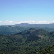
Pico do Selado, Mountain summit in Minas Gerais, Brazil.
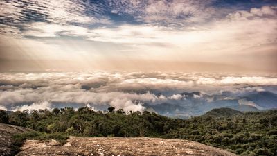
Pico do Selado is a mountain summit in the Serra da Mantiqueira range, rising to 2,082 meters between Monte Verde district and São Francisco Xavier. The peak stands as a prominent landmark that shapes the landscape of this border region.
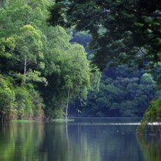
The Serra da Mantiqueira was originally inhabited by indigenous peoples before Portuguese colonizers arrived to exploit timber and mineral resources in the region. This early settlement and subsequent economic activity shaped the development of the surrounding communities over centuries.
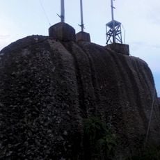
Locals name the mountain after its distinctive flat-topped shape resembling a saddle, which has become part of how they navigate and discuss the landscape. This practical naming reflects how people in the region relate to the natural landmarks that surround them.
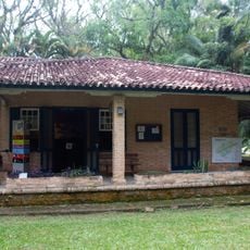
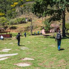
Several marked trails lead to the summit, offering options for hikers of different experience levels to reach the peak. Nearby communities have accommodations such as guesthouses and camping areas that make visiting this region convenient.
The summit marks the point where three different municipalities meet, connecting Camanducaia in Minas Gerais with Joanópolis and São Francisco Xavier in São Paulo state in a single geographic location. This border position makes the peak a rare convergence point of three administrative territories.
Location: Minas Gerais
Elevation above the sea: 2,082 m
GPS coordinates: -22.89658,-46.05160
Latest update: December 13, 2025 11:40
Jaguari
38.4 km
Estádio Martins Pereira
37.4 km
Pedra de São Domingos
24.7 km
Museum of Folklore of São José dos Campos
35 km
Residência de Olívio Gomes e Parque Ajardinado
34.9 km
Estádio ADC Parahyba
34 km
O Verdadeiro Sítio do Picapau Amarelo
28.3 km
Casa de Cultura Zé Mira
34.6 km
Fernão Dias Environmental Protection Area
16.7 km
Deuses e Faraós Restaurante
37.8 km
Cine Santana
33.6 km
Museu Interativo de Ciências
37.4 km
Henriques waterfall
35.9 km
Museu do Folclore de São José dos Campos
34.8 km
Conjunto da Tecelagem Parahyba
35.1 km
Museu de Esportes de São José dos Campos
37.3 km
São Dimas Cathedral
37.6 km
Praça Da Matriz
36.1 km
Antigo Cine Teatro São José
35.9 km
Sanatório Vicentina Aranha
37.1 km
Capelinha de Mosaico
39.8 km
Paço Municipal
36.2 km
Cassiano Ricardo City Public Library
35.9 km
Mother Curch of Our Lady of Sorrows
33.1 km
Capela de São Miguel
36.4 km
PP-ZDF
37.5 km
Santos-Dumont 14-bis replica at Parque Santos Dumont
37.5 km
Reserva Particular do Patrimônio Natural Municipal Pico dos Cabritos
26.1 kmVisited this place? Tap the stars to rate it and share your experience / photos with the community! Try now! You can cancel it anytime.
Discover hidden gems everywhere you go!
From secret cafés to breathtaking viewpoints, skip the crowded tourist spots and find places that match your style. Our app makes it easy with voice search, smart filtering, route optimization, and insider tips from travelers worldwide. Download now for the complete mobile experience.
A unique approach to discovering new places❞
— Le Figaro
All the places worth exploring❞
— France Info
A tailor-made excursion in just a few clicks❞
— 20 Minutes