Chest opened
+${chestReward.xp} XP
Explorer
NOUVEAU ×${chestReward.collectible.quantity}
tapez pour fermer
Chest locked

Open chests in the app

Around Us is built for your phone — chests unlock when you walk, explore and capture nearby places.

Enable Location

We need your location to show you interesting places around you

Discover nearby places

Find interesting locations and hidden gems around you

Precise directions

Get accurate directions and distances to places

Your location is never shared with other users. It's only used when you tap the location button.

Santo Antônio do Pinhal

Log in to your account

Start exploring — it's free

Trusted by 72,890 travelers worldwide

Continue with Google
Continue with Apple
or

We will send you a code to connect

By continuing, you accept our Terms and Conditions and our Privacy Policy

Check your inbox

We've sent a pincode in your inbox. Please enter the code below.

Discussion Reviews 1 Photos
23.1k Popularity

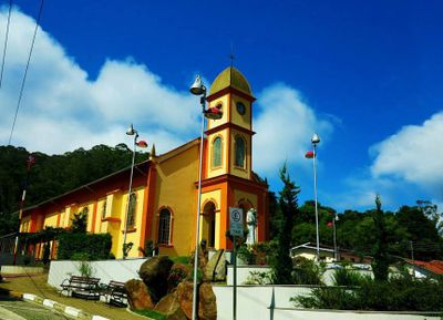
Santo Antônio do Pinhal, Mountain municipality in Serra da Mantiqueira, Brazil

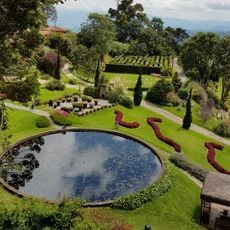
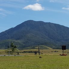
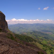
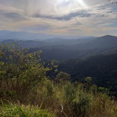
Santo Antônio do Pinhal is a mountain municipality in the Serra da Mantiqueira range, sitting at around 1,080 meters (3,500 feet) elevation across 133 square kilometers (51 square miles). The landscape features steep slopes covered with forests, farm clearings, and streams running through valleys where locals raise trout and grow pine nuts.

The settlement began in the late 1800s as a small farming community taking advantage of the mountain soil and climate. Over time it shifted toward specialized agriculture, particularly trout farming and pine nut cultivation, while becoming known for outdoor tourism.

The Trout and Pine Nut Festival runs between April and May at the Artisan Square, where local food producers gather to sell their goods and share cooking traditions. You can taste regional dishes made from ingredients grown in the surrounding farms and forests.

You can reach the town via the SP-123 highway with regular bus services from São Paulo and Taubaté. The best time to visit is between April and May when local festivals happen and the weather is comfortable for exploring the mountains.

The Sapucaí Mirim Environmental Protection Area covers roughly a third of the municipality and shields rare forest types found at this elevation. This protected zone is what draws many nature visitors who come to see the undisturbed woodland ecosystems.

The community of curious travelers

AroundUs brings together thousands of curated places, local tips, and hidden gems, enriched daily by 60,000 contributors worldwide.

Start exploring
Location
Elevation above the sea
1,080 m
Shares border with
Campos do Jordão, Monteiro Lobato, Pindamonhangaba, São Bento do Sapucaí, Sapucaí-Mirim
GPS coordinates
-22.82694,-45.66278
Latest update
December 22, 2025 02:50
Reviews
Share your experience

No review yet

Discussions
Start a discussion...

No discussion yet

« Santo Antônio do Pinhal - Mountain municipality in Serra da Mantiqueira, Brazil » is provided by Around Us (aroundus.com). Images and texts are derived from Wikimedia project under a Creative Commons license. You are allowed to copy, distribute, and modify copies of this page, under the conditions set by the license, as long as this note is clearly visible.

Discover hidden gems everywhere you go!

From secret cafés to breathtaking viewpoints, skip the crowded tourist spots and find places that match your style. Our app makes it easy with voice search, smart filtering, route optimization, and insider tips from travelers worldwide. Download now for the complete mobile experience.

Around Us App Screenshot

A unique approach to discovering new places

Le Figaro

All the places worth exploring

France Info

A tailor-made excursion in just a few clicks

20 Minutes

Around Us
Travel Guide & Maps
Download

Send to your phone

QR Code
1

Open the camera app on your mobile.

2

Point at the QR code with your camera. A notification will appear.

3

Tap the notification to open the link.