Itatiaia, Mountain municipality in Rio de Janeiro, Brazil
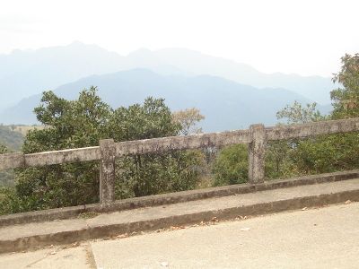
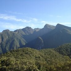
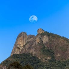
Itatiaia is a mountain municipality situated in the Mantiqueira range in Rio de Janeiro state, positioned at around 1,400 meters (4,600 feet) in elevation. The municipality covers terrain that rises and falls across the borderlands with Minas Gerais, characterized by dense forest and high-altitude plateaus.
Indigenous peoples including the Tupi, Puri, and Coroado inhabited the region before it became part of the Campo Belo district. The area gained independence as its own municipality in 1988 after centuries of being connected to other administrative divisions.
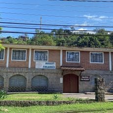
The Penedo neighborhood preserves Finnish architectural styles and customs from settlers who arrived in the early 1900s and built their community in the mountains. Walking through this area, visitors can see how these traditions continue to shape the local landscape and daily life today.
Spring and autumn are the most comfortable times to visit when mountain weather conditions are more stable and pleasant. Visitors should come prepared for hilly paths and elevation changes, making sturdy footwear and layered clothing practical choices for exploring the area.
Despite its tropical setting, the higher elevations occasionally experience snowfall and freezing temperatures, which is rare in Brazil. This unusual weather pattern creates a surprising microclimate where snow can blanket the mountains in the middle of summer elsewhere in the region.
The community of curious travelers
AroundUs brings together thousands of curated places, local tips, and hidden gems, enriched daily by 60,000 contributors worldwide.