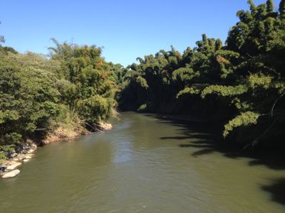
Rio das Mortes, River system in Mato Grosso, Brazil
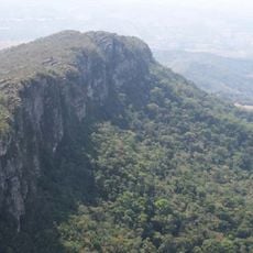
Rio das Mortes is a river system in Mato Grosso that flows about 580 kilometers through varied landscapes. It connects with the Araguaia River system and serves as a major waterway through the region.
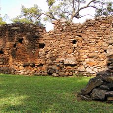
The river was the site of intense conflicts during the colonial period as Portuguese expeditions encountered strong resistance from local groups. These clashes shaped settlement and control patterns along the banks for generations.
Local communities depend on the river for daily life and maintain customs rooted in generations of living beside it. The waterway remains central to how people here work, travel, and connect with each other.
Water levels change considerably depending on the season, with highest water flow between December and May. Visitors should check conditions before planning a visit to understand accessibility along the banks.
Diamond extraction takes place along specific sections of the river, contributing to the local economy. These mining activities have shaped land use and the character of certain areas for decades.
GPS coordinates: -21.12166,-44.23984
Latest update: December 7, 2025 19:31
Parish Church of Saint Antony
6.5 km
Church of Saint Francis of Assisi
2.8 km
Cathedral Basilica of Our Lady of the Pillar
2.8 km
Igreja de Nossa Senhora do Carmo
2.5 km
Serra de São José
11.7 km
Church of Our Lady of the Rosary
6.7 km
Sanctuary of the Holy Trinity
6 km
Teatro Municipal
2.4 km
Museu Regional de São João del-Rei
2.7 km
Church of Our Lady of Mercy of the Creoles
7.2 km
Museu de Sant'Ana
6.7 km
Chapel of Good Jesus of the Poor
7 km
Casa do Padre Toledo
6.7 km
Statue of Bárbara Heliodora
2.9 km
Our Lady of the Rosary church, São João del-Rei
2.9 km
Saint Francis of Paola Chapel
7 km
Memorial to the tricentennial of the foundation of Tiradentes city
6.7 km
Saint Rita of Cascia Church
13.4 km
Chafariz de São José
6.8 km
Igreja Matriz de Nossa Senhora da Conceição
18.1 km
Our Lady of Peñafrancia church, Prados
12.9 km
Monument for the 150 years of the city of São João del-Rei
2.4 km
Pombal Farm Sugarcane Mill
8.2 km
Museu do Automóvel da Estrada Real
11.2 km
Museu da Liturgia
6.6 km
Historic center of São João del-Rei
2.7 km
Parque de Exposições Gastão de Azevedo Cardoso
17.6 km
Cross in front of Saint Francis of Paola Chapel, in Tiradentes
6.9 kmVisited this place? Tap the stars to rate it and share your experience / photos with the community! Try now! You can cancel it anytime.
Discover hidden gems everywhere you go!
From secret cafés to breathtaking viewpoints, skip the crowded tourist spots and find places that match your style. Our app makes it easy with voice search, smart filtering, route optimization, and insider tips from travelers worldwide. Download now for the complete mobile experience.
A unique approach to discovering new places❞
— Le Figaro
All the places worth exploring❞
— France Info
A tailor-made excursion in just a few clicks❞
— 20 Minutes