Chest opened
+${chestReward.xp} XP
Explorer
NOUVEAU ×${chestReward.collectible.quantity}
tapez pour fermer
Chest locked

Open chests in the app

Around Us is built for your phone — chests unlock when you walk, explore and capture nearby places.

Enable Location

We need your location to show you interesting places around you

Discover nearby places

Find interesting locations and hidden gems around you

Precise directions

Get accurate directions and distances to places

Your location is never shared with other users. It's only used when you tap the location button.

Log in to your account

Start exploring — it's free

Trusted by 72,888 travelers worldwide

Continue with Google
Continue with Apple
or

We will send you a code to connect

By continuing, you accept our Terms and Conditions and our Privacy Policy

Check your inbox

We've sent a pincode in your inbox. Please enter the code below.

Discussion Reviews Photo
15.9k Popularity

Nepomuceno, municipality of Brazil

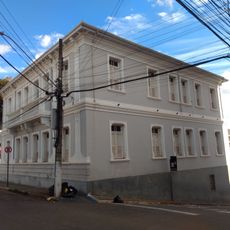
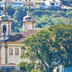
Nepomuceno is a municipality in the southern part of Minas Gerais, set on hilly terrain crossed by rivers and backed by mountain ranges. The town center is made up of modest streets, local shops, and small public squares that form the everyday fabric of daily life here.

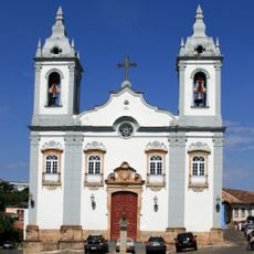
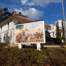
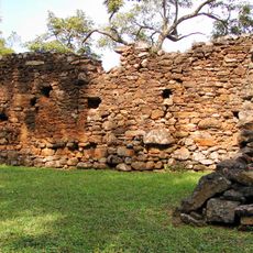
The settlement grew in the 18th century around a chapel built by Captain Mateus Luis Garcia on his farmstead, and the first recorded mass took place in 1776. Over the following decades it became an administrative district in 1831, then a parish in 1841, and finally gained municipal status in 1911.

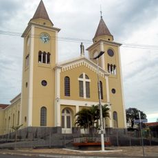
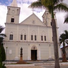
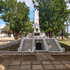
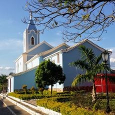
The town's name comes from Saint John Nepomucene, a Bohemian saint long venerated as a patron in this part of Minas Gerais. The chapel built in his honor still anchors the town center and draws locals together during religious feasts and community events.

The town center is compact and easy to get around on foot, with basic services such as small health clinics and shops within easy reach. Roads connecting Nepomuceno to larger cities in the region are generally in good condition, making day trips or onward travel straightforward.

In 1925 the town's official name was simplified specifically to avoid confusion with another similarly named place elsewhere in the state. That change gave the town a clearer identity and helped distinguish it administratively from its neighbor.

The community of curious travelers

AroundUs brings together thousands of curated places, local tips, and hidden gems, enriched daily by 60,000 contributors worldwide.

Start exploring
Location
Elevation above the sea
856 m
Shares border with
Campo Belo, Três Pontas, Santana da Vargem, Carmo da Cachoeira, Cana Verde, Coqueiral, Lavras, Perdões, Aguanil
GPS coordinates
-21.23583,-45.23583
Latest update
March 3, 2026 08:20
Reviews
Share your experience

No review yet

Discussions
Start a discussion...

No discussion yet

« Nepomuceno - municipality of Brazil » is provided by Around Us (aroundus.com). Images and texts are derived from Wikimedia project under a Creative Commons license. You are allowed to copy, distribute, and modify copies of this page, under the conditions set by the license, as long as this note is clearly visible.

Discover hidden gems everywhere you go!

From secret cafés to breathtaking viewpoints, skip the crowded tourist spots and find places that match your style. Our app makes it easy with voice search, smart filtering, route optimization, and insider tips from travelers worldwide. Download now for the complete mobile experience.

Around Us App Screenshot

A unique approach to discovering new places

Le Figaro

All the places worth exploring

France Info

A tailor-made excursion in just a few clicks

20 Minutes

Around Us
Travel Guide & Maps
Download

Send to your phone

QR Code
1

Open the camera app on your mobile.

2

Point at the QR code with your camera. A notification will appear.

3

Tap the notification to open the link.