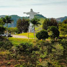
Porciúncula, Municipality in northern Rio de Janeiro state, Brazil
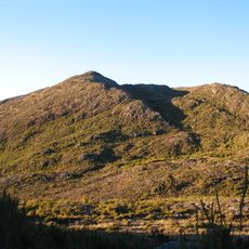
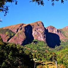
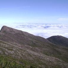
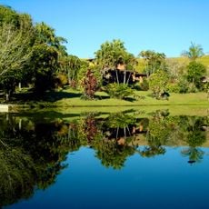
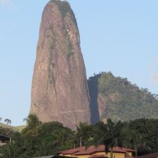
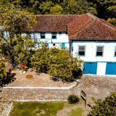
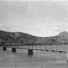
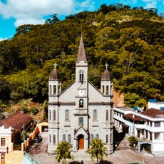
Porciúncula is a municipality in the northern part of Rio de Janeiro state, situated on elevated terrain with rolling hills and farmland. The local landscape consists mainly of rural areas and agricultural zones that define the region's character.
The municipality was officially established on August 21, 1947, as an independent administrative division. This founding marked its separation from previous administrative structures within Rio de Janeiro state.
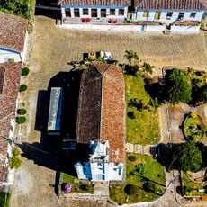
Farming families shape community life through regular markets where regional produce is sold and shared. These gatherings keep people connected to the land and to each other.
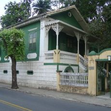
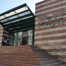
Visitors can obtain information and access public services through the municipal administration located on Cesar Vieira Street. Plan adequate time to explore the hilly terrain and use local transportation to get around the area.
The municipality sits at the northern boundary of Rio de Janeiro state and borders several neighboring municipalities including Carangola and Natividade. This location makes it a natural crossroads between different regions.
Location: Rio de Janeiro
Inception: 1947
Elevation above the sea: 656 m
Shares border with: Faria Lemos, Tombos, Antônio Prado de Minas, Caiana, Dores do Rio Preto, Guaçuí, Natividade, Varre-Sai
Website: http://porciuncula.rj.gov.br
GPS coordinates: -20.96278,-42.04083
Latest update: December 7, 2025 10:08
Pico da Bandeira
64.1 km
Caparaó National Park
62.2 km
Pico do Cristal
62.5 km
Serra do Brigadeiro State Park
50.5 km
Casa de Cultura Roberto Carlos
97 km
Mesquita Brasil
68.4 km
Casa dos Braga
97.6 km
Cachoeira da Fumaça State Park
58.6 km
Monument to Christ the Redeemer
43.8 km
Maurílio Coelho Hunting Hoot Factory
96.6 km
Museu do Tropeiro José Salomão Fadlalah
97.9 km
Mata das Flores State Park
98.7 km
Itabira Natural Monument
102.4 km
Fazenda do Centro
102.8 km
Teatro Municipal Rubem Braga
96.5 km
Santa Rita Farm
69.9 km
Cine Ritz Cataguases
82.5 km
Igreja de Nossa Senhora da Penha
95.8 km
Ponte Metálica sobre o Rio Paraíba do Sul
81.8 km
Main Church of Saint John the Baptist
72.3 km
Núcleo Histórico de São Pedro de Itabapoana
57.9 km
Cine Ritz Perim Center
92.7 km
Festa Nordestina
82.8 km
Sítio Histórico de Muqui
72.3 km
Mulher
82.9 km
Palácio Bernardino Monteiro
97.3 km
Cine Unimed
96.1 km
Historic town center of Cataguases
82.9 kmVisited this place? Tap the stars to rate it and share your experience / photos with the community! Try now! You can cancel it anytime.
Discover hidden gems everywhere you go!
From secret cafés to breathtaking viewpoints, skip the crowded tourist spots and find places that match your style. Our app makes it easy with voice search, smart filtering, route optimization, and insider tips from travelers worldwide. Download now for the complete mobile experience.
A unique approach to discovering new places❞
— Le Figaro
All the places worth exploring❞
— France Info
A tailor-made excursion in just a few clicks❞
— 20 Minutes